
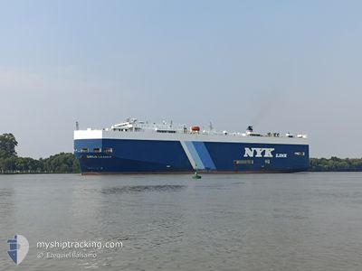
SIRIUS LEADER
Vehicles Carrier
Current Trip
| Time Travelled | 2 days |
|---|---|
| Remaining Time | --- |
| Distance Travelled | 812.36 nm |
| Remaining Distance | --- |
| AVG Speed | 13.6 Knopen |
| MAX Speed | 17.8 Knopen |
| AVG Wind | 7.6 knots |
| MAX Wind | 15 knots |
| MIN Temp | 18°C / 64.4°F |
| MAX Temp | 25.5°C / 77.9°F |
| Diepgang | 7.9 M |
| Positie ontvangen | 1 m geleden |
Current Position
| Lengtegraad | -48.16882° |
|---|---|
| Breedtegraat | -27.69809° |
| Status | Under way using engine |
| Snelheid | 13.1 Knopen |
| Koers | 14.9° |
| Gebied | South Atlantic Ocean |
| Station | T-AIS |
| Positie ontvangen | 1 m geleden |
Info
Information
The current position of SIRIUS LEADER is in South Atlantic Ocean with coordinates -27.69809° / -48.16882° as reported on 2025-02-15 11:25 by AIS to our vessel tracker app. The vessel's current speed is 13.1 Knopen and is heading at the port of PORTO NOGARO. The estimated time of arrival as calculated by MyShipTracking vessel tracking app is 2025-02-16 00:30 LT
The vessel SIRIUS LEADER (IMO: 9213806, MMSI: 564561000) is a Vehicles Carrier that was built in 2000 ( 25 Jaar oud ). It's sailing under the flag of [SG] Singapore.
In this page you can find informations about the vessels current position, last detected port calls, and current voyage information. If the vessels is not in coverage by AIS you will find the latest position.
The current position of SIRIUS LEADER is detected by our AIS receivers and we are not responsible for the reliability of the data. The last position was recorded while the vessel was in Coverage by the Ais receivers of our vessel tracking app.
The current draught of SIRIUS LEADER as reported by AIS is 7.9 meters
Weather
| Temperature | 25.5°C / 77.9°F |
|---|---|
| Wind Speed | 4 knots |
| Direction | 344° NNW |
| Pressure | 1012.7 hPa |
| Humidity | 81.5 % |
| Cloud Coverage | 13 % |
Featured Company
Last Port Calls
| Port | Arrival | Departure | Time In Port |
|---|---|---|---|
| 2025-02-11 13:38 | 2025-02-12 22:50 | 1 d | |
| 2025-02-08 09:37 | 2025-02-08 13:36 | 3 h | |
| 2025-02-06 05:05 | 2025-02-07 16:58 | 1 d | |
| 2025-01-23 13:34 | 2025-01-23 19:18 | 5 h | |
| 2025-01-18 10:54 | 2025-01-18 21:50 | 10 h | |
| 2025-01-14 07:31 | 2025-01-15 18:39 | 1 d | |
| 2025-01-09 13:55 | 2025-01-10 02:19 | 12 h | |
| 2024-12-27 21:46 | 2024-12-28 15:50 | 18 h | |
| 2024-12-24 02:43 | 2024-12-24 11:42 | 8 h | |
| 2024-12-19 13:14 | 2024-12-21 04:09 | 1 d |
Last Trips
| Origin | Departure | Destination | Arrival | Distance | |
|---|---|---|---|---|---|
| 2025-02-08 13:36 | 2025-02-11 13:38 | 962.04 nm | |||
| 2025-02-07 16:58 | 2025-02-08 09:37 | 169.68 nm | |||
| 2025-01-23 19:18 | 2025-02-06 05:05 | 4500.92 nm | |||
| 2025-01-18 21:50 | 2025-01-23 13:34 | 1475.66 nm | |||
| 2025-01-15 18:39 | 2025-01-18 10:54 | 661.86 nm | |||
| 2025-01-10 02:19 | 2025-01-14 07:31 | 1531.30 nm | |||
| 2024-12-28 15:50 | 2025-01-09 13:55 | 4540.21 nm | |||
| 2024-12-24 11:42 | 2024-12-27 21:46 | 196.40 nm | |||
| 2024-12-21 04:09 | 2024-12-24 02:43 | 955.27 nm | |||
| 2024-12-16 10:56 | 2024-12-19 13:14 | 1050.91 nm |
Events
| Tijd | Evenement | Details | Positie / Bestemming | Info |
|---|---|---|---|---|
| 2025-02-15 05:59 | Draught Changed | 7.9 8.5 |
-28.79213 / -48.55752
BR>PNG
|
Snelheid: 12.8 kn Koers: 33.4° |
| 2025-02-15 05:59 | Destination Changed | BR>PNG AR>ZAE |
-28.79213 / -48.55752
BR>PNG
|
Snelheid: 12.8 kn Koers: 33.4° |
| 2025-02-15 05:59 | ETA Changed | 2025/02/15 23:30 2025/02/11 12:00 |
-28.79213 / -48.55752
BR>PNG
|
Snelheid: 12.8 kn Koers: 33.4° |
| 2025-02-15 05:52 | Gevonden in zee | Brazilian part of the South Atlantic Ocean |
-28.81216 / -48.57220
South Atlantic Ocean
|
Snelheid: 12.8 kn Koers: 31.8° |
| 2025-02-15 05:52 | Status Changed | Under way using engine Default |
-28.81216 / -48.57220
AR>ZAE
|
Snelheid: 12.9 kn Koers: 32° |
| 2025-02-15 05:52 | Binnenbereik |
-28.81216 / -48.57220
South Atlantic Ocean
|
Snelheid: 12.8 kn Koers: 31.8° |
|
| 2025-02-13 21:06 | Status Changed | Default Under way using engine |
-35.08994 / -54.59756
AR>ZAE
|
Snelheid: 17 kn Koers: 86.8° |
| 2025-02-13 20:58 | Buitenbereik |
-35.09148 / -54.63954
South Atlantic Ocean
|
Snelheid: 17 kn Koers: 86.8° |
|
| 2025-02-13 20:56 | Status Changed | Under way using engine Default |
-35.09198 / -54.65399
AR>ZAE
|
Snelheid: 16.7 kn Koers: 90° |
| 2025-02-13 20:53 | Status Changed | Default Under way using engine |
-35.09238 / -54.67244
AR>ZAE
|
Snelheid: 16.7 kn Koers: 88.7° |