
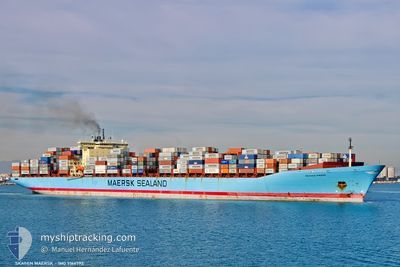
SKAGEN MAERSK
Container Ship
Current Trip
| Time Travelled | 4 days |
|---|---|
| Remaining Time | 19 h, 48 mins |
| Distance Travelled | 2263.64 nm |
| Remaining Distance | 408.92 nm |
| AVG Speed | 20.2 Noeuds |
| MAX Speed | 21.7 Noeuds |
| AVG Wind | 8.6 knots |
| MAX Wind | 13.9 knots |
| MIN Temp | 16.5°C / 61.7°F |
| MAX Temp | 27.4°C / 81.32°F |
| Tirant d eau | 11.4 m |
| Position reçue | 4 d depuis |
Current Position
| Longitude | -72.59862° |
|---|---|
| Latitude | -31.66192° |
| Etat | Under way using engine |
| Vitesse | 20.1 Noeuds |
| Parcours | 341.1° |
| Zone | South Pacific Ocean |
| Station | T-AIS |
| Position reçue | 4 d depuis |
Info
Information
The current position of SKAGEN MAERSK is in South Pacific Ocean with coordinates -31.66192° / -72.59862° as reported on 2025-02-20 07:47 by AIS to our vessel tracker app. The vessel's current speed is 20.1 Noeuds and is heading at the port of BALBOA. The estimated time of arrival as calculated by MyShipTracking vessel tracking app is 2025-02-25 11:34 LT
The vessel SKAGEN MAERSK (IMO: 9166792, MMSI: 219821000) is a Container Ship that was built in 1999 ( 26 Age ). It's sailing under the flag of [DK] Denmark.
In this page you can find informations about the vessels current position, last detected port calls, and current voyage information. If the vessels is not in coverage by AIS you will find the latest position.
The current position of SKAGEN MAERSK is detected by our AIS receivers and we are not responsible for the reliability of the data. The last position was recorded while the vessel was in Coverage by the Ais receivers of our vessel tracking app.
The current draught of SKAGEN MAERSK as reported by AIS is 11.4 meters
Weather
| Temperature | 25.9°C / 78.62°F |
|---|---|
| Wind Speed | 6 knots |
| Direction | 20° NNE |
| Pressure | 1012.3 hPa |
| Humidity | 85.3 % |
| Cloud Coverage | 100 % |
Featured Company
Last Port Calls
| Port | Arrival | Departure | Time In Port |
|---|---|---|---|
| 2025-02-17 18:49 | 2025-02-19 23:08 | 2 d | |
| 2025-02-13 16:42 | 2025-02-15 04:56 | 1 d | |
| 2025-02-10 07:38 | 2025-02-11 14:50 | 1 d | |
| 2025-02-06 00:44 | 2025-02-07 17:39 | 1 d | |
| 2025-02-03 07:28 | 2025-02-05 00:12 | 1 d | |
| 2025-01-12 05:23 | 2025-01-13 09:54 | 1 d | |
| 2025-01-11 07:26 | 2025-01-11 21:21 | 13 h | |
| 2025-01-04 01:08 | 2025-01-05 04:56 | 1 d | |
| 2024-12-31 12:22 | 2025-01-01 09:44 | 21 h | |
| 2024-12-26 18:57 | 2024-12-27 18:45 | 23 h |
Most Visited Ports (Last year)
| Port | Arrivals | |
|---|---|---|
| 5 | ||
| 5 | ||
| 5 | ||
| 5 | ||
| 5 | ||
| 5 |
Last Trips
| Origin | Departure | Destination | Arrival | Distance | |
|---|---|---|---|---|---|
| 2025-02-15 01:56 | 2025-02-17 15:49 | 666.88 nm | |||
| 2025-02-11 09:50 | 2025-02-13 13:42 | 781.22 nm | |||
| 2025-02-07 12:39 | 2025-02-10 02:38 | 1146.72 nm | |||
| 2025-02-04 19:12 | 2025-02-05 19:44 | 364.00 nm | |||
| 2025-01-13 18:54 | 2025-02-03 02:28 | 8200.38 nm | |||
| 2025-01-12 06:21 | 2025-01-12 14:23 | 96.02 nm | |||
| 2025-01-05 12:56 | 2025-01-11 16:26 | 637.21 nm | |||
| 2025-01-01 17:44 | 2025-01-04 09:08 | 835.32 nm | |||
| 2024-12-28 02:45 | 2024-12-31 20:22 | 98.74 nm | |||
| 2024-12-05 00:44 | 2024-12-27 02:57 | 10647.52 nm |
Events
| Heure | Evenement | Détails | Position/ Destination | Info |
|---|---|---|---|---|
| 2025-02-20 07:53 | Etat Changé | Default Under way using engine |
-31.62773 / -72.61178
PABLB
|
Vitesse: 20.1 kn Parcours: 341.1° |
| 2025-02-20 07:47 | Etat Changé | Under way using engine Default |
-31.66192 / -72.59862
PABLB
|
Vitesse: 20.2 kn Parcours: 341° |
| 2025-02-20 07:47 | Hors de la zone couverte |
-31.66192 / -72.59862
South Pacific Ocean
PABLB
|
Vitesse: 20.1 kn Parcours: 341.1° |
|
| 2025-02-20 07:45 | Etat Changé | Default Under way using engine |
-31.67156 / -72.59489
PABLB
|
Vitesse: 20.3 kn Parcours: 340.9° |
| 2025-02-20 07:41 | Etat Changé | Under way using engine Default |
-31.69549 / -72.58539
PABLB
|
Vitesse: 20.2 kn Parcours: 342° |
| 2025-02-20 07:22 | Dans la zone couverte |
-31.69239 / -72.58662
South Pacific Ocean
PABLB
|
Vitesse: 20.3 kn Parcours: 340.9° |
|
| 2025-02-20 04:18 | Etat Changé | Default Under way using engine |
-32.64575 / -72.21091
PABLB
|
Vitesse: 13.2 kn Parcours: 342.1° |
| 2025-02-20 04:12 | Hors de la zone couverte |
-32.66475 / -72.20393
South Pacific Ocean
PABLB
|
Vitesse: 13.2 kn Parcours: 342.1° |
|
| 2025-02-20 04:11 | Etat Changé | Under way using engine Default |
-32.66828 / -72.20262
PABLB
|
Vitesse: 13.3 kn Parcours: 346° |
| 2025-02-20 04:06 | Etat Changé | Default Under way using engine |
-32.68886 / -72.19515
PABLB
|
Vitesse: 13.2 kn Parcours: 341.6° |