

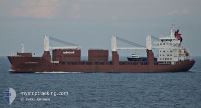
SLOTERGRACHT
General Cargo

Current Trip
| Time Travelled | 1 day |
|---|---|
| Remaining Time | 16 h, 47 mins |
| Distance Travelled | 347.70 nm |
| Remaining Distance | 259.29 nm |
| AVG Speed | 13.5 Noeuds |
| MAX Speed | 18 Noeuds |
| AVG Wind | 16.9 knots |
| MAX Wind | 22 knots |
| MIN Temp | 8.6°C / 47.48°F |
| MAX Temp | 16.3°C / 61.34°F |
| Tirant d eau | 6.9 m |
| Position reçue | 3 m depuis |
Current Position
| Longitude | -2.50155° |
|---|---|
| Latitude | 49.89847° |
| Etat | Under way using engine |
| Vitesse | 16.1 Noeuds |
| Parcours | 73.2° |
| Zone | English Channel |
| Station | T-AIS |
| Position reçue | 3 m depuis |
Information
The current position of SLOTERGRACHT is in English Channel with coordinates 49.89847° / -2.50155° as reported on 2025-04-10 17:28 by AIS to our vessel tracker app. The vessel's current speed is 16.1 Noeuds and is heading at the port of VLISSINGEN. The estimated time of arrival as calculated by MyShipTracking vessel tracking app is 2025-04-11 12:19 LT
The vessel SLOTERGRACHT (IMO: 9197947, MMSI: 246456000) is a General Cargo that was built in 2000 ( 25 Age ). It's sailing under the flag of [NL] Netherlands.
In this page you can find informations about the vessels current position, last detected port calls, and current voyage information. If the vessels is not in coverage by AIS you will find the latest position.
The current position of SLOTERGRACHT is detected by our AIS receivers and we are not responsible for the reliability of the data. The last position was recorded while the vessel was in Coverage by the Ais receivers of our vessel tracking app.
The current draught of SLOTERGRACHT as reported by AIS is 6.9 meters
Weather
| Temperature | 8.7°C / 47.66°F |
|---|---|
| Wind Speed | 12 knots |
| Direction | 79° E |
| Pressure | 1028.9 hPa |
| Humidity | 82.1 % |
| Cloud Coverage | 56 % |


Featured Company
Last Port Calls
| Port | Arrival | Departure | Time In Port |
|---|---|---|---|
| 2025-04-09 11:03 | 2025-04-09 18:27 | 7 h | |
| 2025-03-29 10:34 | 2025-03-29 20:01 | 9 h | |
| 2025-03-18 18:21 | 2025-03-23 13:35 | 4 d | |
| 2025-03-08 08:33 | 2025-03-08 20:54 | 12 h | |
| 2025-02-26 16:02 | 2025-03-03 19:12 | 5 d | |
| 2025-02-24 12:49 | 2025-02-25 22:21 | 1 d | |
| 2025-02-07 01:18 | 2025-02-08 03:24 | 1 d | |
| 2025-02-07 00:15 | 2025-02-07 00:24 | 9 m | |
| 2025-02-06 08:47 | 2025-02-06 15:17 | 6 h | |
| 2025-02-04 02:05 | 2025-02-05 19:40 | 1 d |
Last Trips
| Origin | Departure | Destination | Arrival | Distance | |
|---|---|---|---|---|---|
| 2025-03-29 20:01 | 2025-04-09 11:03 | 3414.96 nm | |||
| 2025-03-23 13:35 | 2025-03-29 10:34 | 380.16 nm | |||
| 2025-03-08 20:54 | 2025-03-18 18:21 | 3375.17 nm | |||
| 2025-03-03 19:12 | 2025-03-08 08:33 | 1687.89 nm | |||
| 2025-02-25 22:21 | 2025-02-26 16:02 | 155.40 nm | |||
| 2025-02-08 03:24 | 2025-02-24 12:49 | 4892.83 nm | |||
| 2025-02-07 00:24 | 2025-02-07 01:18 | 3.57 nm | |||
| 2025-02-06 15:17 | 2025-02-07 00:15 | 1.18 nm | |||
| 2025-02-05 19:40 | 2025-02-06 08:47 | 94.20 nm | |||
| 2025-02-03 14:24 | 2025-02-04 02:05 | 161.62 nm |
Events
| Heure | Evenement | Détails | Position/ Destination | Info |
|---|---|---|---|---|
| 2025-04-10 17:11 | Etat Changé | Under way using engine Default |
49.87624 / -2.61122
NLVLI
|
Vitesse: 15.9 kn Parcours: 73° |
| 2025-04-10 17:08 | Etat Changé | Default Under way using engine |
49.87141 / -2.63402
NLVLI
|
Vitesse: 15.8 kn Parcours: 71.4° |
| 2025-04-10 16:05 | Etat Changé | Under way using engine Default |
49.76415 / -3.01524
NLVLI
|
Vitesse: 15.1 kn Parcours: 58° |
| 2025-04-10 16:04 | Etat Changé | Default Under way using engine |
49.76140 / -3.02184
NLVLI
|
Vitesse: 15 kn Parcours: 58.7° |
| 2025-04-10 15:42 | Etat Changé | Under way using engine Default |
49.71303 / -3.14060
NLVLI
|
Vitesse: 14.8 kn Parcours: 58° |
| 2025-04-10 15:40 | Etat Changé | Default Under way using engine |
49.70805 / -3.15232
NLVLI
|
Vitesse: 14.7 kn Parcours: 59.9° |
| 2025-04-10 14:16 | Changement de zone | Guernsey part of the English Channel French part of the English Channel |
49.52517 / -3.66560
English Channel
NLVLI
|
Vitesse: 14.5 kn Parcours: 59.3° |
| 2025-04-10 10:13 | Detecté en mer | French part of the English Channel |
49.07188 / -4.91478
English Channel
NLVLI
|
Vitesse: 13 kn Parcours: 62.4° |
| 2025-04-10 09:28 | Etat Changé | Under way using engine Default |
48.99103 / -5.13107
NLVLI
|
Vitesse: 12.8 kn Parcours: 59° |
| 2025-04-10 09:24 | Etat Changé | Default Under way using engine |
48.98382 / -5.14975
NLVLI
|
Vitesse: 12.8 kn Parcours: 58.7° |