
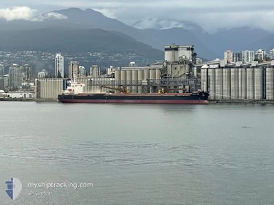
STAR NINA
Bulk Carrier
Current Trip
| Trip Time | 77 days |
|---|---|
| Trip Distance | 13958.99 nm |
| AVG Speed | 10.9 Noeuds |
| MAX Speed | 15.2 Noeuds |
| Tirant d eau | 6.8 m |
| AVG Wind | 11.7 knots |
| MAX Wind | 30 knots |
| MIN Temp | 1.8°C / 35.24°F |
| MAX Temp | 29.9°C / 85.82°F |
| Position reçue | 6 d depuis |
Current Position
| Longitude | -48.28930° |
|---|---|
| Latitude | -25.60693° |
| Etat | At anchor |
| Vitesse | 11.3 Noeuds |
| Parcours | 313.3° |
| Zone | South Atlantic Ocean |
| Station | T-AIS |
| Position reçue | 6 d depuis |
Info
Information
The current position of STAR NINA is in South Atlantic Ocean with coordinates -25.60693° / -48.28930° as reported on 2025-01-25 21:22 by AIS to our vessel tracker app. The vessel's current speed is 11.3 Noeuds and is currently inside the port of PARANAGUA.
The vessel STAR NINA (IMO: 9354832, MMSI: 538002635) is a Bulk Carrier that was built in 2006 ( 19 Age ). It's sailing under the flag of [MH] Marshall Is.
In this page you can find informations about the vessels current position, last detected port calls, and current voyage information. If the vessels is not in coverage by AIS you will find the latest position.
The current position of STAR NINA is detected by our AIS receivers and we are not responsible for the reliability of the data. The last position was recorded while the vessel was in Coverage by the Ais receivers of our vessel tracking app.
The current draught of STAR NINA as reported by AIS is 6.8 meters
Weather
| Temperature | 21.8°C / 71.24°F |
|---|---|
| Wind Speed | 3 knots |
| Direction | 253° WSW |
| Pressure | 1007.7 hPa |
| Humidity | 98.4 % |
| Cloud Coverage | 100 % |
Featured Company
Events
| Heure | Evenement | Détails | Position/ Destination | Info |
|---|---|---|---|---|
| 2025-01-29 06:18 | Arret |
-25.50104 / -48.50319
[BR] PARANAGUA
|
Vitesse: 0.2 kn Parcours: 261° |
|
| 2025-01-29 06:18 | Port d'arrivée |
|
-25.50104 / -48.50319
[BR] PARANAGUA
|
Vitesse: 7.8 kn Parcours: 262° |
| 2025-01-29 05:34 | Démarrage | 4.13 nm, North West of PONTAL DO SUL |
-25.50904 / -48.40052
BR PNG
|
Vitesse: 6.4 kn Parcours: 221° |
| 2025-01-25 22:29 | Arret | 4.57 nm, North West of PONTAL DO SUL |
-25.50203 / -48.40348
BR PNG
|
Vitesse: 0.3 kn Parcours: 63° |
| 2025-01-25 21:26 | Etat Changé | Default At anchor |
-25.59689 / -48.30105
BR PNG
|
Vitesse: 11.3 kn Parcours: 313.3° |
| 2025-01-25 21:22 | Hors de la zone couverte |
-25.60693 / -48.28930
South Atlantic Ocean
|
Vitesse: 11.3 kn Parcours: 313.3° |
|
| 2025-01-25 21:14 | Etat Changé | At anchor Default |
-25.62431 / -48.26852
BR PNG
|
Vitesse: 7.7 kn Parcours: 332° |
| 2025-01-25 21:14 | Dans la zone couverte |
-25.61915 / -48.27459
South Atlantic Ocean
|
Vitesse: 11.1 kn Parcours: 312.5° |
|
| 2025-01-25 20:08 | Démarrage | 9.25 nm, South of PONTAL DO SUL |
-25.70786 / -48.29122
BR PNG
|
Vitesse: 3.4 kn Parcours: 15° |
| 2025-01-25 18:59 | Hors de la zone couverte |
-25.71091 / -48.28939
South Atlantic Ocean
|
Vitesse: 0.2 kn Parcours: 241.8° |