

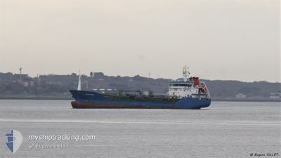
STRAITVIEW
Oil/Chemical Tanker

Current Trip
| Time Travelled | 5 days |
|---|---|
| Remaining Time | --- |
| Distance Travelled | 730.98 nm |
| Remaining Distance | --- |
| AVG Speed | 11.3 Noeuds |
| MAX Speed | 14.7 Noeuds |
| AVG Wind | 9 knots |
| MAX Wind | 17.8 knots |
| MIN Temp | 12.8°C / 55.04°F |
| MAX Temp | 21.1°C / 69.98°F |
| Tirant d eau | 4.6 m |
| Position reçue | 1 h, 50 m depuis |
Current Position
| Longitude | -1.50049° |
|---|---|
| Latitude | 45.58302° |
| Etat | Under way using engine |
| Vitesse | 9.5 Noeuds |
| Parcours | 245° |
| Zone | Bay of Biscay |
| Station | T-AIS |
| Position reçue | 1 h, 50 m depuis |
Information
The current position of STRAITVIEW is in Bay of Biscay with coordinates 45.58302° / -1.50049° as reported on 2025-06-06 20:37 by AIS to our vessel tracker app. The vessel's current speed is 9.5 Noeuds and is heading at the port of MONTOIR. The estimated time of arrival as calculated by MyShipTracking vessel tracking app is 2025-06-07 18:00 LT
The vessel STRAITVIEW (IMO: 9391127, MMSI: 256765000) is a Oil/Chemical Tanker that was built in 2007 ( 18 Age ). It's sailing under the flag of [MT] Malta.
In this page you can find informations about the vessels current position, last detected port calls, and current voyage information. If the vessels is not in coverage by AIS you will find the latest position.
The current position of STRAITVIEW is detected by our AIS receivers and we are not responsible for the reliability of the data. The last position was recorded while the vessel was in Coverage by the Ais receivers of our vessel tracking app.
The current draught of STRAITVIEW as reported by AIS is 4.6 meters
Weather
| Temperature | 17.6°C / 63.68°F |
|---|---|
| Wind Speed | 11 knots |
| Direction | 245° WSW |
| Pressure | 1016.8 hPa |
| Humidity | 75.4 % |
| Cloud Coverage | 53 % |


Featured Company
Last Port Calls
| Port | Arrival | Departure | Time In Port |
|---|---|---|---|
| 2025-05-31 16:10 | 2025-06-01 08:16 | 16 h | |
| 2025-05-29 11:47 | 2025-05-29 11:52 | 4 m | |
| 2025-05-29 03:52 | 2025-05-29 11:45 | 7 h | |
| 2025-05-25 08:12 | 2025-05-26 04:39 | 20 h | |
| 2025-05-21 04:48 | 2025-05-21 19:44 | 14 h | |
| 2025-05-21 04:30 | 2025-05-21 04:41 | 11 m | |
| 2025-05-17 16:43 | 2025-05-18 13:58 | 21 h | |
| 2025-05-09 20:13 | 2025-05-10 20:03 | 23 h | |
| 2025-05-03 16:59 | 2025-05-04 14:56 | 21 h | |
| 2025-04-29 15:21 | 2025-04-30 11:10 | 19 h |
Last Trips
| Origin | Departure | Destination | Arrival | Distance | |
|---|---|---|---|---|---|
| 2025-05-29 11:52 | 2025-05-31 16:10 | 509.44 nm | |||
| 2025-05-29 11:45 | 2025-05-29 11:47 | 1.07 nm | |||
| 2025-05-26 04:39 | 2025-05-29 03:52 | 665.62 nm | |||
| 2025-05-21 19:44 | 2025-05-25 08:12 | 657.60 nm | |||
| 2025-05-21 04:41 | 2025-05-21 04:48 | 0.07 nm | |||
| 2025-05-18 13:58 | 2025-05-21 04:30 | 567.70 nm | |||
| 2025-05-10 20:03 | 2025-05-17 16:43 | 1377.71 nm | |||
| 2025-05-04 14:56 | 2025-05-09 20:13 | 897.20 nm | |||
| 2025-04-30 11:10 | 2025-05-03 16:59 | 832.97 nm | |||
| 2025-04-28 15:12 | 2025-04-29 15:21 | 205.48 nm |
Events
| Heure | Evenement | Détails | Position/ Destination | Info |
|---|---|---|---|---|
| 2025-06-06 20:37 | Hors de la zone couverte |
45.58302 / -1.50049
Bay of Biscay
FRMTX
|
Vitesse: 9.5 kn Parcours: 245° |
|
| 2025-06-06 17:48 | Tirant d'eau modifié | 4.6 6.1 |
45.43537 / -.88087
FRMTX
|
Vitesse: 13.3 kn Parcours: 322.5° |
| 2025-06-06 17:48 | Changement de destination | FRMTX FRBOD |
45.43537 / -.88087
FRMTX
|
Vitesse: 13.3 kn Parcours: 322.5° |
| 2025-06-06 17:48 | Changement d'ETA | 2025/06/07 16:00 2025/06/01 15:00 |
45.43537 / -.88087
FRMTX
|
Vitesse: 13.3 kn Parcours: 322.5° |
| 2025-06-06 17:22 | Etat Changé | Under way using engine Default |
45.35567 / -.80106
FRBOD
|
Vitesse: 14.6 kn Parcours: 337° |
| 2025-06-06 17:16 | Dans la zone couverte |
45.35567 / -.80106
Bay of Biscay
|
Vitesse: 14.7 kn Parcours: 335.1° |
|
| 2025-06-06 15:01 | Démarrage | 4.21 nm, North of BORDEAUX |
44.91561 / -.54546
FRBOD
|
Vitesse: 7.6 kn Parcours: 331° |
| 2025-06-04 21:20 | Etat Changé | Default Under way using engine |
45.25035 / -.74411
FRBOD
|
Vitesse: 12.3 kn Parcours: 160.5° |
| 2025-06-04 21:09 | Hors de la zone couverte |
45.28546 / -.75947
Bay of Biscay
|
Vitesse: 12.3 kn Parcours: 160.5° |
|
| 2025-06-04 17:43 | Etat Changé | Under way using engine Default |
45.60629 / -1.36575
FRBOD
|
Vitesse: 9.9 kn Parcours: 65° |