

STRAITVIEW
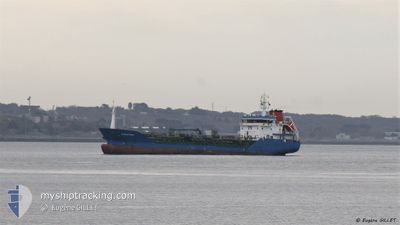
Oil/Chemical Tanker

Current Trip
| Time Travelled | 1 day |
|---|---|
| Remaining Time | 20 h, 9 mins |
| Distance Travelled | 317.82 nm |
| Remaining Distance | 197.08 nm |
| AVG Speed | 10.8 Knots |
| MAX Speed | 14.9 Knots |
| AVG Wind | 5.5 knots |
| MAX Wind | 8 knots |
| MIN Temp | 14.8°C / 58.64°F |
| MAX Temp | 18.3°C / 64.94°F |
| Draught | 5 m |
| Position Received | 1 m ago |
Current Position
| Longitude | -2.99548° |
|---|---|
| Latitude | 49.77043° |
| Status | Under way using engine |
| Speed | 9 Knots |
| Course | 77.2° |
| Area | English Channel |
| Station | T-AIS |
| Position Received | 1 m ago |
Information
The current position of STRAITVIEW is in English Channel with coordinates 49.77043° / -2.99548° as reported on 2025-05-30 15:03 by AIS to our vessel tracker app. The vessel's current speed is 9 Knots and is heading at the port of ROUEN. The estimated time of arrival as calculated by MyShipTracking vessel tracking app is 2025-05-31 13:14 LT
The vessel STRAITVIEW (IMO: 9391127, MMSI: 256765000) is a Oil/Chemical Tanker that was built in 2007 ( 18 years old ). It's sailing under the flag of [MT] Malta.
In this page you can find informations about the vessels current position, last detected port calls, and current voyage information. If the vessels is not in coverage by AIS you will find the latest position.
The current position of STRAITVIEW is detected by our AIS receivers and we are not responsible for the reliability of the data. The last position was recorded while the vessel was in Coverage by the Ais receivers of our vessel tracking app.
The current draught of STRAITVIEW as reported by AIS is 5 meters
Weather
| Temperature | 15.2°C / 59.36°F |
|---|---|
| Wind Speed | 8 knots |
| Direction | 244° WSW |
| Pressure | 1020.4 hPa |
| Humidity | 87.8 % |
| Cloud Coverage | 67 % |


Featured Company
Last Port Calls
| Port | Arrival | Departure | Time In Port |
|---|---|---|---|
| 2025-05-29 11:47 | 2025-05-29 11:52 | 4 m | |
| 2025-05-29 03:52 | 2025-05-29 11:45 | 7 h | |
| 2025-05-25 08:12 | 2025-05-26 04:39 | 20 h | |
| 2025-05-21 04:48 | 2025-05-21 19:44 | 14 h | |
| 2025-05-21 04:30 | 2025-05-21 04:41 | 11 m | |
| 2025-05-17 16:43 | 2025-05-18 13:58 | 21 h | |
| 2025-05-09 20:13 | 2025-05-10 20:03 | 23 h | |
| 2025-05-03 16:59 | 2025-05-04 14:56 | 21 h | |
| 2025-04-29 15:21 | 2025-04-30 11:10 | 19 h | |
| 2025-04-26 22:54 | 2025-04-28 15:12 | 1 d |
Last Trips
| Origin | Departure | Destination | Arrival | Distance | |
|---|---|---|---|---|---|
| 2025-05-29 11:45 | 2025-05-29 11:47 | 1.07 nm | |||
| 2025-05-26 04:39 | 2025-05-29 03:52 | 665.62 nm | |||
| 2025-05-21 19:44 | 2025-05-25 08:12 | 657.60 nm | |||
| 2025-05-21 04:41 | 2025-05-21 04:48 | 0.07 nm | |||
| 2025-05-18 13:58 | 2025-05-21 04:30 | 567.70 nm | |||
| 2025-05-10 20:03 | 2025-05-17 16:43 | 1377.71 nm | |||
| 2025-05-04 14:56 | 2025-05-09 20:13 | 897.20 nm | |||
| 2025-04-30 11:10 | 2025-05-03 16:59 | 832.97 nm | |||
| 2025-04-28 15:12 | 2025-04-29 15:21 | 205.48 nm | |||
| 2025-04-05 18:21 | 2025-04-26 22:54 | 985.22 nm |
Events
| Time | Event | Details | Position / Dest | Info |
|---|---|---|---|---|
| 2025-05-30 13:37 | Status Changed | Under way using engine Default |
49.65283 / -3.29337
FRURO
|
Speed: 9.9 kn Course: 60° |
| 2025-05-30 13:36 | Status Changed | Default Under way using engine |
49.65209 / -3.29530
FRURO
|
Speed: 10.2 kn Course: 59.1° |
| 2025-05-30 12:46 | Status Changed | Under way using engine Default |
49.57958 / -3.48697
FRURO
|
Speed: 10.3 kn Course: 57° |
| 2025-05-30 12:37 | Status Changed | Default Under way using engine |
49.56553 / -3.51913
FRURO
|
Speed: 10 kn Course: 55.2° |
| 2025-05-30 12:25 | Status Changed | Under way using engine Default |
49.54673 / -3.56356
FRURO
|
Speed: 10.2 kn Course: 60° |
| 2025-05-30 12:12 | Status Changed | Default Under way using engine |
49.53079 / -3.61045
FRURO
|
Speed: 10.3 kn Course: 56.5° |
| 2025-05-30 12:04 | Detected in Sea | Guernsey part of the English Channel |
49.52012 / -3.64265
English Channel
FRURO
|
Speed: 10.4 kn Course: 62.2° |
| 2025-05-30 11:33 | Status Changed | Under way using engine Default |
49.47298 / -3.76214
FRURO
|
Speed: 10.5 kn Course: 62° |
| 2025-05-30 11:15 | Status Changed | Default Under way using engine |
49.44650 / -3.83319
FRURO
|
Speed: 10.7 kn Course: 58.9° |
| 2025-05-30 11:04 | Status Changed | Under way using engine Default |
49.42914 / -3.87636
FRURO
|
Speed: 11.3 kn Course: 55° |