
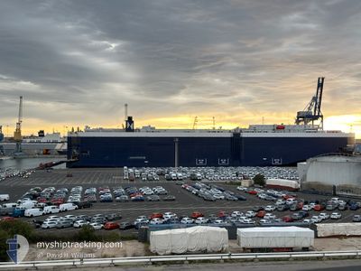
SUNBELT SPIRIT
Vehicles Carrier
Current Trip
| Time Travelled | 1 day |
|---|---|
| Remaining Time | 1 day |
| Distance Travelled | 542.95 nm |
| Remaining Distance | 655.01 nm |
| AVG Speed | 14.9 Noeuds |
| MAX Speed | 16.2 Noeuds |
| AVG Wind | 6.2 knots |
| MAX Wind | 19.7 knots |
| MIN Temp | 11.8°C / 53.24°F |
| MAX Temp | 13.5°C / 56.3°F |
| Tirant d eau | 8.8 m |
| Position reçue | 1 h, 26 m depuis |
Current Position
| Longitude | 11.98475° |
|---|---|
| Latitude | 37.56205° |
| Etat | Under way using engine |
| Vitesse | 14.3 Noeuds |
| Parcours | 119.6° |
| Zone | Mediterranean Sea - Eastern Basin |
| Station | T-AIS |
| Position reçue | 1 h, 26 m depuis |
Info
Information
The current position of SUNBELT SPIRIT is in Mediterranean Sea - Eastern Basin with coordinates 37.56205° / 11.98475° as reported on 2025-02-07 04:01 by AIS to our vessel tracker app. The vessel's current speed is 14.3 Noeuds and is heading at the port of PIRAEUS. The estimated time of arrival as calculated by MyShipTracking vessel tracking app is 2025-02-08 22:40 LT
The vessel SUNBELT SPIRIT (IMO: 9233246, MMSI: 538001657) is a Vehicles Carrier that was built in 2002 ( 23 Age ). It's sailing under the flag of [MH] Marshall Is.
In this page you can find informations about the vessels current position, last detected port calls, and current voyage information. If the vessels is not in coverage by AIS you will find the latest position.
The current position of SUNBELT SPIRIT is detected by our AIS receivers and we are not responsible for the reliability of the data. The last position was recorded while the vessel was in Coverage by the Ais receivers of our vessel tracking app.
The current draught of SUNBELT SPIRIT as reported by AIS is 8.8 meters
Weather
| Temperature | 13.7°C / 56.66°F |
|---|---|
| Wind Speed | 21 knots |
| Direction | 127° SE |
| Pressure | 1024.8 hPa |
| Humidity | 76.3 % |
| Cloud Coverage | 86 % |
Featured Company
Last Port Calls
| Port | Arrival | Departure | Time In Port |
|---|---|---|---|
| 2025-02-05 06:20 | 2025-02-05 14:57 | 8 h | |
| 2025-02-03 23:08 | 2025-02-05 02:39 | 1 d | |
| 2025-02-01 13:55 | 2025-02-02 13:05 | 23 h | |
| 2025-01-29 12:13 | 2025-01-30 13:34 | 1 d | |
| 2025-01-25 04:50 | 2025-01-26 18:10 | 1 d | |
| 2025-01-20 05:16 | 2025-01-21 12:00 | 1 d | |
| 2025-01-16 17:22 | 2025-01-17 18:26 | 1 d | |
| 2025-01-16 02:58 | 2025-01-16 11:36 | 8 h | |
| 2025-01-11 19:07 | 2025-01-12 05:35 | 10 h | |
| 2025-01-11 08:34 | 2025-01-11 12:53 | 4 h |
Last Trips
| Origin | Departure | Destination | Arrival | Distance | |
|---|---|---|---|---|---|
| 2025-02-05 03:39 | 2025-02-05 07:20 | 50.47 nm | |||
| 2025-02-02 14:05 | 2025-02-04 00:08 | 396.68 nm | |||
| 2025-01-30 14:34 | 2025-02-01 14:55 | 97.45 nm | |||
| 2025-01-26 19:10 | 2025-01-29 13:13 | 875.62 nm | |||
| 2025-01-21 13:00 | 2025-01-25 05:50 | 472.21 nm | |||
| 2025-01-17 19:26 | 2025-01-20 06:16 | 345.17 nm | |||
| 2025-01-16 12:36 | 2025-01-16 18:22 | 71.57 nm | |||
| 2025-01-12 08:35 | 2025-01-16 03:58 | 1415.40 nm | |||
| 2025-01-11 15:53 | 2025-01-11 22:07 | 70.07 nm | |||
| 2025-01-10 09:15 | 2025-01-11 11:34 | 247.58 nm |
Events
| Heure | Evenement | Détails | Position/ Destination | Info |
|---|---|---|---|---|
| 2025-02-07 04:06 | Etat Changé | Default Under way using engine |
37.55341 / 12.00515
GRPIR
|
Vitesse: 14.3 kn Parcours: 119.6° |
| 2025-02-07 04:01 | Detecté en mer | Italian part of the Mediterranean Sea - Eastern Basin |
37.56205 / 11.98475
Mediterranean Sea - Eastern Basin
GRPIR
|
Vitesse: 14.3 kn Parcours: 119.6° |
| 2025-02-07 04:01 | Hors de la zone couverte |
37.56205 / 11.98475
Mediterranean Sea - Eastern Basin
GRPIR
|
Vitesse: 14.3 kn Parcours: 119.6° |
|
| 2025-02-07 03:43 | Detecté en mer | Italian part of the Mediterranean Sea - Western Basin |
37.59863 / 11.90228
Mediterranean Sea - Western Basin
GRPIR
|
Vitesse: 14.2 kn Parcours: 119.2° |
| 2025-02-07 03:43 | Etat Changé | Under way using engine Default |
37.59886 / 11.90178
GRPIR
|
Vitesse: 14.2 kn Parcours: 120° |
| 2025-02-07 03:31 | Dans la zone couverte |
37.59863 / 11.90228
Mediterranean Sea - Western Basin
GRPIR
|
Vitesse: 14.2 kn Parcours: 119.2° |
|
| 2025-02-06 01:29 | Etat Changé | Default Under way using engine |
40.10661 / 4.36049
GRPIR
|
Vitesse: 14.4 kn Parcours: 112.5° |
| 2025-02-06 01:06 | Hors de la zone couverte |
40.14150 / 4.24810
Mediterranean Sea - Western Basin
GRPIR
|
Vitesse: 14.4 kn Parcours: 112.5° |
|
| 2025-02-06 00:58 | Detecté en mer | Spanish part of the Mediterranean Sea - Western Basin |
40.15230 / 4.21324
Mediterranean Sea - Western Basin
GRPIR
|
Vitesse: 14.4 kn Parcours: 111.6° |
| 2025-02-06 00:56 | Dans la zone couverte |
40.15230 / 4.21324
Mediterranean Sea - Western Basin
GRPIR
|
Vitesse: 14.4 kn Parcours: 111.6° |