
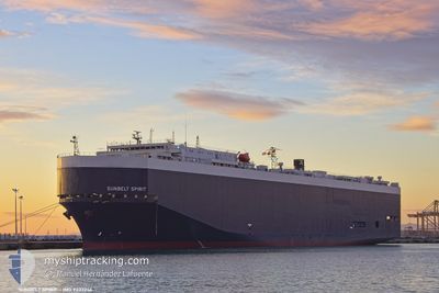
SUNBELT SPIRIT
Vehicles Carrier
Current Trip
| Time Travelled | 3 days |
|---|---|
| Remaining Time | 3 h, 52 mins |
| Distance Travelled | 967.20 nm |
| Remaining Distance | 47.01 nm |
| AVG Speed | 12 Knop |
| MAX Speed | 15.8 Knop |
| AVG Wind | 9.4 knots |
| MAX Wind | 23 knots |
| MIN Temp | 8.4°C / 47.12°F |
| MAX Temp | 20.7°C / 69.26°F |
| Djupgående | 8.7 m |
| Position mottagen | Nu |
Current Position
| Longitud | 23.63268° |
|---|---|
| Latitude | 37.25401° |
| Status | Under way using engine |
| Fart | 11.4 Knop |
| Kurs | 15° |
| Område | Aegean Sea |
| Station | T-AIS |
| Position mottagen | Nu |
Info
Information
The current position of SUNBELT SPIRIT is in Aegean Sea with coordinates 37.25401° / 23.63268° as reported on 2025-03-14 23:34 by AIS to our vessel tracker app. The vessel's current speed is 11.4 Knop and is heading at the port of PIRAEUS. The estimated time of arrival as calculated by MyShipTracking vessel tracking app is 2025-03-15 03:27 LT
The vessel SUNBELT SPIRIT (IMO: 9233246, MMSI: 538001657) is a Vehicles Carrier that was built in 2002 ( 23 År gammal ). It's sailing under the flag of [MH] Marshall Is.
In this page you can find informations about the vessels current position, last detected port calls, and current voyage information. If the vessels is not in coverage by AIS you will find the latest position.
The current position of SUNBELT SPIRIT is detected by our AIS receivers and we are not responsible for the reliability of the data. The last position was recorded while the vessel was in Coverage by the Ais receivers of our vessel tracking app.
The current draught of SUNBELT SPIRIT as reported by AIS is 8.7 meters
Weather
| Temperature | 16.5°C / 61.7°F |
|---|---|
| Wind Speed | 9 knots |
| Direction | 187° S |
| Pressure | 1018.1 hPa |
| Humidity | 84.5 % |
| Cloud Coverage | 92 % |
Featured Company
Last Port Calls
| Port | Arrival | Departure | Time In Port |
|---|---|---|---|
| 2025-03-11 05:38 | 2025-03-11 17:10 | 11 h | |
| 2025-03-09 10:24 | 2025-03-10 11:06 | 1 d | |
| 2025-03-08 02:10 | 2025-03-08 18:13 | 16 h | |
| 2025-03-04 09:45 | 2025-03-06 00:39 | 1 d | |
| 2025-03-03 05:15 | 2025-03-04 01:48 | 20 h | |
| 2025-03-01 07:19 | 2025-03-02 02:51 | 19 h | |
| 2025-02-27 05:16 | 2025-02-27 19:43 | 14 h | |
| 2025-02-26 03:03 | 2025-02-26 13:47 | 10 h | |
| 2025-02-25 03:25 | 2025-02-25 13:16 | 9 h | |
| 2025-02-24 01:22 | 2025-02-24 19:52 | 18 h |
Last Trips
| Origin | Departure | Destination | Arrival | Distance | |
|---|---|---|---|---|---|
| 2025-03-10 12:06 | 2025-03-11 06:38 | 232.05 nm | |||
| 2025-03-08 19:13 | 2025-03-09 11:24 | 189.38 nm | |||
| 2025-03-06 00:39 | 2025-03-08 03:10 | 533.22 nm | |||
| 2025-03-04 02:48 | 2025-03-04 09:45 | 89.38 nm | |||
| 2025-03-02 02:51 | 2025-03-03 06:15 | 124.95 nm | |||
| 2025-02-27 20:43 | 2025-03-01 07:19 | 419.20 nm | |||
| 2025-02-26 14:47 | 2025-02-27 06:16 | 160.91 nm | |||
| 2025-02-25 14:16 | 2025-02-26 04:03 | 162.62 nm | |||
| 2025-02-24 20:52 | 2025-02-25 04:25 | 74.50 nm | |||
| 2025-02-19 13:26 | 2025-02-24 02:22 | 1415.22 nm |
Events
| Tid | Event | Detaljer | Position / Dest | Information |
|---|---|---|---|---|
| 2025-03-14 21:01 | ETA ändrat | 2025/03/15 04:00 2025/03/14 18:00 |
36.78406 / 23.54954
GRPIR
|
Fart: 11.6 kn Kurs: 340.7° |
| 2025-03-14 10:22 | Byter havsområde | Greek part of the Aegean Sea Greek part of the Mediterranean Sea - Eastern Basin |
36.39101 / 22.99667
Aegean Sea
GRPIR
|
Fart: 7.6 kn Kurs: 108.9° |
| 2025-03-14 09:28 | Status ändrad | Under way using engine Default |
36.38161 / 22.86350
GRPIR
|
Fart: 7.3 kn Kurs: 73° |
| 2025-03-14 09:28 | I täckningsområde |
36.38161 / 22.86350
Mediterranean Sea - Eastern Basin
GRPIR
|
Fart: 7.3 kn Kurs: 73.7° |
|
| 2025-03-14 08:06 | Status ändrad | Default Under way using engine |
36.33317 / 22.63206
GRPIR
|
Fart: 11.2 kn Kurs: 73.1° |
| 2025-03-14 08:02 | Status ändrad | Under way using engine Default |
36.33006 / 22.61864
GRPIR
|
Fart: 11.3 kn Kurs: 75° |
| 2025-03-14 08:02 | UTANFÖR täckningsområde |
36.33006 / 22.61864
Mediterranean Sea - Eastern Basin
GRPIR
|
Fart: 11.2 kn Kurs: 73.1° |
|
| 2025-03-14 07:26 | Status ändrad | Default Under way using engine |
36.33824 / 22.47380
GRPIR
|
Fart: 13.6 kn Kurs: 106° |
| 2025-03-14 06:42 | Upptäckt i hav | Greek part of the Mediterranean Sea - Eastern Basin |
36.37821 / 22.27492
Mediterranean Sea - Eastern Basin
GRPIR
|
Fart: 13.8 kn Kurs: 101.7° |
| 2025-03-14 06:42 | Status ändrad | Under way using engine Default |
36.37821 / 22.27492
GRPIR
|
Fart: 13.8 kn Kurs: 106° |