

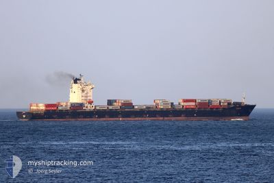
TANJA
Container Ship

Current Trip
| Time Travelled | 1 day |
|---|---|
| Remaining Time | 2 days |
| Distance Travelled | 344.57 nm |
| Remaining Distance | 737.40 nm |
| AVG Speed | 13.9 Noeuds |
| MAX Speed | 17.9 Noeuds |
| AVG Wind | 8.3 knots |
| MAX Wind | 20.6 knots |
| MIN Temp | 29.4°C / 84.92°F |
| MAX Temp | 31.4°C / 88.52°F |
| Tirant d eau | 12.1 m |
| Position reçue | 4 h, 34 m depuis |
Current Position
| Longitude | 57.02569° |
|---|---|
| Latitude | 24.68008° |
| Etat | Under way using engine |
| Vitesse | 13.2 Noeuds |
| Parcours | 137.2° |
| Zone | Gulf of Oman |
| Station | T-AIS |
| Position reçue | 4 h, 34 m depuis |
Information
The current position of TANJA is in Gulf of Oman with coordinates 24.68008° / 57.02569° as reported on 2025-05-25 12:13 by AIS to our vessel tracker app. The vessel's current speed is 13.2 Noeuds and is heading at the port of SALALAH. The estimated time of arrival as calculated by MyShipTracking vessel tracking app is 2025-05-27 23:18 LT
The vessel TANJA (IMO: 9431692, MMSI: 538003717) is a Container Ship that was built in 2009 ( 16 Age ). It's sailing under the flag of [MH] Marshall Is.
In this page you can find informations about the vessels current position, last detected port calls, and current voyage information. If the vessels is not in coverage by AIS you will find the latest position.
The current position of TANJA is detected by our AIS receivers and we are not responsible for the reliability of the data. The last position was recorded while the vessel was in Coverage by the Ais receivers of our vessel tracking app.
The current draught of TANJA as reported by AIS is 12.1 meters
Weather
| Temperature | 30.7°C / 87.26°F |
|---|---|
| Wind Speed | 2 knots |
| Direction | 71° ENE |
| Pressure | 999.3 hPa |
| Humidity | 84.9 % |
| Cloud Coverage | --- |


Featured Company
Last Port Calls
| Port | Arrival | Departure | Time In Port |
|---|---|---|---|
| 2025-05-23 13:14 | 2025-05-24 20:20 | 1 d | |
| 2025-05-22 10:13 | 2025-05-23 04:07 | 17 h | |
| 2025-05-17 11:22 | 2025-05-18 11:36 | 1 d | |
| 2025-05-12 11:51 | 2025-05-14 03:56 | 1 d | |
| 2025-05-11 10:54 | 2025-05-11 22:18 | 11 h | |
| 2025-05-07 02:25 | 2025-05-07 21:27 | 19 h | |
| 2025-05-02 13:12 | 2025-05-02 23:46 | 10 h | |
| 2025-05-01 14:08 | 2025-05-02 03:01 | 12 h | |
| 2025-04-30 01:04 | 2025-04-30 20:02 | 18 h | |
| 2025-04-27 18:10 | 2025-04-28 14:55 | 20 h |
Last Trips
| Origin | Departure | Destination | Arrival | Distance | |
|---|---|---|---|---|---|
| 2025-05-23 04:07 | 2025-05-23 13:14 | 52.14 nm | |||
| 2025-05-18 11:36 | 2025-05-22 10:13 | 1034.46 nm | |||
| 2025-05-14 03:56 | 2025-05-17 11:22 | 907.17 nm | |||
| 2025-05-11 22:18 | 2025-05-12 11:51 | 57.69 nm | |||
| 2025-05-07 21:27 | 2025-05-11 10:54 | 896.76 nm | |||
| 2025-05-02 23:46 | 2025-05-07 02:25 | 1029.50 nm | |||
| 2025-05-02 03:01 | 2025-05-02 13:12 | 64.08 nm | |||
| 2025-04-30 20:02 | 2025-05-01 14:08 | 42.17 nm | |||
| 2025-04-28 14:55 | 2025-04-30 01:04 | 110.30 nm | |||
| 2025-04-24 05:03 | 2025-04-27 18:10 | 1016.88 nm |
Events
| Heure | Evenement | Détails | Position/ Destination | Info |
|---|---|---|---|---|
| 2025-05-25 12:18 | Etat Changé | Default Under way using engine |
24.66430 / 57.04180
AEKHL>OMSLV
|
Vitesse: 13.2 kn Parcours: 137.2° |
| 2025-05-25 12:13 | Hors de la zone couverte |
24.68008 / 57.02569
Gulf of Oman
AEKHL>OMSLV
|
Vitesse: 13.2 kn Parcours: 137.2° |
|
| 2025-05-25 10:13 | Changement de zone | Omani part of the Gulf of Oman United Arab Emirates part of the Gulf of Oman |
25.03139 / 56.73463
Gulf of Oman
AEKHL>OMSLV
|
Vitesse: 13.7 kn Parcours: 179.8° |
| 2025-05-25 07:25 | Changement de zone | United Arab Emirates part of the Gulf of Oman Omani part of the Gulf of Oman |
25.67224 / 56.72209
Gulf of Oman
AEKHL>OMSLV
|
Vitesse: 13.5 kn Parcours: 174° |
| 2025-05-25 06:25 | Changement de zone | Omani part of the Gulf of Oman Omani part of the Persian Gulf |
25.90965 / 56.72967
Gulf of Oman
AEKHL>OMSLV
|
Vitesse: 17.2 kn Parcours: 178.7° |
| 2025-05-25 06:23 | Etat Changé | Under way using engine Default |
25.91881 / 56.72944
AEKHL>OMSLV
|
Vitesse: 17.8 kn Parcours: 178° |
| 2025-05-25 06:22 | Dans la zone couverte |
25.90965 / 56.72967
Gulf of Oman
AEKHL>OMSLV
|
Vitesse: 17.2 kn Parcours: 178.7° |
|
| 2025-05-25 01:42 | Etat Changé | Default Under way using engine |
26.23048 / 55.96491
AEKHL>OMSLV
|
Vitesse: 14.3 kn Parcours: 38.1° |
| 2025-05-25 01:35 | Hors de la zone couverte |
26.20866 / 55.94633
Persian Gulf
AEKHL>OMSLV
|
Vitesse: 14.3 kn Parcours: 38.1° |
|
| 2025-05-25 01:24 | Changement de zone | Omani part of the Persian Gulf United Arab Emirates part of the Persian Gulf |
26.17317 / 55.91542
Persian Gulf
AEKHL>OMSLV
|
Vitesse: 14.4 kn Parcours: 38° |