
TARIFA
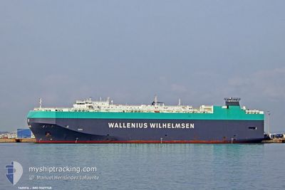
Vehicles Carrier
Current Trip
| Time Travelled | 3 days |
|---|---|
| Remaining Time | 3 days |
| Distance Travelled | 1218.23 nm |
| Remaining Distance | 1229.61 nm |
| AVG Speed | 13.3 Noeuds |
| MAX Speed | 20.5 Noeuds |
| AVG Wind | 19.6 knots |
| MAX Wind | 31 knots |
| MIN Temp | 18.9°C / 66.02°F |
| MAX Temp | 26.4°C / 79.52°F |
| Tirant d eau | 8.8 m |
| Position reçue | 1 d depuis |
Current Position
| Longitude | 17.88873° |
|---|---|
| Latitude | -34.44129° |
| Etat | Under way using engine |
| Vitesse | 13.7 Noeuds |
| Parcours | 308.7° |
| Zone | South Atlantic Ocean |
| Station | T-AIS |
| Position reçue | 1 d depuis |
Info
Information
The current position of TARIFA is in South Atlantic Ocean with coordinates -34.44129° / 17.88873° as reported on 2025-02-10 01:38 by AIS to our vessel tracker app. The vessel's current speed is 13.7 Noeuds and is heading at the port of LUANDA. The estimated time of arrival as calculated by MyShipTracking vessel tracking app is 2025-02-15 07:33 LT
The vessel TARIFA (IMO: 9327748, MMSI: 309847000) is a Vehicles Carrier that was built in 2007 ( 18 Age ). It's sailing under the flag of [BS] Bahamas.
In this page you can find informations about the vessels current position, last detected port calls, and current voyage information. If the vessels is not in coverage by AIS you will find the latest position.
The current position of TARIFA is detected by our AIS receivers and we are not responsible for the reliability of the data. The last position was recorded while the vessel was in Coverage by the Ais receivers of our vessel tracking app.
The current draught of TARIFA as reported by AIS is 8.8 meters
Weather
| Temperature | 19.2°C / 66.56°F |
|---|---|
| Wind Speed | 23 knots |
| Direction | 156° SSE |
| Pressure | 1008.7 hPa |
| Humidity | 86.6 % |
| Cloud Coverage | --- |
Featured Company
Last Port Calls
| Port | Arrival | Departure | Time In Port |
|---|---|---|---|
| 2025-02-05 23:02 | 2025-02-07 14:35 | 1 d | |
| 2025-01-30 15:24 | 2025-02-01 15:31 | 2 d | |
| 2025-01-28 18:31 | 2025-01-29 19:39 | 1 d | |
| 2025-01-07 10:27 | 2025-01-07 23:01 | 12 h | |
| 2025-01-02 16:21 | 2025-01-03 06:20 | 13 h | |
| 2024-12-31 16:35 | 2025-01-02 07:08 | 1 d | |
| 2024-12-28 22:59 | 2024-12-29 08:37 | 9 h | |
| 2024-12-27 22:30 | 2024-12-28 07:27 | 8 h | |
| 2024-12-26 21:08 | 2024-12-27 08:05 | 10 h |
Last Trips
| Origin | Departure | Destination | Arrival | Distance | |
|---|---|---|---|---|---|
| 2025-02-01 18:31 | 2025-02-06 01:02 | 1756.59 nm | |||
| 2025-01-29 22:39 | 2025-01-30 18:24 | 202.25 nm | |||
| 2025-01-08 07:01 | 2025-01-28 21:31 | 6527.63 nm | |||
| 2025-01-03 15:20 | 2025-01-07 18:27 | 1049.68 nm | |||
| 2025-01-02 16:08 | 2025-01-03 01:21 | 128.05 nm | |||
| 2024-12-29 17:37 | 2025-01-01 01:35 | 839.16 nm | |||
| 2024-12-28 16:27 | 2024-12-29 07:59 | 244.94 nm | |||
| 2024-12-27 17:05 | 2024-12-28 07:30 | 210.90 nm | |||
| 2024-11-30 05:50 | 2024-12-27 06:08 | 9679.97 nm |
Events
| Heure | Evenement | Détails | Position/ Destination | Info |
|---|---|---|---|---|
| 2025-02-10 01:40 | Etat Changé | Default Under way using engine |
-34.43623 / 17.88079
AO LAD
|
Vitesse: 13.7 kn Parcours: 308.7° |
| 2025-02-10 01:38 | Hors de la zone couverte |
-34.44129 / 17.88873
South Atlantic Ocean
AO LAD
|
Vitesse: 13.7 kn Parcours: 308.7° |
|
| 2025-02-10 01:36 | Etat Changé | Under way using engine Default |
-34.44606 / 17.89607
AO LAD
|
Vitesse: 13.8 kn Parcours: 302° |
| 2025-02-10 01:16 | Etat Changé | Default Under way using engine |
-34.48664 / 17.97570
AO LAD
|
Vitesse: 14 kn Parcours: 298.4° |
| 2025-02-10 01:10 | Etat Changé | Under way using engine Default |
-34.49924 / 18.00249
AO LAD
|
Vitesse: 13.7 kn Parcours: 301° |
| 2025-02-10 01:02 | Etat Changé | Default Under way using engine |
-34.51402 / 18.03338
AO LAD
|
Vitesse: 13.7 kn Parcours: 299.1° |
| 2025-02-10 00:59 | Etat Changé | Under way using engine Default |
-34.51994 / 18.04562
AO LAD
|
Vitesse: 13.9 kn Parcours: 300° |
| 2025-02-10 00:36 | Etat Changé | Default Under way using engine |
-34.56359 / 18.13840
AO LAD
|
Vitesse: 13.5 kn Parcours: 298.8° |
| 2025-02-10 00:05 | Etat Changé | Under way using engine Default |
-34.62095 / 18.26223
AO LAD
|
Vitesse: 13.5 kn Parcours: 298° |
| 2025-02-10 00:02 | Etat Changé | Default Under way using engine |
-34.62653 / 18.27422
AO LAD
|
Vitesse: 13.5 kn Parcours: 300.4° |