

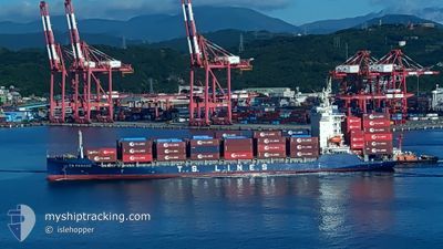
TS PENANG
Cargo A

Current Trip
| Time Travelled | 1 day |
|---|---|
| Remaining Time | --- |
| Distance Travelled | 377.41 nm |
| Remaining Distance | --- |
| AVG Speed | 12.4 Noeuds |
| MAX Speed | 17 Noeuds |
| AVG Wind | 7.2 knots |
| MAX Wind | 16 knots |
| MIN Temp | 21.3°C / 70.34°F |
| MAX Temp | 24.8°C / 76.64°F |
| Tirant d eau | 8.5 m |
| Position reçue | 17 h, 6 m depuis |
Current Position
| Longitude | 114.11583° |
|---|---|
| Latitude | 22.25100° |
| Etat | Under way using engine |
| Vitesse | 12.5 Noeuds |
| Parcours | 150.4° |
| Zone | South China Sea |
| Station | T-AIS |
| Position reçue | 17 h, 6 m depuis |
Information
The current position of TS PENANG is in South China Sea with coordinates 22.25100° / 114.11583° as reported on 2025-04-09 19:56 by AIS to our vessel tracker app. The vessel's current speed is 12.5 Noeuds
The vessel TS PENANG (IMO: 9948877, MMSI: 538010813) is a Cargo A It's sailing under the flag of [MH] Marshall Is.
In this page you can find informations about the vessels current position, last detected port calls, and current voyage information. If the vessels is not in coverage by AIS you will find the latest position.
The current position of TS PENANG is detected by our AIS receivers and we are not responsible for the reliability of the data. The last position was recorded while the vessel was in Coverage by the Ais receivers of our vessel tracking app.
The current draught of TS PENANG as reported by AIS is 8.5 meters
Weather
| Temperature | 23.5°C / 74.3°F |
|---|---|
| Wind Speed | 11 knots |
| Direction | 147° SSE |
| Pressure | 1007.3 hPa |
| Humidity | 90.4 % |
| Cloud Coverage | 100 % |


Featured Company
Last Port Calls
| Port | Arrival | Departure | Time In Port |
|---|---|---|---|
| 2025-04-08 13:03 | 2025-04-08 21:14 | 8 h | |
| 2025-04-07 16:05 | 2025-04-08 05:58 | 13 h | |
| 2025-04-06 09:14 | 2025-04-06 15:57 | 6 h | |
| 2025-04-05 17:06 | 2025-04-05 23:38 | 6 h | |
| 2025-04-05 00:26 | 2025-04-05 09:53 | 9 h | |
| 2025-04-01 20:23 | 2025-04-02 04:26 | 8 h | |
| 2025-03-31 17:50 | 2025-04-01 03:40 | 9 h | |
| 2025-03-29 18:29 | 2025-03-31 17:00 | 1 d | |
| 2025-03-23 15:59 | 2025-03-24 01:17 | 9 h | |
| 2025-03-22 22:35 | 2025-03-23 07:10 | 8 h |
Last Trips
| Origin | Departure | Destination | Arrival | Distance | |
|---|---|---|---|---|---|
| 2025-04-08 05:58 | 2025-04-08 13:03 | 68.55 nm | |||
| 2025-04-06 15:57 | 2025-04-07 16:05 | 353.86 nm | |||
| 2025-04-05 23:38 | 2025-04-06 09:14 | 140.25 nm | |||
| 2025-04-05 09:53 | 2025-04-05 17:06 | 114.72 nm | |||
| 2025-04-02 04:26 | 2025-04-05 00:26 | 1026.12 nm | |||
| 2025-04-01 03:40 | 2025-04-01 20:23 | 200.60 nm | |||
| 2025-03-31 17:00 | 2025-03-31 17:50 | 11.37 nm | |||
| 2025-03-24 01:17 | 2025-03-29 18:29 | 1804.17 nm | |||
| 2025-03-23 07:10 | 2025-03-23 15:59 | 81.44 nm | |||
| 2025-03-21 23:12 | 2025-03-22 22:35 | 397.82 nm |
Events
| Heure | Evenement | Détails | Position/ Destination | Info |
|---|---|---|---|---|
| 2025-04-09 20:02 | Etat Changé | Default Under way using engine |
22.23878 / 114.12833
HPH VN
|
Vitesse: 12.5 kn Parcours: 150.4° |
| 2025-04-09 19:56 | Hors de la zone couverte |
22.25100 / 114.11583
South China Sea
HPH VN
|
Vitesse: 12.5 kn Parcours: 150.4° |
|
| 2025-04-09 17:56 | Démarrage | 0.84 nm, North West of CHIWAN |
22.46817 / 113.87187
HPH VN
|
Vitesse: 3.1 kn Parcours: 176° |
| 2025-04-09 17:55 | Etat Changé | Under way using engine Moored |
22.46898 / 113.87240
HPH VN
|
Vitesse: 1.7 kn Parcours: 272° |
| 2025-04-09 17:04 | Tirant d'eau modifié | 8.5 8.9 |
22.46985 / 113.87393
HPH VN
|
Vitesse: Parcours: 335° |
| 2025-04-09 17:04 | Changement de destination | HPH VN SKU CN |
22.46985 / 113.87393
HPH VN
|
Vitesse: Parcours: 335° |
| 2025-04-09 17:04 | Changement d'ETA | 2025/04/10 23:00 2025/04/09 04:00 |
22.46985 / 113.87393
HPH VN
|
Vitesse: Parcours: 335° |
| 2025-04-09 16:42 | Etat Changé | Moored Default |
22.46983 / 113.87397
SKU CN
|
Vitesse: Parcours: 335° |
| 2025-04-09 16:36 | Etat Changé | Default Moored |
22.46984 / 113.87386
SKU CN
|
Vitesse: Parcours: 335° |
| 2025-04-09 13:30 | Etat Changé | Moored Default |
22.46983 / 113.87392
SKU CN
|
Vitesse: Parcours: 335° |