
UNION GROOVE
Bulk Carrier
Current Trip
AR ROS
| Time Travelled | 2 days |
|---|---|
| Remaining Time | --- |
| Distance Travelled | 714.76 nm |
| Remaining Distance | --- |
| AVG Speed | 10.6 Noeuds |
| MAX Speed | 13.6 Noeuds |
| AVG Wind | 9.5 knots |
| MAX Wind | 21 knots |
| MIN Temp | 16.4°C / 61.52°F |
| MAX Temp | 34.3°C / 93.74°F |
| Tirant d eau | 6.5 m |
| Position reçue | 1 d depuis |
Current Position
| Longitude | -56.00733° |
|---|---|
| Latitude | -35.07641° |
| Etat | Under way using engine |
| Vitesse | 4.2 Noeuds |
| Parcours | 62° |
| Zone | Rio de La Plata |
| Station | T-AIS |
| Position reçue | 1 d depuis |
Info
Information
The current position of UNION GROOVE is in Rio de La Plata with coordinates -35.07641° / -56.00733° as reported on 2025-02-08 02:46 by AIS to our vessel tracker app. The vessel's current speed is 4.2 Noeuds
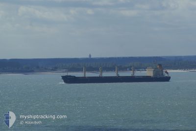
The vessel UNION GROOVE (IMO: 9580106, MMSI: 538004477) is a Bulk Carrier that was built in 2012 ( 13 Age ). It's sailing under the flag of [MH] Marshall Is.
In this page you can find informations about the vessels current position, last detected port calls, and current voyage information. If the vessels is not in coverage by AIS you will find the latest position.
The current position of UNION GROOVE is detected by our AIS receivers and we are not responsible for the reliability of the data. The last position was recorded while the vessel was in Coverage by the Ais receivers of our vessel tracking app.
The current draught of UNION GROOVE as reported by AIS is 6.5 meters
Weather
| Temperature | 23.5°C / 74.3°F |
|---|---|
| Wind Speed | 9 knots |
| Direction | 294° WNW |
| Pressure | 1017.1 hPa |
| Humidity | 84.9 % |
| Cloud Coverage | --- |
Featured Company
Most Visited Ports (Last year)
| Port | Arrivals | |
|---|---|---|
| 2 | ||
| 2 | ||
| 2 | ||
| 2 | ||
| 1 | ||
| 1 |
Last Trips
Events
| Heure | Evenement | Détails | Position/ Destination | Info |
|---|---|---|---|---|
| 2025-02-08 02:54 | Etat Changé | Default Under way using engine |
-35.07293 / -55.99457
AR ROS
|
Vitesse: 4.2 kn Parcours: 62° |
| 2025-02-08 02:46 | Hors de la zone couverte |
-35.07641 / -56.00733
Rio de La Plata
|
Vitesse: 4.2 kn Parcours: 62.1° |
|
| 2025-02-08 02:42 | Etat Changé | Under way using engine Default |
-35.08111 / -56.01068
AR ROS
|
Vitesse: 7.1 kn Parcours: 47° |
| 2025-02-08 02:38 | Etat Changé | Default Under way using engine |
-35.08698 / -56.01402
AR ROS
|
Vitesse: 7.9 kn Parcours: 64.8° |
| 2025-02-08 02:14 | Etat Changé | Under way using engine Default |
-35.11404 / -56.09141
AR ROS
|
Vitesse: 10.5 kn Parcours: 68° |
| 2025-02-08 02:10 | Etat Changé | Default Under way using engine |
-35.11835 / -56.10361
AR ROS
|
Vitesse: 10.6 kn Parcours: 67.6° |
| 2025-02-08 02:04 | Etat Changé | Under way using engine Default |
-35.12555 / -56.12471
AR ROS
|
Vitesse: 10.4 kn Parcours: 67° |
| 2025-02-08 02:02 | Etat Changé | Default Under way using engine |
-35.12741 / -56.13003
AR ROS
|
Vitesse: 10.4 kn Parcours: 66.9° |
| 2025-02-08 02:02 | Etat Changé | Under way using engine Default |
-35.12782 / -56.13122
AR ROS
|
Vitesse: 10.3 kn Parcours: 66° |
| 2025-02-08 01:42 | Etat Changé | Default Under way using engine |
-35.14979 / -56.19463
AR ROS
|
Vitesse: 10.4 kn Parcours: 67.4° |