

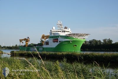
VIKING NEPTUN
Other Type

Current Trip
CVOW OWF VIRGINIA US
| Time Travelled | 44 days |
|---|---|
| Remaining Time | --- |
| Distance Travelled | 8744.25 nm |
| Remaining Distance | --- |
| AVG Speed | 12.5 Noeuds |
| MAX Speed | 20 Noeuds |
| AVG Wind | 12.8 knots |
| MAX Wind | 29.9 knots |
| MIN Temp | 4.8°C / 40.64°F |
| MAX Temp | 24.1°C / 75.38°F |
| Tirant d eau | 8.6 m |
| Position reçue | 8 m depuis |
Current Position
| Longitude | -75.58552° |
|---|---|
| Latitude | 36.81108° |
| Etat | Restricted manoeuverability |
| Vitesse | 0.3 Noeuds |
| Parcours | 234° |
| Zone | North Atlantic Ocean |
| Station | T-AIS |
| Position reçue | 8 m depuis |
Information
The current position of VIKING NEPTUN is in North Atlantic Ocean with coordinates 36.81108° / -75.58552° as reported on 2025-06-10 06:03 by AIS to our vessel tracker app. The vessel's current speed is 0.3 Noeuds
The vessel VIKING NEPTUN (IMO: 9664902, MMSI: 258789000) is a Other Type It's sailing under the flag of [NO] Norway.
In this page you can find informations about the vessels current position, last detected port calls, and current voyage information. If the vessels is not in coverage by AIS you will find the latest position.
The current position of VIKING NEPTUN is detected by our AIS receivers and we are not responsible for the reliability of the data. The last position was recorded while the vessel was in Coverage by the Ais receivers of our vessel tracking app.
The current draught of VIKING NEPTUN as reported by AIS is 8.6 meters
Weather
| Temperature | 23.4°C / 74.12°F |
|---|---|
| Wind Speed | 17 knots |
| Direction | 202° SSW |
| Pressure | 1010.8 hPa |
| Humidity | 89.2 % |
| Cloud Coverage | 86 % |


Featured Company
Most Visited Ports (Last year)
| Port | Arrivals | |
|---|---|---|
| 7 | ||
| 2 | ||
| 2 | ||
| 2 | ||
| 2 | ||
| 1 |
Events
| Heure | Evenement | Détails | Position/ Destination | Info |
|---|---|---|---|---|
| 2025-06-10 06:02 | Dans la zone couverte |
36.81108 / -75.58552
North Atlantic Ocean
|
Vitesse: 0.3 kn Parcours: 226.3° |
|
| 2025-06-09 23:28 | Hors de la zone couverte |
36.82920 / -75.56715
North Atlantic Ocean
|
Vitesse: 0.3 kn Parcours: 246.8° |
|
| 2025-06-09 19:49 | Dans la zone couverte |
36.83357 / -75.54456
North Atlantic Ocean
|
Vitesse: 0.4 kn Parcours: 249.6° |
|
| 2025-06-09 18:46 | Hors de la zone couverte |
36.83406 / -75.54214
North Atlantic Ocean
|
Vitesse: 0.1 kn Parcours: 250.1° |
|
| 2025-06-09 18:35 | Dans la zone couverte |
36.83417 / -75.54133
North Atlantic Ocean
|
Vitesse: 0.3 kn Parcours: 260.6° |
|
| 2025-06-09 09:23 | Hors de la zone couverte |
36.84634 / -75.47019
North Atlantic Ocean
|
Vitesse: 0.4 kn Parcours: 263.9° |
|
| 2025-06-09 09:18 | Dans la zone couverte |
36.84638 / -75.46950
North Atlantic Ocean
|
Vitesse: 0.3 kn Parcours: 267.6° |
|
| 2025-06-09 08:12 | Hors de la zone couverte |
36.84666 / -75.46073
North Atlantic Ocean
|
Vitesse: 0.3 kn Parcours: 269° |
|
| 2025-06-09 08:12 | Dans la zone couverte |
36.84666 / -75.46073
North Atlantic Ocean
|
Vitesse: 0.3 kn Parcours: 269° |
|
| 2025-06-09 00:34 | Hors de la zone couverte |
36.84830 / -75.40517
North Atlantic Ocean
|
Vitesse: 0.3 kn Parcours: 267.9° |