

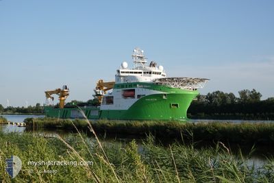
VIKING NEPTUN
Other Type

Current Trip
CVOW OWF VIRGINIA US
| Time Travelled | 38 days |
|---|---|
| Remaining Time | --- |
| Distance Travelled | 5730.35 nm |
| Remaining Distance | --- |
| AVG Speed | 12.5 Knots |
| MAX Speed | 20 Knots |
| AVG Wind | 12.8 knots |
| MAX Wind | 29.9 knots |
| MIN Temp | 4.8°C / 40.64°F |
| MAX Temp | 20.3°C / 68.54°F |
| Draught | 8.6 m |
| Position Received | 7 d ago |
Current Position
| Longitude | -4.65255° |
|---|---|
| Latitude | 58.74724° |
| Status | Under way using engine |
| Speed | 9.2 Knots |
| Course | 281.5° |
| Area | North Atlantic Ocean |
| Station | T-AIS |
| Position Received | 7 d ago |
Information
The current position of VIKING NEPTUN is in North Atlantic Ocean with coordinates 58.74724° / -4.65255° as reported on 2025-05-27 19:21 by AIS to our vessel tracker app. The vessel's current speed is 9.2 Knots
The vessel VIKING NEPTUN (IMO: 9664902, MMSI: 258789000) is a Other Type It's sailing under the flag of [NO] Norway.
In this page you can find informations about the vessels current position, last detected port calls, and current voyage information. If the vessels is not in coverage by AIS you will find the latest position.
The current position of VIKING NEPTUN is detected by our AIS receivers and we are not responsible for the reliability of the data. The last position was recorded while the vessel was in Coverage by the Ais receivers of our vessel tracking app.
The current draught of VIKING NEPTUN as reported by AIS is 8.6 meters
Weather
| Temperature | 10.2°C / 50.36°F |
|---|---|
| Wind Speed | 18 knots |
| Direction | 266° W |
| Pressure | 1000.8 hPa |
| Humidity | 79.2 % |
| Cloud Coverage | 5 % |


Featured Company
Most Visited Ports (Last year)
| Port | Arrivals | |
|---|---|---|
| 7 | ||
| 3 | ||
| 2 | ||
| 2 | ||
| 2 | ||
| 1 |
Events
| Time | Event | Details | Position / Dest | Info |
|---|---|---|---|---|
| 2025-05-27 19:21 | OUT of Coverage |
58.74724 / -4.65255
North Atlantic Ocean
CVOW OWF VIRGINIA US
|
Speed: 9.2 kn Course: 281.5° |
|
| 2025-05-27 15:51 | START Moving | 0.94 nm, North East of SCRABSTER |
58.61885 / -3.51814
CVOW OWF VIRGINIA US
|
Speed: 4.6 kn Course: 346° |
| 2025-05-27 14:58 | STOP Moving | 0.7 nm, North East of SCRABSTER |
58.61785 / -3.52672
CVOW OWF VIRGINIA US
|
Speed: 0.3 kn Course: 359° |
| 2025-05-27 14:19 | Change Sea Area | United Kingdom part of the North Atlantic Ocean United Kingdom part of the North Sea |
58.68026 / -3.42748
North Atlantic Ocean
CVOW OWF VIRGINIA US
|
Speed: 13.4 kn Course: 218.9° |
| 2025-05-27 11:16 | START Moving |
58.64586 / -2.03155
CVOW OWF VIRGINIA US
|
Speed: 4.2 kn Course: 284° |
|
| 2025-05-27 11:12 | STOP Moving |
58.64578 / -2.02790
CVOW OWF VIRGINIA US
|
Speed: 0.3 kn Course: 270° |
|
| 2025-05-27 09:11 | Change Sea Area | United Kingdom part of the North Sea Norwegian part of the North Sea |
58.64077 / -1.60048
North Sea
CVOW OWF VIRGINIA US
|
Speed: 12.5 kn Course: 277.1° |
| 2025-05-27 09:09 | IN Coverage |
58.64077 / -1.60048
North Sea
CVOW OWF VIRGINIA US
|
Speed: 12.5 kn Course: 277.1° |
|
| 2025-05-26 15:10 | OUT of Coverage |
58.04827 / 3.80529
North Sea
CVOW OWF VIRGINIA US
|
Speed: 12 kn Course: 284.2° |
|
| 2025-05-26 04:49 | Change Sea Area | Norwegian part of the North Sea Norwegian part of the Skaggerak |
57.63764 / 7.65089
North Sea
CVOW OWF VIRGINIA US
|
Speed: 12.6 kn Course: 270.4° |