
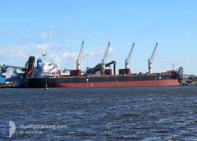
VSC CASTOR
Cargo
Current Trip
IN PRT
| Time Travelled | 6 days |
|---|---|
| Remaining Time | --- |
| Distance Travelled | 496.89 nm |
| Remaining Distance | --- |
| AVG Speed | 11.5 Noeuds |
| MAX Speed | 13.9 Noeuds |
| AVG Wind | 7.2 knots |
| MAX Wind | 12.5 knots |
| MIN Temp | 22.6°C / 72.68°F |
| MAX Temp | 32.2°C / 89.96°F |
| Tirant d eau | 12.6 m |
| Position reçue | 14 d depuis |
Current Position
| Longitude | 80.40991° |
|---|---|
| Latitude | 5.71188° |
| Etat | Under way using engine |
| Vitesse | 9.9 Noeuds |
| Parcours | 89.1° |
| Zone | Indian Ocean |
| Station | T-AIS |
| Position reçue | 14 d depuis |
Info
Information
The current position of VSC CASTOR is in Indian Ocean with coordinates 5.71188° / 80.40991° as reported on 2025-01-24 13:01 by AIS to our vessel tracker app. The vessel's current speed is 9.9 Noeuds
The vessel VSC CASTOR (IMO: 9676084, MMSI: 636016318) is a Cargo It's sailing under the flag of [LR] Liberia.
In this page you can find informations about the vessels current position, last detected port calls, and current voyage information. If the vessels is not in coverage by AIS you will find the latest position.
The current position of VSC CASTOR is detected by our AIS receivers and we are not responsible for the reliability of the data. The last position was recorded while the vessel was in Coverage by the Ais receivers of our vessel tracking app.
The current draught of VSC CASTOR as reported by AIS is 12.6 meters
Weather
| Temperature | 26°C / 78.8°F |
|---|---|
| Wind Speed | 13 knots |
| Direction | 7° N |
| Pressure | 1012 hPa |
| Humidity | 64.3 % |
| Cloud Coverage | 10 % |
Featured Company
Events
| Heure | Evenement | Détails | Position/ Destination | Info |
|---|---|---|---|---|
| 2025-02-06 08:14 | Démarrage |
22.01519 / 88.07626
IN PRT
|
Vitesse: 8 kn Parcours: 238° |
|
| 2025-02-03 08:48 | Arret |
22.01978 / 88.08425
IN PRT
|
Vitesse: 0.2 kn Parcours: 238° |
|
| 2025-02-03 01:53 | Démarrage |
21.02953 / 87.77171
IN PRT
|
Vitesse: 7.4 kn Parcours: 76° |
|
| 2025-02-01 15:17 | Arret |
21.02953 / 87.76246
IN PRT
|
Vitesse: 0.1 kn Parcours: 154° |
|
| 2025-02-01 07:55 | PORT DE DEPART |
|
20.25692 / 86.68884
IN PRT
|
Vitesse: 4 kn Parcours: 150° |
| 2025-02-01 07:43 | Démarrage |
20.27111 / 86.67088
[IN] PARADIP
|
Vitesse: 3.8 kn Parcours: 151° |
|
| 2025-01-30 03:19 | Arret |
20.27672 / 86.66817
[IN] PARADIP
|
Vitesse: 0.2 kn Parcours: 29° |
|
| 2025-01-30 02:55 | Port d'arrivée |
|
20.26456 / 86.67580
[IN] PARADIP
|
Vitesse: 7.4 kn Parcours: 302° |
| 2025-01-30 01:04 | Démarrage | 6.96 nm, South East of PARADIP |
20.17058 / 86.74277
IN PRT
|
Vitesse: 4.7 kn Parcours: 351° |