
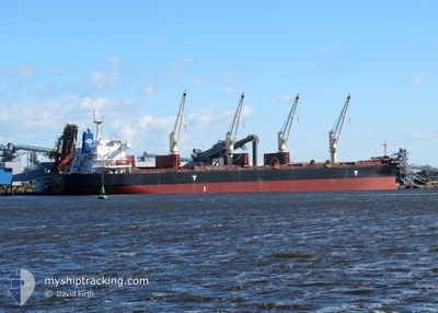
VSC CASTOR
Cargo
Current Trip
PEBGB FOR ORDERS
| Time Travelled | 11 days |
|---|---|
| Remaining Time | --- |
| Distance Travelled | 1770.46 nm |
| Remaining Distance | --- |
| AVG Speed | 10.3 Knots |
| MAX Speed | 13.9 Knots |
| AVG Wind | 8.4 knots |
| MAX Wind | 18.9 knots |
| MIN Temp | 22.6°C / 72.68°F |
| MAX Temp | 32.2°C / 89.96°F |
| Draught | 6.3 m |
| Position Received | 3 m ago |
Current Position
| Longitude | 103.96044° |
|---|---|
| Latitude | 1.28028° |
| Status | At anchor |
| Speed | 0.1 Knots |
| Course | 233° |
| Area | Singapore Strait |
| Station | T-AIS |
| Position Received | 3 m ago |
Info
Information
The current position of VSC CASTOR is in Singapore Strait with coordinates 1.28028° / 103.96044° as reported on 2025-02-12 09:34 by AIS to our vessel tracker app. The vessel's current speed is 0.1 Knots
The vessel VSC CASTOR (IMO: 9676084, MMSI: 636016318) is a Cargo It's sailing under the flag of [LR] Liberia.
In this page you can find informations about the vessels current position, last detected port calls, and current voyage information. If the vessels is not in coverage by AIS you will find the latest position.
The current position of VSC CASTOR is detected by our AIS receivers and we are not responsible for the reliability of the data. The last position was recorded while the vessel was in Coverage by the Ais receivers of our vessel tracking app.
The current draught of VSC CASTOR as reported by AIS is 6.3 meters
Weather
| Temperature | 27.3°C / 81.14°F |
|---|---|
| Wind Speed | 14 knots |
| Direction | 79° E |
| Pressure | 1008.7 hPa |
| Humidity | 76.6 % |
| Cloud Coverage | 20 % |
Featured Company
Events
| Time | Event | Details | Position / Dest | Info |
|---|---|---|---|---|
| 2025-02-11 21:43 | Status Changed | At anchor Under way using engine |
1.28004 / 103.95827
PEBGB FOR ORDERS
|
Speed: 0.4 kn Course: 85° |
| 2025-02-11 21:40 | STOP Moving | 4.05 nm, South West of TANAH MERAH |
1.27993 / 103.95854
PEBGB FOR ORDERS
|
Speed: 0.3 kn Course: 71° |
| 2025-02-11 20:43 | Change Sea Area | Singaporean part of the Singapore Strait Indonesian part of the Singapore Strait |
1.23609 / 103.94350
Singapore Strait
PEBGB FOR ORDERS
|
Speed: 7.4 kn Course: 23.4° |
| 2025-02-11 17:27 | ETA Changed | 2025/02/11 22:00 2025/02/11 19:00 |
1.05738 / 103.60462
PEBGB FOR ORDERS
|
Speed: 8.4 kn Course: 93.2° |
| 2025-02-11 16:55 | Status Changed | Under way using engine Default |
1.08533 / 103.54486
PEBGB FOR ORDERS
|
Speed: 10.4 kn Course: 125° |
| 2025-02-11 16:49 | Status Changed | Default Under way using engine |
1.09687 / 103.53153
PEBGB FOR ORDERS
|
Speed: 13 kn Course: 118° |
| 2025-02-11 16:21 | Draught Changed | 6.3 12.6 |
1.15390 / 103.44650
PEBGB FOR ORDERS
|
Speed: 13 kn Course: 118.6° |
| 2025-02-11 16:21 | Destination Changed | PEBGB FOR ORDERS IN PRT |
1.15390 / 103.44650
PEBGB FOR ORDERS
|
Speed: 13 kn Course: 118.6° |
| 2025-02-11 16:21 | ETA Changed | 2025/02/11 19:00 2025/01/27 18:30 |
1.15390 / 103.44650
PEBGB FOR ORDERS
|
Speed: 13 kn Course: 118.6° |
| 2025-02-11 16:14 | Change Sea Area | Indonesian part of the Singapore Strait Indonesian part of the Malacca Strait |
1.16820 / 103.42446
Singapore Strait
|
Speed: 13.1 kn Course: 134.1° |