
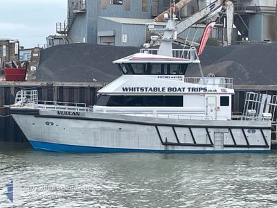
VULCAN
High speed craft
Current Trip
WHITSTABLE
| Time Travelled | 1 day |
|---|---|
| Remaining Time | --- |
| Distance Travelled | 56.18 nm |
| Remaining Distance | --- |
| AVG Speed | 14.4 Noeuds |
| MAX Speed | 20.3 Noeuds |
| AVG Wind | 15.6 knots |
| MAX Wind | 17.8 knots |
| MIN Temp | 7.4°C / 45.32°F |
| MAX Temp | 10.5°C / 50.9°F |
| Tirant d eau | 1.8 m |
| Position reçue | Maintenant |
Current Position
| Longitude | 0.62766° |
|---|---|
| Latitude | 51.40743° |
| Etat | Under way using engine |
| Vitesse | 0.8 Noeuds |
| Parcours | --- |
| Zone | North Sea |
| Station | T-AIS |
| Position reçue | Maintenant |
Info
Information
The current position of VULCAN is in North Sea with coordinates 51.40743° / 0.62766° as reported on 2025-12-15 11:45 by AIS to our vessel tracker app. The vessel's current speed is 0.8 Noeuds
The vessel VULCAN (MMSI: 235077424) is a High speed craft It's sailing under the flag of [GB] United Kingdom.
In this page you can find informations about the vessels current position, last detected port calls, and current voyage information. If the vessels is not in coverage by AIS you will find the latest position.
The current position of VULCAN is detected by our AIS receivers and we are not responsible for the reliability of the data. The last position was recorded while the vessel was in Coverage by the Ais receivers of our vessel tracking app.
The current draught of VULCAN as reported by AIS is 1.8 meters
Weather
| Temperature | 10.3°C / 50.54°F |
|---|---|
| Wind Speed | 16 knots |
| Direction | 192° SSW |
| Pressure | 1008 hPa |
| Humidity | 84.4 % |
| Cloud Coverage | 100 % |
Featured Company
Last Port Calls
| Port | Arrival | Departure | Time In Port |
|---|---|---|---|
| 2025-12-08 15:22 | 2025-12-14 08:37 | 5 d | |
| 2025-12-08 12:52 | 2025-12-08 13:31 | 39 m | |
| 2025-12-07 11:34 | 2025-12-08 11:29 | 23 h | |
| 2025-10-24 10:27 | 2025-10-24 11:30 | 1 h | |
| 2025-10-22 13:34 | 2025-10-22 14:02 | 27 m | |
| 2025-10-17 12:19 | 2025-10-22 10:25 | 4 d | |
| 2025-10-17 10:03 | 2025-10-17 11:22 | 1 h | |
| 2025-10-12 13:56 | 2025-10-12 14:06 | 10 m | |
| 2025-10-11 14:56 | 2025-10-12 13:02 | 22 h | |
| 2025-10-11 14:28 | 2025-10-11 14:38 | 9 m |
Most Visited Ports (Last year)
| Port | Arrivals | |
|---|---|---|
| 218 | ||
| 2 | ||
| 1 | ||
| 1 | ||
| 1 |
Last Trips
| Origin | Departure | Destination | Arrival | Distance | |
|---|---|---|---|---|---|
| 2025-12-08 13:31 | 2025-12-08 15:22 | 26.69 nm | |||
| 2025-12-08 11:29 | 2025-12-08 12:52 | 21.92 nm | |||
| 2025-10-24 11:30 | 2025-12-07 11:34 | 261.95 nm | |||
| 2025-10-22 14:02 | 2025-10-24 10:27 | 37.96 nm | |||
| 2025-10-22 10:25 | 2025-10-22 13:34 | 6.34 nm | |||
| 2025-10-17 11:22 | 2025-10-17 12:19 | 15.31 nm | |||
| 2025-10-12 14:06 | 2025-10-17 10:03 | 45.19 nm | |||
| 2025-10-12 13:02 | 2025-10-12 13:56 | 10.27 nm | |||
| 2025-10-11 14:38 | 2025-10-11 14:56 | 1.91 nm | |||
| 2025-10-11 13:28 | 2025-10-11 14:28 | 15.22 nm |
Events
| Heure | Evenement | Détails | Position/ Destination | Info |
|---|---|---|---|---|
| 2025-12-15 10:11 | Démarrage | 3.81 nm, West of WHITSTABLE |
51.35307 / .92532
WHITSTABLE
|
Vitesse: 18.6 kn Parcours: 60.9° |
| 2025-12-15 09:57 | Arret | 3.94 nm, West of WHITSTABLE |
51.35294 / .92182
WHITSTABLE
|
Vitesse: Parcours: 511° |
| 2025-12-15 08:45 | Démarrage | 1.3 nm, South of SHEERNESS |
51.41929 / .73471
WHITSTABLE
|
Vitesse: 7 kn Parcours: 342.6° |
| 2025-12-15 08:17 | Dans la zone couverte |
51.41768 / .73631
North Sea
|
Vitesse: Parcours: 0° |
|
| 2025-12-14 09:44 | Hors de la zone couverte |
51.41767 / .73631
North Sea
|
Vitesse: Parcours: 0° |
|
| 2025-12-14 09:40 | Arret | 1.4 nm, South of SHEERNESS |
51.41753 / .73632
WHITSTABLE
|
Vitesse: Parcours: 511° |
| 2025-12-14 08:37 | PORT DE DEPART |
|
51.36595 / 1.02257
WHITSTABLE
|
Vitesse: 8.4 kn Parcours: 315.1° |
| 2025-12-14 08:36 | Démarrage |
51.36434 / 1.02487
[GB] WHITSTABLE
|
Vitesse: 7.4 kn Parcours: 317.8° |
|
| 2025-12-14 08:25 | Dans la zone couverte |
51.36328 / 1.02757
North Sea
[GB] WHITSTABLE
|
Vitesse: Parcours: 0° |
|
| 2025-12-11 13:56 | Hors de la zone couverte |
51.36329 / 1.02754
North Sea
[GB] WHITSTABLE
|
Vitesse: Parcours: 0° |