
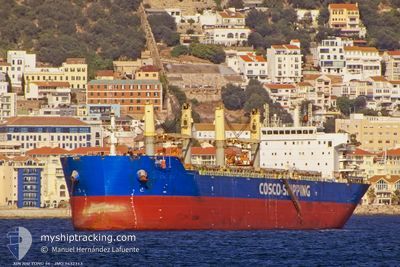
XIN HAI TONG 56
Bulk Carrier
Current Trip
| Time Travelled | 52 days |
|---|---|
| Remaining Time | 9 days |
| Distance Travelled | 7755.97 nm |
| Remaining Distance | 2248.45 nm |
| AVG Speed | 9.5 Noeuds |
| MAX Speed | 13.8 Noeuds |
| AVG Wind | 12 knots |
| MAX Wind | 38 knots |
| MIN Temp | 12.4°C / 54.32°F |
| MAX Temp | 27°C / 80.6°F |
| Tirant d eau | 13.1 m |
| Position reçue | 7 d depuis |
Current Position
| Longitude | 34.33473° |
|---|---|
| Latitude | 27.13903° |
| Etat | Under way using engine |
| Vitesse | 10.9 Noeuds |
| Parcours | 147.2° |
| Zone | Red Sea |
| Station | T-AIS |
| Position reçue | 7 d depuis |
Info
Information
The current position of XIN HAI TONG 56 is in Red Sea with coordinates 27.13903° / 34.33473° as reported on 2025-02-06 10:23 by AIS to our vessel tracker app. The vessel's current speed is 10.9 Noeuds and is heading at the port of KRISHNAPATNAM. The estimated time of arrival as calculated by MyShipTracking vessel tracking app is 2025-02-23 10:53 LT
The vessel XIN HAI TONG 56 (IMO: 9632313, MMSI: 477222100) is a Bulk Carrier that was built in 2013 ( 12 Age ). It's sailing under the flag of [HK] Hong Kong.
In this page you can find informations about the vessels current position, last detected port calls, and current voyage information. If the vessels is not in coverage by AIS you will find the latest position.
The current position of XIN HAI TONG 56 is detected by our AIS receivers and we are not responsible for the reliability of the data. The last position was recorded while the vessel was in Coverage by the Ais receivers of our vessel tracking app.
The current draught of XIN HAI TONG 56 as reported by AIS is 13.1 meters
Weather
| Temperature | 23.7°C / 74.66°F |
|---|---|
| Wind Speed | 8 knots |
| Direction | 75° ENE |
| Pressure | 1014.3 hPa |
| Humidity | 77.3 % |
| Cloud Coverage | 13 % |
Featured Company
Last Port Calls
| Port | Arrival | Departure | Time In Port |
|---|---|---|---|
| 2025-02-05 07:21 | 2025-02-05 17:33 | 10 h | |
| 2024-12-18 15:10 | 2024-12-22 17:38 | 4 d | |
| 2024-12-02 20:09 |
Most Visited Ports (Last year)
| Port | Arrivals | |
|---|---|---|
| 2 | ||
| 2 | ||
| 1 | ||
| 1 | ||
| 1 | ||
| 1 |
Last Trips
| Origin | Departure | Destination | Arrival | Distance | |
|---|---|---|---|---|---|
| 2024-12-22 17:38 | 2025-02-05 07:21 | 5757.48 nm | |||
| 2024-12-02 20:09 | 2024-12-18 15:10 | 4177.31 nm |
Events
| Heure | Evenement | Détails | Position/ Destination | Info |
|---|---|---|---|---|
| 2025-02-06 10:30 | Etat Changé | Default Under way using engine |
27.12146 / 34.34760
KRISHNAPATNAM
|
Vitesse: 10.9 kn Parcours: 147.2° |
| 2025-02-06 10:23 | Hors de la zone couverte |
27.13903 / 34.33473
Red Sea
KRISHNAPATNAM
|
Vitesse: 10.9 kn Parcours: 147.2° |
|
| 2025-02-06 08:16 | Changement de zone | Egyptian part of the Red Sea Egyptian part of the Gulf of Suez |
27.47539 / 34.08839
Red Sea
KRISHNAPATNAM
|
Vitesse: 11.1 kn Parcours: 145.4° |
| 2025-02-06 07:37 | Etat Changé | Under way using engine Default |
27.56194 / 34.00264
KRISHNAPATNAM
|
Vitesse: 10.5 kn Parcours: 137° |
| 2025-02-06 07:27 | Etat Changé | Default Under way using engine |
27.58342 / 33.98092
KRISHNAPATNAM
|
Vitesse: 10.6 kn Parcours: 138.9° |
| 2025-02-06 07:18 | Etat Changé | Under way using engine Default |
27.60243 / 33.96160
KRISHNAPATNAM
|
Vitesse: 10.7 kn Parcours: 137° |
| 2025-02-06 07:13 | Dans la zone couverte |
27.60091 / 33.96318
Gulf of Suez
KRISHNAPATNAM
|
Vitesse: 10.6 kn Parcours: 137.2° |
|
| 2025-02-05 16:29 | Etat Changé | Default Under way using engine |
29.84672 / 32.55179
KRISHNAPATNAM
|
Vitesse: 9.7 kn Parcours: 171° |
| 2025-02-05 16:21 | Hors de la zone couverte |
29.86936 / 32.55073
Gulf of Suez
KRISHNAPATNAM
|
Vitesse: 9.7 kn Parcours: 171° |
|
| 2025-02-05 15:35 | Changement de zone | Egyptian part of the Gulf of Suez Italian part of the Mediterranean Sea - Eastern Basin |
29.94365 / 32.57569
Gulf of Suez
KRISHNAPATNAM
|
Vitesse: 5.9 kn Parcours: 220° |