

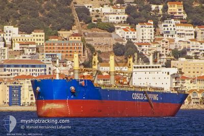
XIN HAI TONG 56
Bulk Carrier

Current Trip
| Time Travelled | 4 days |
|---|---|
| Remaining Time | --- |
| Distance Travelled | 292.67 nm |
| Remaining Distance | --- |
| AVG Speed | 8.5 Knots |
| MAX Speed | 11.4 Knots |
| AVG Wind | 8.9 knots |
| MAX Wind | 17 knots |
| MIN Temp | 17.6°C / 63.68°F |
| MAX Temp | 27.1°C / 80.78°F |
| Draught | 11.5 m |
| Position Received | 2 m ago |
Current Position
| Longitude | 29.44657° |
|---|---|
| Latitude | 40.75822° |
| Status | At anchor |
| Speed | 0.2 Knots |
| Course | 352° |
| Area | Sea of Marmara |
| Station | T-AIS |
| Position Received | 2 m ago |
Information
The current position of XIN HAI TONG 56 is in Sea of Marmara with coordinates 40.75822° / 29.44657° as reported on 2025-06-08 18:09 by AIS to our vessel tracker app. The vessel's current speed is 0.2 Knots
The vessel XIN HAI TONG 56 (IMO: 9632313, MMSI: 477222100) is a Bulk Carrier that was built in 2013 ( 12 years old ). It's sailing under the flag of [HK] Hong Kong.
In this page you can find informations about the vessels current position, last detected port calls, and current voyage information. If the vessels is not in coverage by AIS you will find the latest position.
The current position of XIN HAI TONG 56 is detected by our AIS receivers and we are not responsible for the reliability of the data. The last position was recorded while the vessel was in Coverage by the Ais receivers of our vessel tracking app.
The current draught of XIN HAI TONG 56 as reported by AIS is 11.5 meters
Weather
| Temperature | 22.3°C / 72.14°F |
|---|---|
| Wind Speed | 3 knots |
| Direction | 53° NE |
| Pressure | 1013.1 hPa |
| Humidity | 70.6 % |
| Cloud Coverage | --- |


Featured Company
Last Port Calls
| Port | Arrival | Departure | Time In Port |
|---|---|---|---|
| 2025-05-31 17:34 | 2025-06-04 15:56 | 3 d | |
| 2025-05-25 15:46 | 2025-05-29 00:58 | 3 d | |
| 2025-05-20 08:49 | 2025-05-20 18:53 | 10 h | |
| 2025-04-11 20:13 | 2025-04-18 09:06 | 6 d |
Most Visited Ports (Last year)
| Port | Arrivals | |
|---|---|---|
| 3 | ||
| 3 | ||
| 3 | ||
| 1 | ||
| 1 | ||
| 1 |
Last Trips
| Origin | Departure | Destination | Arrival | Distance | |
|---|---|---|---|---|---|
| 2025-05-29 00:58 | 2025-05-31 17:34 | 683.63 nm | |||
| 2025-04-18 09:06 | 2025-05-25 15:46 | 8388.25 nm | |||
| 2025-04-18 09:06 | 2025-05-20 08:49 | 7913.13 nm | |||
| 2025-03-30 18:42 | 2025-04-11 20:13 | 249.53 nm |
Events
| Time | Event | Details | Position / Dest | Info |
|---|---|---|---|---|
| 2025-06-08 14:00 | Status Changed | At anchor Default |
40.76143 / 29.44824
TR DILISKELESI
|
Speed: Course: 211° |
| 2025-06-08 13:57 | Status Changed | Default At anchor |
40.76143 / 29.44826
TR DILISKELESI
|
Speed: 0.1 kn Course: 211° |
| 2025-06-07 19:36 | Status Changed | At anchor Default |
40.75798 / 29.44512
TR DILISKELESI
|
Speed: 0.1 kn Course: 17° |
| 2025-06-07 19:33 | Status Changed | Default At anchor |
40.75796 / 29.44507
TR DILISKELESI
|
Speed: 0.1 kn Course: 17° |
| 2025-06-07 06:24 | Status Changed | At anchor Default |
40.75994 / 29.44327
TR DILISKELESI
|
Speed: Course: 86° |
| 2025-06-07 06:21 | Status Changed | Default At anchor |
40.75994 / 29.44324
TR DILISKELESI
|
Speed: Course: 86° |
| 2025-06-07 01:00 | Status Changed | At anchor Default |
40.75993 / 29.44341
TR DILISKELESI
|
Speed: Course: 77° |
| 2025-06-07 00:57 | Status Changed | Default At anchor |
40.75992 / 29.44341
TR DILISKELESI
|
Speed: Course: 76° |
| 2025-06-06 17:12 | Status Changed | At anchor Default |
40.75948 / 29.44327
TR DILISKELESI
|
Speed: Course: 66° |
| 2025-06-06 17:09 | Status Changed | Default At anchor |
40.75949 / 29.44326
TR DILISKELESI
|
Speed: Course: 68° |