

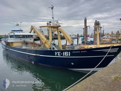
YE161 DINGENIS MARIA
Fishing Vessel

Current Trip
YERSEKE
| Time Travelled | 1 day |
|---|---|
| Remaining Time | --- |
| Distance Travelled | 37.33 nm |
| Remaining Distance | --- |
| AVG Speed | 10.6 Noeuds |
| MAX Speed | 12.8 Noeuds |
| AVG Wind | 10.6 knots |
| MAX Wind | 18 knots |
| MIN Temp | 9.2°C / 48.56°F |
| MAX Temp | 15.8°C / 60.44°F |
| Tirant d eau | 1 m |
| Position reçue | 2 m depuis |
Current Position
| Longitude | 5.07281° |
|---|---|
| Latitude | 52.99787° |
| Etat | Under way using engine |
| Vitesse | |
| Parcours | 179° |
| Zone | North Sea |
| Station | T-AIS |
| Position reçue | 2 m depuis |
Information
The current position of YE161 DINGENIS MARIA is in North Sea with coordinates 52.99787° / 5.07281° as reported on 2025-04-16 23:56 by AIS to our vessel tracker app. The vessel's current speed is 0 Noeuds
The vessel YE161 DINGENIS MARIA (IMO: 9280249, MMSI: 244228000) is a Fishing Vessel that was built in 2002 ( 23 Age ). It's sailing under the flag of [NL] Netherlands.
In this page you can find informations about the vessels current position, last detected port calls, and current voyage information. If the vessels is not in coverage by AIS you will find the latest position.
The current position of YE161 DINGENIS MARIA is detected by our AIS receivers and we are not responsible for the reliability of the data. The last position was recorded while the vessel was in Coverage by the Ais receivers of our vessel tracking app.
The current draught of YE161 DINGENIS MARIA as reported by AIS is 1 meters
Weather
| Temperature | 9.8°C / 49.64°F |
|---|---|
| Wind Speed | 8 knots |
| Direction | 220° SW |
| Pressure | 1012.3 hPa |
| Humidity | 71 % |
| Cloud Coverage | 100 % |


Featured Company
Last Port Calls
| Port | Arrival | Departure | Time In Port |
|---|---|---|---|
| 2025-04-15 07:48 | 2025-04-15 16:27 | 8 h | |
| 2025-04-14 14:46 | 2025-04-14 15:02 | 16 m | |
| 2025-04-14 12:40 | 2025-04-14 12:59 | 19 m | |
| 2025-04-14 11:16 | 2025-04-14 12:09 | 52 m | |
| 2025-04-14 10:25 | 2025-04-14 10:52 | 26 m | |
| 2025-04-10 16:43 | 2025-04-14 09:44 | 3 d | |
| 2025-04-09 17:15 | 2025-04-10 07:27 | 14 h | |
| 2025-04-08 17:33 | 2025-04-09 06:31 | 12 h | |
| 2025-04-07 17:09 | 2025-04-08 06:32 | 13 h | |
| 2025-04-04 09:38 | 2025-04-07 06:31 | 2 d |
Most Visited Ports (Last year)
| Port | Arrivals | |
|---|---|---|
| 160 | ||
| 19 | ||
| 15 | ||
| 6 | ||
| 5 | ||
| 4 |
Last Trips
| Origin | Departure | Destination | Arrival | Distance | |
|---|---|---|---|---|---|
| 2025-04-14 15:02 | 2025-04-15 07:48 | 122.97 nm | |||
| 2025-04-14 12:59 | 2025-04-14 14:46 | 17.29 nm | |||
| 2025-04-14 12:09 | 2025-04-14 12:40 | 4.66 nm | |||
| 2025-04-14 10:52 | 2025-04-14 11:16 | 3.71 nm | |||
| 2025-04-14 09:44 | 2025-04-14 10:25 | 5.73 nm | |||
| 2025-04-10 07:27 | 2025-04-10 16:43 | 52.09 nm | |||
| 2025-04-09 06:31 | 2025-04-09 17:15 | 38.12 nm | |||
| 2025-04-08 06:32 | 2025-04-08 17:33 | 48.69 nm | |||
| 2025-04-07 06:31 | 2025-04-07 17:09 | 30.06 nm | |||
| 2025-04-04 07:36 | 2025-04-04 09:38 | 16.36 nm |
Events
| Heure | Evenement | Détails | Position/ Destination | Info |
|---|---|---|---|---|
| 2025-04-16 17:17 | Arret | 3.82 nm, North of DEN OEVER |
52.99730 / 5.07332
YERSEKE
|
Vitesse: 0.3 kn Parcours: 295° |
| 2025-04-16 15:49 | Démarrage | 6.2 nm, East of OUDESCHILD |
53.04818 / 5.02560
YERSEKE
|
Vitesse: 9.1 kn Parcours: 124° |
| 2025-04-16 14:01 | Dans la zone couverte |
53.09278 / 4.92446
North Sea
|
Vitesse: 0.1 kn Parcours: 232° |
|
| 2025-04-16 12:57 | Hors de la zone couverte |
53.09004 / 4.92405
North Sea
|
Vitesse: 2.1 kn Parcours: 265° |
|
| 2025-04-16 12:57 | Dans la zone couverte |
53.09004 / 4.92405
North Sea
|
Vitesse: 2.1 kn Parcours: 265° |
|
| 2025-04-16 10:47 | Hors de la zone couverte |
53.09044 / 4.91960
North Sea
|
Vitesse: 0.1 kn Parcours: 93° |
|
| 2025-04-16 10:47 | Dans la zone couverte |
53.09044 / 4.91960
North Sea
|
Vitesse: 0.1 kn Parcours: 93° |
|
| 2025-04-16 06:45 | Hors de la zone couverte |
53.09362 / 4.90719
North Sea
|
Vitesse: 1.3 kn Parcours: 200° |
|
| 2025-04-16 06:02 | Arret | 3.74 nm, North East of OUDESCHILD |
53.09056 / 4.91941
YERSEKE
|
Vitesse: Parcours: 210° |
| 2025-04-16 05:57 | Démarrage | 3.79 nm, North East of OUDESCHILD |
53.09132 / 4.92028
YERSEKE
|
Vitesse: 3.3 kn Parcours: 217° |