
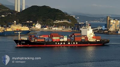
YM IMMENSE
Container Ship
Current Trip
| Time Travelled | 14 h, 1 mins |
|---|---|
| Remaining Time | 1 day |
| Distance Travelled | 201.10 nm |
| Remaining Distance | 720.77 nm |
| AVG Speed | 17.6 Noeuds |
| MAX Speed | 18.5 Noeuds |
| AVG Wind | 19.8 knots |
| MAX Wind | 28 knots |
| MIN Temp | 1°C / 33.8°F |
| MAX Temp | 6.8°C / 44.24°F |
| Tirant d eau | 8.6 m |
| Position reçue | 11 h, 5 m depuis |
Current Position
| Longitude | 134.89013° |
|---|---|
| Latitude | 33.92970° |
| Etat | Under way using engine |
| Vitesse | 17.8 Noeuds |
| Parcours | 187° |
| Zone | Philippine Sea |
| Station | T-AIS |
| Position reçue | 11 h, 5 m depuis |
Info
Information
The current position of YM IMMENSE is in Philippine Sea with coordinates 33.92970° / 134.89013° as reported on 2025-02-23 18:48 by AIS to our vessel tracker app. The vessel's current speed is 17.8 Noeuds and is heading at the port of KEELUNG. The estimated time of arrival as calculated by MyShipTracking vessel tracking app is 2025-02-25 21:50 LT
The vessel YM IMMENSE (IMO: 9319131, MMSI: 416492000) is a Container Ship that was built in 2006 ( 19 Age ). It's sailing under the flag of [TW] Taiwan.
In this page you can find informations about the vessels current position, last detected port calls, and current voyage information. If the vessels is not in coverage by AIS you will find the latest position.
The current position of YM IMMENSE is detected by our AIS receivers and we are not responsible for the reliability of the data. The last position was recorded while the vessel was in Coverage by the Ais receivers of our vessel tracking app.
The current draught of YM IMMENSE as reported by AIS is 8.6 meters
Weather
| Temperature | 5.5°C / 41.9°F |
|---|---|
| Wind Speed | 10 knots |
| Direction | 349° N |
| Pressure | 1027.4 hPa |
| Humidity | 49.6 % |
| Cloud Coverage | 17 % |
Featured Company
Last Port Calls
| Port | Arrival | Departure | Time In Port |
|---|---|---|---|
| 2025-02-23 09:24 | 2025-02-23 15:53 | 6 h | |
| 2025-02-23 02:27 | 2025-02-23 08:20 | 5 h | |
| 2025-02-21 22:13 | 2025-02-22 12:05 | 13 h | |
| 2025-02-20 22:34 | 2025-02-21 07:55 | 9 h | |
| 2025-02-19 22:23 | 2025-02-20 08:24 | 10 h | |
| 2025-02-16 06:33 | 2025-02-16 16:53 | 10 h | |
| 2025-02-15 06:13 | 2025-02-15 23:01 | 16 h | |
| 2025-02-14 09:55 | 2025-02-14 22:44 | 12 h | |
| 2025-02-12 22:41 | 2025-02-13 09:59 | 11 h | |
| 2025-02-07 11:25 | 2025-02-07 22:21 | 10 h |
Last Trips
| Origin | Departure | Destination | Arrival | Distance | |
|---|---|---|---|---|---|
| 2025-02-23 17:20 | 2025-02-23 18:24 | 7.61 nm | |||
| 2025-02-22 21:05 | 2025-02-23 11:27 | 238.97 nm | |||
| 2025-02-21 16:55 | 2025-02-22 07:13 | 200.74 nm | |||
| 2025-02-20 17:24 | 2025-02-21 07:34 | 16.75 nm | |||
| 2025-02-17 00:53 | 2025-02-20 07:23 | 1146.39 nm | |||
| 2025-02-16 07:01 | 2025-02-16 14:33 | 111.57 nm | |||
| 2025-02-15 06:44 | 2025-02-15 14:13 | 130.36 nm | |||
| 2025-02-13 17:59 | 2025-02-14 17:55 | 355.66 nm | |||
| 2025-02-08 05:21 | 2025-02-13 06:41 | 1579.70 nm | |||
| 2025-02-07 07:06 | 2025-02-07 18:25 | 34.87 nm |
Events
| Heure | Evenement | Détails | Position/ Destination | Info |
|---|---|---|---|---|
| 2025-02-23 18:54 | Etat Changé | Default Under way using engine |
33.90408 / 134.88638
TWKEL
|
Vitesse: 17.8 kn Parcours: 187° |
| 2025-02-23 18:48 | Hors de la zone couverte |
33.92970 / 134.89013
Philippine Sea
TWKEL
|
Vitesse: 17.8 kn Parcours: 187° |
|
| 2025-02-23 18:42 | Etat Changé | Under way using engine Default |
33.95972 / 134.89472
TWKEL
|
Vitesse: 17.8 kn Parcours: 192° |
| 2025-02-23 18:38 | Etat Changé | Default Under way using engine |
33.98193 / 134.90117
TWKEL
|
Vitesse: 17.8 kn Parcours: 194° |
| 2025-02-23 17:31 | Changement de zone | Japanese part of the Philippine Sea Japanese part of the Inland Sea |
34.26970 / 134.97228
Philippine Sea
TWKEL
|
Vitesse: 13.1 kn Parcours: 189° |
| 2025-02-23 15:53 | PORT DE DEPART |
|
34.64903 / 135.26487
TWKEL
|
Vitesse: 13.2 kn Parcours: 150° |
| 2025-02-23 15:41 | Démarrage |
34.68028 / 135.25223
[JP] KOBE
|
Vitesse: 5.5 kn Parcours: 193° |
|
| 2025-02-23 15:23 | Etat Changé | Under way using engine Moored |
34.68193 / 135.25353
[JP] KOBE
|
Vitesse: Parcours: 173° |
| 2025-02-23 15:04 | Tirant d'eau modifié | 8.6 7.9 |
34.68198 / 135.25355
[JP] KOBE
|
Vitesse: Parcours: 173° |
| 2025-02-23 14:59 | Changement de destination | TWKEL JP UKB RW |
34.68188 / 135.25358
[JP] KOBE
|
Vitesse: Parcours: 173° |