
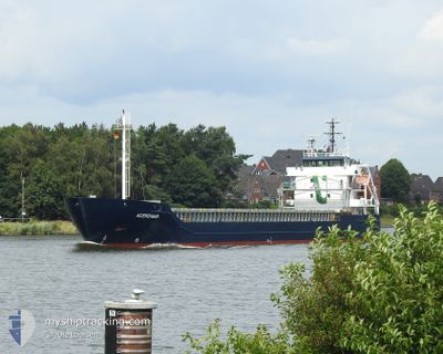
ACEROMAR
General Cargo
Current Trip
| Time Travelled | 2 days |
|---|---|
| Remaining Time | --- |
| Distance Travelled | 585.95 nm |
| Remaining Distance | --- |
| AVG Speed | 8.8 Knopen |
| MAX Speed | 10.8 Knopen |
| AVG Wind | 18.5 knots |
| MAX Wind | 25 knots |
| MIN Temp | 0.5°C / 32.9°F |
| MAX Temp | 5.9°C / 42.62°F |
| Diepgang | 6.3 M |
| Positie ontvangen | 1 m geleden |
Current Position
| Lengtegraad | 12.64011° |
|---|---|
| Breedtegraat | 56.04339° |
| Status | Under way using engine |
| Snelheid | 6.1 Knopen |
| Koers | 194.7° |
| Gebied | Kattegat |
| Station | T-AIS |
| Positie ontvangen | 1 m geleden |
Info
Information
The current position of ACEROMAR is in Kattegat with coordinates 56.04339° / 12.64011° as reported on 2025-02-11 06:16 by AIS to our vessel tracker app. The vessel's current speed is 6.1 Knopen and is heading at the port of VASTERAS. The estimated time of arrival as calculated by MyShipTracking vessel tracking app is 2025-02-12 16:00 LT
The vessel ACEROMAR (IMO: 9552082, MMSI: 253371000) is a General Cargo that was built in 2012 ( 13 Jaar oud ). It's sailing under the flag of [LU] Luxembourg.
In this page you can find informations about the vessels current position, last detected port calls, and current voyage information. If the vessels is not in coverage by AIS you will find the latest position.
The current position of ACEROMAR is detected by our AIS receivers and we are not responsible for the reliability of the data. The last position was recorded while the vessel was in Coverage by the Ais receivers of our vessel tracking app.
The current draught of ACEROMAR as reported by AIS is 6.3 meters
Weather
| Temperature | 1.3°C / 34.34°F |
|---|---|
| Wind Speed | 17 knots |
| Direction | 98° E |
| Pressure | 1036.3 hPa |
| Humidity | 75.8 % |
| Cloud Coverage | 15 % |
Featured Company
Last Port Calls
| Port | Arrival | Departure | Time In Port |
|---|---|---|---|
| 2025-02-05 22:13 | 2025-02-08 11:58 | 2 d | |
| 2025-02-04 06:00 | 2025-02-05 19:27 | 1 d | |
| 2025-01-29 03:10 | 2025-01-30 23:56 | 1 d | |
| 2025-01-28 02:07 | 2025-01-29 00:24 | 22 h | |
| 2025-01-24 18:38 | 2025-01-27 05:20 | 2 d | |
| 2025-01-21 18:25 | 2025-01-24 05:33 | 2 d | |
| 2025-01-14 18:32 | 2025-01-16 21:17 | 2 d | |
| 2025-01-11 02:16 | 2025-01-12 08:15 | 1 d | |
| 2025-01-06 23:13 | 2025-01-07 01:31 | 2 h | |
| 2024-12-30 05:09 | 2025-01-02 20:17 | 3 d |
Last Trips
| Origin | Departure | Destination | Arrival | Distance | |
|---|---|---|---|---|---|
| 2025-02-05 19:27 | 2025-02-05 22:13 | 27.12 nm | |||
| 2025-01-31 00:56 | 2025-02-04 06:00 | 961.34 nm | |||
| 2025-01-29 01:24 | 2025-01-29 04:10 | 29.65 nm | |||
| 2025-01-27 07:20 | 2025-01-28 03:07 | 210.08 nm | |||
| 2025-01-24 07:33 | 2025-01-24 20:38 | 149.47 nm | |||
| 2025-01-16 22:17 | 2025-01-21 20:25 | 1108.29 nm | |||
| 2025-01-12 09:15 | 2025-01-14 19:32 | 95.96 nm | |||
| 2025-01-07 02:31 | 2025-01-11 03:16 | 327.93 nm | |||
| 2025-01-02 21:17 | 2025-01-07 00:13 | 801.32 nm | |||
| 2024-12-28 07:53 | 2024-12-30 06:09 | 431.09 nm |
Events
| Tijd | Evenement | Details | Positie / Bestemming | Info |
|---|---|---|---|---|
| 2025-02-11 04:28 | Wijzig zee gebeid | Danish part of the Kattegat Swedish part of the Kattegat |
56.20511 / 12.38097
Kattegat
SEVST
|
Snelheid: 7.4 kn Koers: 163.7° |
| 2025-02-10 19:04 | Wijzig zee gebeid | Swedish part of the Kattegat Danish part of the Kattegat |
57.50995 / 11.34260
Kattegat
SEVST
|
Snelheid: 9.8 kn Koers: 135° |
| 2025-02-10 16:46 | Wijzig zee gebeid | Danish part of the Kattegat Danish part of the Skaggerak |
57.77876 / 10.87003
Kattegat
SEVST
|
Snelheid: 9.3 kn Koers: 134.2° |
| 2025-02-10 05:52 | Gevonden in zee | Danish part of the Skaggerak |
57.33633 / 8.23163
Skaggerak
SEVST
|
Snelheid: 8.1 kn Koers: 62.7° |
| 2025-02-10 00:25 | Status Changed | Under way using engine Default |
57.11199 / 6.89437
SEVST
|
Snelheid: 8.6 kn Koers: 77° |
| 2025-02-10 00:20 | Status Changed | Default Under way using engine |
57.10862 / 6.86855
SEVST
|
Snelheid: 8.3 kn Koers: 75.4° |
| 2025-02-09 23:34 | ETA Changed | 2025/02/12 16:00 2025/02/12 07:00 |
57.08265 / 6.66427
SEVST
|
Snelheid: 8.6 kn Koers: 78.1° |
| 2025-02-09 23:25 | Wijzig zee gebeid | Danish part of the North Sea Norwegian part of the North Sea |
57.07960 / 6.63857
North Sea
SEVST
|
Snelheid: 8.7 kn Koers: 77.5° |
| 2025-02-09 20:50 | Status Changed | Under way using engine Default |
57.08045 / 5.94116
SEVST
|
Snelheid: 8.6 kn Koers: 93° |
| 2025-02-09 19:44 | Buitenbereik |
57.08404 / 5.63639
North Sea
SEVST
|
Snelheid: 9.1 kn Koers: 90.4° |