
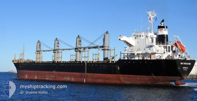
AGIOI THEODOROI
Bulk Carrier
Current Trip
| Trip Time | 22 days |
|---|---|
| Trip Distance | 5008.38 nm |
| AVG Speed | 8.9 Knopen |
| MAX Speed | 10.7 Knopen |
| Diepgang | 9 M |
| AVG Wind | 10.1 knots |
| MAX Wind | 27 knots |
| MIN Temp | 11.7°C / 53.06°F |
| MAX Temp | 26.6°C / 79.88°F |
| Positie ontvangen | 9 d geleden |
Current Position
| Lengtegraad | -72.10548° |
|---|---|
| Breedtegraat | 20.61830° |
| Status | Under way using engine |
| Snelheid | 10.4 Knopen |
| Koers | 252° |
| Gebied | North Atlantic Ocean |
| Station | T-AIS |
| Positie ontvangen | 9 d geleden |
Info
Information
The current position of AGIOI THEODOROI is in North Atlantic Ocean with coordinates 20.61830° / -72.10548° as reported on 2025-02-09 18:16 by AIS to our vessel tracker app. The vessel's current speed is 10.4 Knopen and is currently inside the port of CIENFUEGOS.
The vessel AGIOI THEODOROI (IMO: 9515527, MMSI: 636019935) is a Bulk Carrier that was built in 2009 ( 16 Jaar oud ). It's sailing under the flag of [LR] Liberia.
In this page you can find informations about the vessels current position, last detected port calls, and current voyage information. If the vessels is not in coverage by AIS you will find the latest position.
The current position of AGIOI THEODOROI is detected by our AIS receivers and we are not responsible for the reliability of the data. The last position was recorded while the vessel was in Coverage by the Ais receivers of our vessel tracking app.
The current draught of AGIOI THEODOROI as reported by AIS is 9 meters
Weather
| Temperature | 21.5°C / 70.7°F |
|---|---|
| Wind Speed | 6 knots |
| Direction | 50° NE |
| Pressure | 1017.9 hPa |
| Humidity | 68.6 % |
| Cloud Coverage | 100 % |
Featured Company
Last Port Calls
| Port | Arrival | Departure | Time In Port |
|---|---|---|---|
| 2025-02-12 08:46 | |||
| 2025-01-11 05:42 | 2025-01-20 22:55 | 9 d | |
| 2024-12-27 21:49 |
Last Trips
| Origin | Departure | Destination | Arrival | Distance | |
|---|---|---|---|---|---|
| 2025-01-20 22:55 | 2025-02-12 08:46 | 5008.38 nm | |||
| 2024-12-27 21:49 | 2025-01-11 05:42 | 184.61 nm |
Events
| Tijd | Evenement | Details | Positie / Bestemming | Info |
|---|---|---|---|---|
| 2025-02-12 14:47 | Stop beweging |
22.16552 / -80.47252
[CU] CIENFUEGOS
|
Snelheid: Koers: 19° |
|
| 2025-02-12 13:46 | Aankomsthaven |
|
22.13405 / -80.47780
[CU] CIENFUEGOS
|
Snelheid: 7.4 kn Koers: 353° |
| 2025-02-09 18:26 | Status Changed | Default Under way using engine |
20.61025 / -72.13250
CUCFG
|
Snelheid: 10.4 kn Koers: 252° |
| 2025-02-09 18:16 | Buitenbereik |
20.61830 / -72.10548
North Atlantic Ocean
|
Snelheid: 10.4 kn Koers: 252° |
|
| 2025-02-09 13:49 | Status Changed | Under way using engine Default |
20.87230 / -71.34398
CUCFG
|
Snelheid: 9.6 kn Koers: 231° |
| 2025-02-09 13:28 | Status Changed | Default Under way using engine |
20.90892 / -71.29485
CUCFG
|
Snelheid: 9.5 kn Koers: 233° |
| 2025-02-09 13:21 | Gevonden in zee | Turks and Caicos part of the North Atlantic Ocean |
20.91860 / -71.28055
North Atlantic Ocean
|
Snelheid: 9.5 kn Koers: 233° |
| 2025-02-09 13:21 | Status Changed | Under way using engine Default |
20.91860 / -71.28055
CUCFG
|
Snelheid: 9.4 kn Koers: 231° |
| 2025-02-09 13:21 | Binnenbereik |
20.91860 / -71.28055
North Atlantic Ocean
|
Snelheid: 9.5 kn Koers: 233° |