
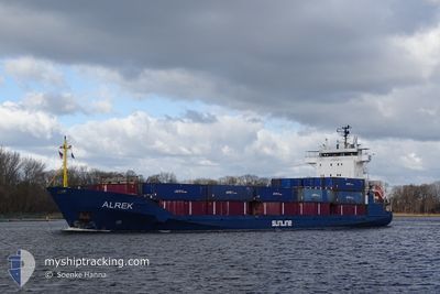
ALREK
General Cargo
Current Trip
| Time Travelled | 4 h, 9 mins |
|---|---|
| Remaining Time | 3 days |
| Distance Travelled | 49.05 nm |
| Remaining Distance | 959.18 nm |
| AVG Speed | 11.9 Knopen |
| MAX Speed | 13 Knopen |
| AVG Wind | 8.1 knots |
| MAX Wind | 13 knots |
| MIN Temp | 0.8°C / 33.44°F |
| MAX Temp | 1.9°C / 35.42°F |
| Diepgang | 6.1 M |
| Positie ontvangen | 51 m geleden |
Current Position
| Lengtegraad | 17.40318° |
|---|---|
| Breedtegraat | 58.13270° |
| Status | Under way using engine |
| Snelheid | 12.8 Knopen |
| Koers | 186° |
| Gebied | Baltic Sea |
| Station | T-AIS |
| Positie ontvangen | 51 m geleden |
Info
Information
The current position of ALREK is in Baltic Sea with coordinates 58.13270° / 17.40318° as reported on 2025-02-10 15:00 by AIS to our vessel tracker app. The vessel's current speed is 12.8 Knopen and is heading at the port of ANTWERP. The estimated time of arrival as calculated by MyShipTracking vessel tracking app is 2025-02-13 19:05 LT
The vessel ALREK (IMO: 9330953, MMSI: 304944000) is a General Cargo that was built in 2006 ( 19 Jaar oud ). It's sailing under the flag of [AG] Antigua Barbuda.
In this page you can find informations about the vessels current position, last detected port calls, and current voyage information. If the vessels is not in coverage by AIS you will find the latest position.
The current position of ALREK is detected by our AIS receivers and we are not responsible for the reliability of the data. The last position was recorded while the vessel was in Coverage by the Ais receivers of our vessel tracking app.
The current draught of ALREK as reported by AIS is 6.1 meters
Weather
| Temperature | 1.8°C / 35.24°F |
|---|---|
| Wind Speed | 12 knots |
| Direction | 60° ENE |
| Pressure | 1043 hPa |
| Humidity | 77.3 % |
| Cloud Coverage | 71 % |
Featured Company
Last Port Calls
| Port | Arrival | Departure | Time In Port |
|---|---|---|---|
| 2025-02-08 12:20 | 2025-02-10 11:43 | 1 d | |
| 2025-02-05 09:59 | 2025-02-05 19:25 | 9 h | |
| 2025-02-05 08:31 | 2025-02-05 09:18 | 47 m | |
| 2025-02-03 22:38 | 2025-02-04 17:05 | 18 h | |
| 2025-02-02 08:45 | 2025-02-02 09:24 | 38 m | |
| 2025-01-31 20:44 | 2025-01-31 21:25 | 41 m | |
| 2025-01-29 12:06 | 2025-01-31 16:11 | 2 d | |
| 2025-01-29 07:23 | 2025-01-29 07:47 | 24 m | |
| 2025-01-25 23:45 | 2025-01-26 10:57 | 11 h | |
| 2025-01-25 19:39 | 2025-01-25 23:17 | 3 h |
Last Trips
| Origin | Departure | Destination | Arrival | Distance | |
|---|---|---|---|---|---|
| 2025-02-05 20:25 | 2025-02-08 13:20 | 722.22 nm | |||
| 2025-02-05 10:18 | 2025-02-05 10:59 | 5.47 nm | |||
| 2025-02-04 17:05 | 2025-02-05 09:31 | 204.61 nm | |||
| 2025-02-02 10:24 | 2025-02-03 22:38 | 402.56 nm | |||
| 2025-01-31 22:25 | 2025-02-02 09:45 | 457.09 nm | |||
| 2025-01-31 17:11 | 2025-01-31 21:44 | 48.73 nm | |||
| 2025-01-29 08:47 | 2025-01-29 13:06 | 50.04 nm | |||
| 2025-01-26 11:57 | 2025-01-29 08:23 | 750.52 nm | |||
| 2025-01-26 00:17 | 2025-01-26 00:45 | 0.51 nm | |||
| 2025-01-25 19:34 | 2025-01-25 20:39 | 9.16 nm |
Events
| Tijd | Evenement | Details | Positie / Bestemming | Info |
|---|---|---|---|---|
| 2025-02-10 15:05 | Status Changed | Default Under way using engine |
58.11375 / 17.39940
BEANR
|
Snelheid: 12.8 kn Koers: 186° |
| 2025-02-10 14:31 | Status Changed | Under way using engine Default |
58.23828 / 17.42045
BEANR
|
Snelheid: 12.7 kn Koers: 183° |
| 2025-02-10 14:29 | Status Changed | Default Under way using engine |
58.24312 / 17.42093
BEANR
|
Snelheid: 12.6 kn Koers: 184° |
| 2025-02-10 14:12 | Draught Changed | 6.1 6 |
58.30477 / 17.42515
BEANR
|
Snelheid: 12.8 kn Koers: 183.2° |
| 2025-02-10 14:12 | ETA Changed | 2025/02/13 14:00 |
58.30477 / 17.42515
BEANR
|
Snelheid: 12.8 kn Koers: 183.2° |
| 2025-02-10 14:00 | Draught Changed | 6 6.1 |
58.34692 / 17.43170
BEANR
|
Snelheid: 12.6 kn Koers: 186.6° |
| 2025-02-10 11:43 | Vertrekhaven |
|
58.67587 / 17.15140
BEANR
|
Snelheid: 8.1 kn Koers: 60° |
| 2025-02-10 11:39 | Start beweging |
58.67460 / 17.13953
[SE] OXELOSUND
|
Snelheid: 4 kn Koers: 113° |
|
| 2025-02-10 11:24 | Draught Changed | 6.1 5.4 |
58.67568 / 17.13663
[SE] OXELOSUND
|
Snelheid: Koers: 162° |
| 2025-02-10 11:24 | Destination Changed | BEANR SEOXE |
58.67568 / 17.13663
[SE] OXELOSUND
|
Snelheid: Koers: 162° |