

AMERICA
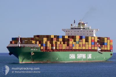
Container Ship

Current Trip
| Time Travelled | 22 days |
|---|---|
| Remaining Time | --- |
| Distance Travelled | 8678.08 nm |
| Remaining Distance | 17.02 nm |
| AVG Speed | 16 Knopen |
| MAX Speed | 21.4 Knopen |
| AVG Wind | 14 knots |
| MAX Wind | 30 knots |
| MIN Temp | 7.8°C / 46.04°F |
| MAX Temp | 28.8°C / 83.84°F |
| Diepgang | 15 M |
| Positie ontvangen | 5 d geleden |
Current Position
| Lengtegraad | 31.63268° |
|---|---|
| Breedtegraat | -31.73923° |
| Status | Under way using engine |
| Snelheid | 19 Knopen |
| Koers | 62° |
| Gebied | Indian Ocean |
| Station | T-AIS |
| Positie ontvangen | 5 d geleden |
Information
The current position of AMERICA is in Indian Ocean with coordinates -31.73923° / 31.63268° as reported on 2025-05-25 17:12 by AIS to our vessel tracker app. The vessel's current speed is 19 Knopen and is heading at the port of PORT LOUIS. The estimated time of arrival as calculated by MyShipTracking vessel tracking app is 2025-05-29 18:00 LT
The vessel AMERICA (IMO: 9285990, MMSI: 209550000) is a Container Ship that was built in 2004 ( 21 Jaar oud ). It's sailing under the flag of [CY] Cyprus.
In this page you can find informations about the vessels current position, last detected port calls, and current voyage information. If the vessels is not in coverage by AIS you will find the latest position.
The current position of AMERICA is detected by our AIS receivers and we are not responsible for the reliability of the data. The last position was recorded while the vessel was in Coverage by the Ais receivers of our vessel tracking app.
The current draught of AMERICA as reported by AIS is 15 meters
Weather
| Temperature | 24.9°C / 76.82°F |
|---|---|
| Wind Speed | 19 knots |
| Direction | 102° ESE |
| Pressure | 1020.5 hPa |
| Humidity | 70.4 % |
| Cloud Coverage | 1 % |


Featured Company
Last Port Calls
| Port | Arrival | Departure | Time In Port |
|---|---|---|---|
| 2025-05-07 11:04 | 2025-05-08 20:52 | 1 d | |
| 2025-05-05 01:12 | 2025-05-06 06:34 | 1 d | |
| 2025-05-02 10:41 | 2025-05-03 11:38 | 1 d | |
| 2025-04-26 22:26 | 2025-04-29 21:36 | 2 d | |
| 2025-04-24 09:31 | 2025-04-25 06:36 | 21 h | |
| 2025-04-22 01:47 | 2025-04-23 15:20 | 1 d | |
| 2025-04-19 01:39 | 2025-04-20 10:33 | 1 d | |
| 2025-04-15 23:47 | 2025-04-17 13:38 | 1 d | |
| 2025-03-11 02:31 | 2025-03-13 04:39 | 2 d | |
| 2025-03-07 18:32 | 2025-03-08 15:08 | 20 h |
Last Trips
| Origin | Departure | Destination | Arrival | Distance | |
|---|---|---|---|---|---|
| 2025-05-06 06:34 | 2025-05-07 11:04 | 266.17 nm | |||
| 2025-05-03 11:38 | 2025-05-05 01:12 | 306.35 nm | |||
| 2025-04-29 21:36 | 2025-05-02 10:41 | 107.92 nm | |||
| 2025-04-25 06:36 | 2025-04-26 22:26 | 381.25 nm | |||
| 2025-04-23 15:20 | 2025-04-24 09:31 | 148.14 nm | |||
| 2025-04-20 10:33 | 2025-04-22 01:47 | 342.85 nm | |||
| 2025-04-17 13:38 | 2025-04-19 01:39 | 118.15 nm | |||
| 2025-03-13 04:39 | 2025-04-15 23:47 | 11034.75 nm | |||
| 2025-03-08 15:08 | 2025-03-11 02:31 | 550.74 nm | |||
| 2025-03-05 12:26 | 2025-03-07 18:32 | 565.04 nm |
Events
| Tijd | Evenement | Details | Positie / Bestemming | Info |
|---|---|---|---|---|
| 2025-05-31 00:22 | Start beweging | 21.22 nm, North West of PORT LOUIS |
-20.00067 / 57.13723
MUPLU
|
Snelheid: 3.7 kn Koers: 63° |
| 2025-05-30 16:09 | Stop beweging | 16.26 nm, North West of PORT LOUIS |
-20.00443 / 57.23332
MUPLU
|
Snelheid: 0.3 kn Koers: 89° |
| 2025-05-25 17:16 | Status Changed | Default Under way using engine |
-31.73078 / 31.65250
MUPLU
|
Snelheid: 19 kn Koers: 62° |
| 2025-05-25 17:12 | Buitenbereik |
-31.73923 / 31.63268
Indian Ocean
MUPLU
|
Snelheid: 19 kn Koers: 62° |
|
| 2025-05-25 16:17 | ETA Changed | 2025/05/29 14:00 2025/05/28 16:00 |
-31.85915 / 31.32145
MUPLU
|
Snelheid: 18.6 kn Koers: 67° |
| 2025-05-25 15:40 | Status Changed | Under way using engine Default |
-31.92770 / 31.12257
MUPLU
|
Snelheid: 18.1 kn Koers: 67° |
| 2025-05-25 15:40 | Binnenbereik |
-31.92680 / 31.12507
Indian Ocean
MUPLU
|
Snelheid: 17.8 kn Koers: 67° |
|
| 2025-05-25 14:36 | Status Changed | Default Under way using engine |
-32.05243 / 30.77625
MUPLU
|
Snelheid: 17.3 kn Koers: 68° |
| 2025-05-25 14:32 | Buitenbereik |
-32.06005 / 30.75270
Indian Ocean
MUPLU
|
Snelheid: 17.3 kn Koers: 68° |
|
| 2025-05-25 13:38 | Wijzig zee gebeid | South African part of the Indian Ocean South African part of the South Atlantic Ocean |
-32.15678 / 30.46863
Indian Ocean
MUPLU
|
Snelheid: 17 kn Koers: 68° |