
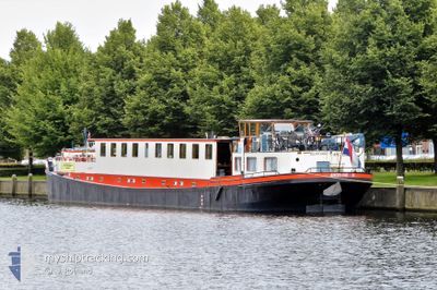
ANGELINE
Not available
Current Trip
HELMOND
| Time Travelled | 4 days |
|---|---|
| Remaining Time | --- |
| Distance Travelled | 72.05 nm |
| Remaining Distance | --- |
| AVG Speed | 5.1 Knopen |
| MAX Speed | 8.3 Knopen |
| AVG Wind | 5.4 knots |
| MAX Wind | 9.6 knots |
| MIN Temp | 7.2°C / 44.96°F |
| MAX Temp | 20.1°C / 68.18°F |
| Diepgang | 1.3 M |
| Positie ontvangen | 29 m geleden |
Current Position
| Lengtegraad | 5.68504° |
|---|---|
| Breedtegraat | 51.44722° |
| Status | Under way using engine |
| Snelheid | 0.1 Knopen |
| Koers | --- |
| Gebied | North Sea |
| Station | T-AIS |
| Positie ontvangen | 29 m geleden |
Information
The current position of ANGELINE is in North Sea with coordinates 51.44722° / 5.68504° as reported on 2025-05-22 09:43 by AIS to our vessel tracker app. The vessel's current speed is 0.1 Knopen
The vessel ANGELINE (MMSI: 244660894) is a Not available It's sailing under the flag of [NL] Netherlands.
In this page you can find informations about the vessels current position, last detected port calls, and current voyage information. If the vessels is not in coverage by AIS you will find the latest position.
The current position of ANGELINE is detected by our AIS receivers and we are not responsible for the reliability of the data. The last position was recorded while the vessel was in Coverage by the Ais receivers of our vessel tracking app.
The current draught of ANGELINE as reported by AIS is 1.3 meters
Weather
| Temperature | 11.3°C / 52.34°F |
|---|---|
| Wind Speed | 9 knots |
| Direction | 319° NW |
| Pressure | 1015.7 hPa |
| Humidity | 51.7 % |
| Cloud Coverage | 99 % |
Featured Company
Last Port Calls
| Port | Arrival | Departure | Time In Port |
|---|---|---|---|
| 2025-05-17 19:47 | 2025-05-18 07:15 | 11 h | |
| 2025-05-17 17:40 | 2025-05-17 18:17 | 36 m | |
| 2025-05-14 11:28 | 2025-05-17 13:15 | 3 d | |
| 2025-05-14 08:14 | 2025-05-14 09:11 | 56 m | |
| 2025-05-13 11:52 | 2025-05-14 07:08 | 19 h | |
| 2025-05-12 13:49 | 2025-05-13 09:18 | 19 h | |
| 2025-05-12 10:39 | 2025-05-12 10:43 | 4 m | |
| 2025-05-11 12:20 | 2025-05-12 07:02 | 18 h | |
| 2025-05-10 13:01 | 2025-05-11 09:22 | 20 h | |
| 2025-05-05 13:47 | 2025-05-07 09:52 | 1 d |
Last Trips
| Origin | Departure | Destination | Arrival | Distance | |
|---|---|---|---|---|---|
| 2025-05-17 18:17 | 2025-05-17 19:47 | 10.12 nm | |||
| 2025-05-17 13:15 | 2025-05-17 17:40 | 16.81 nm | |||
| 2025-05-14 09:11 | 2025-05-14 11:28 | 12.99 nm | |||
| 2025-05-14 07:08 | 2025-05-14 08:14 | 6.42 nm | |||
| 2025-05-13 09:18 | 2025-05-13 11:52 | 12.63 nm | |||
| 2025-05-12 10:43 | 2025-05-12 13:49 | 6.85 nm | |||
| 2025-05-12 07:02 | 2025-05-12 10:39 | 17.41 nm | |||
| 2025-05-11 09:22 | 2025-05-11 12:20 | 16.66 nm | |||
| 2025-05-07 09:52 | 2025-05-10 13:01 | 65.59 nm | |||
| 2025-05-05 09:16 | 2025-05-05 13:47 | 22.56 nm |
Events
| Tijd | Evenement | Details | Positie / Bestemming | Info |
|---|---|---|---|---|
| 2025-05-22 09:43 | Stop beweging | 2 nm, South East of HELMOND |
51.44720 / 5.68502
HELMOND
|
Snelheid: 0.1 kn Koers: 511° |
| 2025-05-22 09:32 | Binnenbereik |
51.44325 / 5.68993
North Sea
|
Snelheid: 4.9 kn Koers: 322° |
|
| 2025-05-21 06:30 | Buitenbereik |
51.47239 / 6.17904
North Sea
|
Snelheid: Koers: 511° |
|
| 2025-05-21 01:32 | Status Changed | Under way using engine Default |
51.47238 / 6.17906
HELMOND
|
Snelheid: Koers: -1° |
| 2025-05-21 01:11 | Status Changed | Default Under way using engine |
51.47237 / 6.17908
HELMOND
|
Snelheid: Koers: 511° |
| 2025-05-20 22:51 | Status Changed | Under way using engine Default |
51.47239 / 6.17900
HELMOND
|
Snelheid: Koers: -1° |
| 2025-05-20 22:31 | Status Changed | Default Under way using engine |
51.47237 / 6.17904
HELMOND
|
Snelheid: Koers: 511° |
| 2025-05-20 21:45 | Binnenbereik |
51.47239 / 6.17902
North Sea
|
Snelheid: Koers: 511° |
|
| 2025-05-20 07:21 | Buitenbereik |
51.62237 / 6.01886
North Sea
|
Snelheid: 6.3 kn Koers: 140.5° |
|
| 2025-05-20 07:06 | Start beweging | 2.28 nm, South East of BOXMEER |
51.63721 / 5.99071
HELMOND
|
Snelheid: 4.8 kn Koers: 111.2° |