
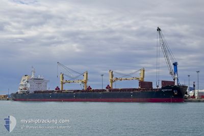
ANTWERP EAGLE
Cargo
Current Trip
| Trip Time | 8 days |
|---|---|
| Trip Distance | 1672.70 nm |
| AVG Speed | 10.1 Knopen |
| MAX Speed | 12.2 Knopen |
| Diepgang | 10.4 M |
| AVG Wind | 11.2 knots |
| MAX Wind | 25 knots |
| MIN Temp | 24.2°C / 75.56°F |
| MAX Temp | 29.6°C / 85.28°F |
| Positie ontvangen | 3 d geleden |
Current Position
| Lengtegraad | -43.95137° |
|---|---|
| Breedtegraat | -22.97993° |
| Status | Under way using engine |
| Snelheid | 11.9 Knopen |
| Koers | 56.5° |
| Gebied | South Atlantic Ocean |
| Station | T-AIS |
| Positie ontvangen | 3 d geleden |
Info
Information
The current position of ANTWERP EAGLE is in South Atlantic Ocean with coordinates -22.97993° / -43.95137° as reported on 2025-02-19 03:41 by AIS to our vessel tracker app. The vessel's current speed is 11.9 Knopen and is currently inside the port of ITAGUAI.
The vessel ANTWERP EAGLE (IMO: 9699036, MMSI: 538009603) is a Cargo It's sailing under the flag of [MH] Marshall Is.
In this page you can find informations about the vessels current position, last detected port calls, and current voyage information. If the vessels is not in coverage by AIS you will find the latest position.
The current position of ANTWERP EAGLE is detected by our AIS receivers and we are not responsible for the reliability of the data. The last position was recorded while the vessel was in Coverage by the Ais receivers of our vessel tracking app.
The current draught of ANTWERP EAGLE as reported by AIS is 10.4 meters
Weather
| Temperature | 27.6°C / 81.68°F |
|---|---|
| Wind Speed | 4 knots |
| Direction | 186° S |
| Pressure | 1016.8 hPa |
| Humidity | 70.5 % |
| Cloud Coverage | 7 % |
Featured Company
Last Port Calls
| Port | Arrival | Departure | Time In Port |
|---|---|---|---|
| 2025-02-19 04:41 | |||
| 2025-02-10 07:47 | |||
| 2025-01-10 23:09 | 2025-01-15 15:10 | 4 d | |
| 2024-12-21 23:43 | 2024-12-25 02:55 | 3 d | |
| 2024-12-12 04:34 | 2024-12-13 15:42 | 1 d | |
| 2024-12-02 08:22 | 2024-12-05 14:19 | 3 d | |
| 2024-12-01 03:32 |
Most Visited Ports (Last year)
| Port | Arrivals | |
|---|---|---|
| 2 | ||
| 1 | ||
| 1 | ||
| 1 | ||
| 1 | ||
| 1 |
Last Trips
| Origin | Departure | Destination | Arrival | Distance | |
|---|---|---|---|---|---|
| 2025-02-10 04:47 | 2025-02-19 01:41 | 1672.70 nm | |||
| 2024-12-25 02:55 | 2025-01-10 18:09 | 3634.91 nm | |||
| 2024-12-13 16:42 | 2024-12-21 23:43 | 1691.90 nm | |||
| 2024-12-05 16:19 | 2024-12-12 05:34 | 1597.39 nm | |||
| 2024-12-01 05:32 | 2024-12-02 10:22 | 55.62 nm |
Events
| Tijd | Evenement | Details | Positie / Bestemming | Info |
|---|---|---|---|---|
| 2025-02-19 05:12 | Stop beweging |
-22.93201 / -43.83509
[BR] ITAGUAI
|
Snelheid: 0.3 kn Koers: 264° |
|
| 2025-02-19 04:41 | Aankomsthaven |
|
-22.93772 / -43.84275
[BR] ITAGUAI
|
Snelheid: 2.4 kn Koers: 351° |
| 2025-02-19 03:43 | Status Changed | Default Under way using engine |
-22.97528 / -43.94389
BR SPB
|
Snelheid: 11.9 kn Koers: 56.5° |
| 2025-02-19 03:41 | Status Changed | Under way using engine Default |
-22.97993 / -43.95137
BR SPB
|
Snelheid: 12.1 kn Koers: 62° |
| 2025-02-19 03:41 | Buitenbereik |
-22.97993 / -43.95137
South Atlantic Ocean
|
Snelheid: 11.9 kn Koers: 56.5° |
|
| 2025-02-19 03:33 | Binnenbereik |
-22.97993 / -43.95137
South Atlantic Ocean
|
Snelheid: 11.9 kn Koers: 56.5° |
|
| 2025-02-19 01:24 | Start beweging | 8.81 nm, South East of VILA DO ABRAAO |
-23.23922 / -44.04961
BR SPB
|
Snelheid: 3.3 kn Koers: 340° |
| 2025-02-17 11:45 | Status Changed | Default At anchor |
-23.24268 / -44.04951
BR SPB
|
Snelheid: 0.2 kn Koers: 21° |
| 2025-02-17 11:30 | Status Changed | At anchor Default |
-23.24250 / -44.04883
BR SPB
|
Snelheid: 0.5 kn Koers: 350° |
| 2025-02-17 11:30 | Buitenbereik |
-23.24250 / -44.04883
South Atlantic Ocean
BR SPB
|
Snelheid: 0.2 kn Koers: 268.7° |