

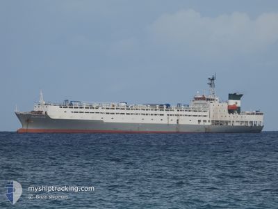
ATLANTIC ROSE
Reefer

Current Trip
| Time Travelled | 4 days |
|---|---|
| Remaining Time | --- |
| Distance Travelled | 1166.48 nm |
| Remaining Distance | --- |
| AVG Speed | 12.1 Knopen |
| MAX Speed | 14.3 Knopen |
| AVG Wind | 8.1 knots |
| MAX Wind | 14 knots |
| MIN Temp | 20.9°C / 69.62°F |
| MAX Temp | 26.4°C / 79.52°F |
| Diepgang | 7.5 M |
| Positie ontvangen | 15 m geleden |
Current Position
| Lengtegraad | 23.12661° |
|---|---|
| Breedtegraat | 36.38660° |
| Status | Under way using engine |
| Snelheid | 11.8 Knopen |
| Koers | 100° |
| Gebied | Aegean Sea |
| Station | T-AIS |
| Positie ontvangen | 15 m geleden |
Information
The current position of ATLANTIC ROSE is in Aegean Sea with coordinates 36.38660° / 23.12661° as reported on 2025-06-10 05:35 by AIS to our vessel tracker app. The vessel's current speed is 11.8 Knopen and is heading at the port of TASUCU. The estimated time of arrival as calculated by MyShipTracking vessel tracking app is 2025-06-12 09:00 LT
The vessel ATLANTIC ROSE (IMO: 8806242, MMSI: 511100124) is a Reefer that was built in 1989 ( 36 Jaar oud ). It's sailing under the flag of [PW] Palau.
In this page you can find informations about the vessels current position, last detected port calls, and current voyage information. If the vessels is not in coverage by AIS you will find the latest position.
The current position of ATLANTIC ROSE is detected by our AIS receivers and we are not responsible for the reliability of the data. The last position was recorded while the vessel was in Coverage by the Ais receivers of our vessel tracking app.
The current draught of ATLANTIC ROSE as reported by AIS is 7.5 meters
Weather
| Temperature | 24.6°C / 76.28°F |
|---|---|
| Wind Speed | 14 knots |
| Direction | 4° N |
| Pressure | 1013.6 hPa |
| Humidity | 68.8 % |
| Cloud Coverage | --- |


Featured Company
Last Port Calls
| Port | Arrival | Departure | Time In Port |
|---|---|---|---|
| 2025-06-05 19:44 | 2025-06-06 07:28 | 11 h | |
| 2025-05-13 19:27 | 2025-05-16 01:35 | 2 d | |
| 2025-04-18 03:00 | 2025-04-20 13:17 | 2 d | |
| 2025-04-02 10:51 |
Most Visited Ports (Last year)
| Port | Arrivals | |
|---|---|---|
| 6 | ||
| 3 | ||
| 3 | ||
| 2 | ||
| 1 | ||
| 1 |
Last Trips
| Origin | Departure | Destination | Arrival | Distance | |
|---|---|---|---|---|---|
| 2025-05-16 01:35 | 2025-06-05 19:44 | 5502.01 nm | |||
| 2025-04-20 13:17 | 2025-05-13 19:27 | 7100.02 nm | |||
| 2025-04-02 10:51 | 2025-04-18 03:00 | 5184.96 nm |
Events
| Tijd | Evenement | Details | Positie / Bestemming | Info |
|---|---|---|---|---|
| 2025-06-10 05:25 | Wijzig zee gebeid | Greek part of the Aegean Sea Greek part of the Mediterranean Sea - Eastern Basin |
36.39249 / 23.08612
Aegean Sea
TR_TAS
|
Snelheid: 11.9 kn Koers: 99.6° |
| 2025-06-10 05:22 | Status Changed | Under way using engine Default |
36.39398 / 23.07540
TR_TAS
|
Snelheid: 11.9 kn Koers: 99° |
| 2025-06-10 05:12 | Status Changed | Default Under way using engine |
36.39960 / 23.03207
TR_TAS
|
Snelheid: 11.9 kn Koers: 98.7° |
| 2025-06-10 05:10 | Status Changed | Under way using engine Default |
36.40011 / 23.02801
TR_TAS
|
Snelheid: 11.7 kn Koers: 100° |
| 2025-06-10 04:49 | Status Changed | Default Under way using engine |
36.41121 / 22.94107
TR_TAS
|
Snelheid: 11.7 kn Koers: 89.9° |
| 2025-06-10 04:30 | Status Changed | Under way using engine Default |
36.40861 / 22.86500
TR_TAS
|
Snelheid: 11.7 kn Koers: 76° |
| 2025-06-10 04:24 | Status Changed | Default Under way using engine |
36.40617 / 22.84034
TR_TAS
|
Snelheid: 11.7 kn Koers: 75.2° |
| 2025-06-10 04:10 | Status Changed | Under way using engine Default |
36.39549 / 22.78550
TR_TAS
|
Snelheid: 11.5 kn Koers: 77° |
| 2025-06-10 03:53 | Binnenbereik |
36.39549 / 22.78550
Mediterranean Sea - Eastern Basin
TR_TAS
|
Snelheid: 11.6 kn Koers: 76.4° |
|
| 2025-06-09 20:28 | Buitenbereik |
36.37406 / 20.84219
Mediterranean Sea - Eastern Basin
TR_TAS
|
Snelheid: 12 kn Koers: 91.1° |