

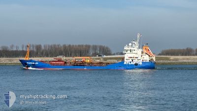
ATLANTIS ANTALYA
Oil/Chemical Tanker

Current Trip
| Time Travelled | 11 h, 42 mins |
|---|---|
| Remaining Time | 5 h, 44 mins |
| Distance Travelled | 95.63 nm |
| Remaining Distance | 41.83 nm |
| AVG Speed | 8.2 Knopen |
| MAX Speed | 11.4 Knopen |
| AVG Wind | 7.2 knots |
| MAX Wind | 12 knots |
| MIN Temp | 8.1°C / 46.58°F |
| MAX Temp | 8.5°C / 47.3°F |
| Diepgang | 5.9 M |
| Positie ontvangen | 1 m geleden |
Current Position
| Lengtegraad | 1.96742° |
|---|---|
| Breedtegraat | 51.41861° |
| Status | Under way using engine |
| Snelheid | 7.3 Knopen |
| Koers | 205.6° |
| Gebied | North Sea |
| Station | T-AIS |
| Positie ontvangen | 1 m geleden |
Information
The current position of ATLANTIS ANTALYA is in North Sea with coordinates 51.41861° / 1.96742° as reported on 2025-04-10 21:43 by AIS to our vessel tracker app. The vessel's current speed is 7.3 Knopen and is heading at the port of DUNKERQUE. The estimated time of arrival as calculated by MyShipTracking vessel tracking app is 2025-04-11 05:29 LT
The vessel ATLANTIS ANTALYA (IMO: 9305350, MMSI: 248252000) is a Oil/Chemical Tanker that was built in 2004 ( 21 Jaar oud ). It's sailing under the flag of [MT] Malta.
In this page you can find informations about the vessels current position, last detected port calls, and current voyage information. If the vessels is not in coverage by AIS you will find the latest position.
The current position of ATLANTIS ANTALYA is detected by our AIS receivers and we are not responsible for the reliability of the data. The last position was recorded while the vessel was in Coverage by the Ais receivers of our vessel tracking app.
The current draught of ATLANTIS ANTALYA as reported by AIS is 5.9 meters
Weather
| Temperature | 8.5°C / 47.3°F |
|---|---|
| Wind Speed | 2 knots |
| Direction | 311° NW |
| Pressure | 1028 hPa |
| Humidity | 78.7 % |
| Cloud Coverage | 6 % |


Featured Company
Last Port Calls
| Port | Arrival | Departure | Time In Port |
|---|---|---|---|
| 2025-04-07 22:24 | 2025-04-10 12:03 | 2 d | |
| 2025-04-07 05:31 | 2025-04-07 09:32 | 4 h | |
| 2025-04-06 19:26 | 2025-04-07 03:25 | 7 h | |
| 2025-04-06 00:31 | 2025-04-06 07:25 | 6 h | |
| 2025-04-04 23:17 | 2025-04-05 02:55 | 3 h | |
| 2025-04-03 12:41 | 2025-04-03 23:18 | 10 h | |
| 2025-03-31 22:11 | 2025-04-03 11:18 | 2 d | |
| 2025-03-31 05:25 | 2025-03-31 09:18 | 3 h | |
| 2025-03-29 23:36 | 2025-03-30 08:19 | 7 h | |
| 2025-03-28 05:07 | 2025-03-28 10:41 | 5 h |
Most Visited Ports (Last year)
| Port | Arrivals | |
|---|---|---|
| 30 | ||
| 29 | ||
| 23 | ||
| 13 | ||
| 11 | ||
| 8 |
Last Trips
| Origin | Departure | Destination | Arrival | Distance | |
|---|---|---|---|---|---|
| 2025-04-07 09:32 | 2025-04-07 22:24 | 131.47 nm | |||
| 2025-04-07 03:25 | 2025-04-07 05:31 | 20.90 nm | |||
| 2025-04-06 07:25 | 2025-04-06 19:26 | 9.35 nm | |||
| 2025-04-05 02:55 | 2025-04-06 00:31 | 14.54 nm | |||
| 2025-04-03 23:18 | 2025-04-04 23:17 | 148.75 nm | |||
| 2025-04-03 11:18 | 2025-04-03 12:41 | 9.58 nm | |||
| 2025-03-31 09:18 | 2025-03-31 22:11 | 130.61 nm | |||
| 2025-03-30 08:19 | 2025-03-31 05:25 | 31.08 nm | |||
| 2025-03-28 10:41 | 2025-03-29 23:36 | 30.88 nm | |||
| 2025-03-27 15:33 | 2025-03-28 05:07 | 141.97 nm |
Events
| Tijd | Evenement | Details | Positie / Bestemming | Info |
|---|---|---|---|---|
| 2025-04-10 18:31 | Gevonden in zee | United Kingdom part of the North Sea |
51.71721 / 2.37610
North Sea
FRDKK
|
Snelheid: 7.5 kn Koers: 221.9° |
| 2025-04-10 17:26 | Status Changed | Under way using engine Default |
51.81704 / 2.52678
FRDKK
|
Snelheid: 7.2 kn Koers: 222° |
| 2025-04-10 17:20 | Status Changed | Default Under way using engine |
51.82787 / 2.54195
FRDKK
|
Snelheid: 7 kn Koers: 224.1° |
| 2025-04-10 17:07 | Wijzig zee gebeid | Belgian part of the North Sea Dutch part of the North Sea |
51.84602 / 2.56804
North Sea
FRDKK
|
Snelheid: 7.5 kn Koers: 221.4° |
| 2025-04-10 16:10 | ETA Changed | 2025/04/11 02:00 2025/04/10 21:30 |
51.93614 / 2.69359
FRDKK
|
Snelheid: 7.4 kn Koers: 222.7° |
| 2025-04-10 14:59 | Status Changed | Under way using engine Default |
52.02495 / 2.87034
FRDKK
|
Snelheid: 7.3 kn Koers: 259° |
| 2025-04-10 14:56 | Status Changed | Default Under way using engine |
52.02579 / 2.87968
FRDKK
|
Snelheid: 7.2 kn Koers: 262.9° |
| 2025-04-10 13:40 | ETA Changed | 2025/04/10 21:30 2025/04/10 20:00 |
52.03887 / 3.15724
FRDKK
|
Snelheid: 10 kn Koers: 267° |
| 2025-04-10 13:03 | Status Changed | Under way using engine Default |
52.04454 / 3.32154
FRDKK
|
Snelheid: 9.9 kn Koers: 271° |
| 2025-04-10 13:02 | Status Changed | Default Under way using engine |
52.04455 / 3.32523
FRDKK
|
Snelheid: 10 kn Koers: 272.6° |