
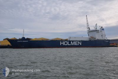
BALTIC BRIGHT
Vehicles Carrier
Current Trip
| Time Travelled | 4 days |
|---|---|
| Remaining Time | 15 h, 36 mins |
| Distance Travelled | 950.35 nm |
| Remaining Distance | 201.22 nm |
| AVG Speed | 10.9 Knopen |
| MAX Speed | 15.7 Knopen |
| AVG Wind | 9.9 knots |
| MAX Wind | 21 knots |
| MIN Temp | 0.4°C / 32.72°F |
| MAX Temp | 6.5°C / 43.7°F |
| Diepgang | 5.4 M |
| Positie ontvangen | 17 h, 24 m geleden |
Current Position
| Lengtegraad | 6.72245° |
|---|---|
| Breedtegraat | 55.87563° |
| Status | Under way using engine |
| Snelheid | 10.9 Knopen |
| Koers | 214.6° |
| Gebied | North Sea |
| Station | T-AIS |
| Positie ontvangen | 17 h, 24 m geleden |
Info
Information
The current position of BALTIC BRIGHT is in North Sea with coordinates 55.87563° / 6.72245° as reported on 2025-02-01 11:21 by AIS to our vessel tracker app. The vessel's current speed is 10.9 Knopen and is heading at the port of SHEERNESS. The estimated time of arrival as calculated by MyShipTracking vessel tracking app is 2025-02-02 20:22 LT
The vessel BALTIC BRIGHT (IMO: 9129263, MMSI: 230042000) is a Vehicles Carrier that was built in 1996 ( 29 Jaar oud ). It's sailing under the flag of [FI] Finland.
In this page you can find informations about the vessels current position, last detected port calls, and current voyage information. If the vessels is not in coverage by AIS you will find the latest position.
The current position of BALTIC BRIGHT is detected by our AIS receivers and we are not responsible for the reliability of the data. The last position was recorded while the vessel was in Coverage by the Ais receivers of our vessel tracking app.
The current draught of BALTIC BRIGHT as reported by AIS is 5.4 meters
Weather
| Temperature | 5.3°C / 41.54°F |
|---|---|
| Wind Speed | 14 knots |
| Direction | 175° S |
| Pressure | 1024.7 hPa |
| Humidity | 71.2 % |
| Cloud Coverage | 28 % |
Featured Company
Last Port Calls
| Port | Arrival | Departure | Time In Port |
|---|---|---|---|
| 2025-01-26 08:40 | 2025-01-28 11:11 | 2 d | |
| 2025-01-19 18:16 | 2025-01-21 07:04 | 1 d | |
| 2025-01-12 12:48 | 2025-01-14 11:09 | 1 d | |
| 2025-01-05 20:53 | 2025-01-07 19:39 | 1 d | |
| 2025-01-04 14:19 | 2025-01-04 15:38 | 1 h | |
| 2024-12-29 06:39 | 2024-12-30 13:41 | 1 d | |
| 2024-12-21 12:52 | 2024-12-23 18:09 | 2 d | |
| 2024-12-21 12:01 | 2024-12-21 12:08 | 6 m | |
| 2024-12-14 23:20 | 2024-12-16 13:03 | 1 d | |
| 2024-12-07 21:10 | 2024-12-11 11:12 | 3 d |
Most Visited Ports (Last year)
| Port | Arrivals | |
|---|---|---|
| 27 | ||
| 25 | ||
| 3 | ||
| 2 | ||
| 1 |
Last Trips
| Origin | Departure | Destination | Arrival | Distance | |
|---|---|---|---|---|---|
| 2025-01-21 07:04 | 2025-01-26 09:40 | 1193.32 nm | |||
| 2025-01-14 12:09 | 2025-01-19 18:16 | 1276.16 nm | |||
| 2025-01-07 19:39 | 2025-01-12 13:48 | 1194.84 nm | |||
| 2025-01-04 16:38 | 2025-01-05 20:53 | 370.70 nm | |||
| 2024-12-30 14:41 | 2025-01-04 15:19 | 721.62 nm | |||
| 2024-12-23 18:09 | 2024-12-29 07:39 | 1190.13 nm | |||
| 2024-12-21 12:08 | 2024-12-21 12:52 | 2.52 nm | |||
| 2024-12-16 14:03 | 2024-12-21 12:01 | 1106.52 nm | |||
| 2024-12-11 11:12 | 2024-12-15 00:20 | 1192.97 nm | |||
| 2024-12-03 11:15 | 2024-12-07 21:10 | 1096.67 nm |
Events
| Tijd | Evenement | Details | Positie / Bestemming | Info |
|---|---|---|---|---|
| 2025-02-01 11:21 | Status Changed | Default Under way using engine |
55.87481 / 6.72147
GBSHS
|
Snelheid: 10.9 kn Koers: 214.6° |
| 2025-02-01 11:21 | Buitenbereik |
55.87563 / 6.72245
North Sea
GBSHS
|
Snelheid: 10.9 kn Koers: 214.6° |
|
| 2025-02-01 07:54 | Status Changed | Under way using engine Default |
56.37268 / 7.35995
GBSHS
|
Snelheid: 10.4 kn Koers: 217° |
| 2025-02-01 07:39 | Status Changed | Default Under way using engine |
56.40765 / 7.40578
GBSHS
|
Snelheid: 10.3 kn Koers: 216.1° |
| 2025-02-01 01:47 | Gevonden in zee | Danish part of the North Sea |
57.20315 / 8.44645
North Sea
GBSHS
|
Snelheid: 9.7 kn Koers: 238.1° |
| 2025-01-31 16:07 | Wijzig zee gebeid | Danish part of the Skaggerak Danish part of the Kattegat |
57.80313 / 10.92684
Skaggerak
GBSHS
|
Snelheid: 10.6 kn Koers: 320.5° |
| 2025-01-31 14:49 | Gevonden in zee | Danish part of the Kattegat |
57.63631 / 11.21988
Kattegat
GBSHS
|
Snelheid: 11 kn Koers: 317.3° |
| 2025-01-31 03:29 | Wijzig zee gebeid | Swedish part of the Kattegat Danish part of the Kattegat |
55.82782 / 12.72337
Kattegat
GBSHS
|
Snelheid: 10.7 kn Koers: 8° |
| 2025-01-31 01:29 | Wijzig zee gebeid | Danish part of the Kattegat Swedish part of the Kattegat |
55.48959 / 12.71525
Kattegat
GBSHS
|
Snelheid: 10.6 kn Koers: 3.7° |
| 2025-01-31 00:38 | Wijzig zee gebeid | Swedish part of the Kattegat Swedish part of the Baltic Sea |
55.33977 / 12.68896
Kattegat
GBSHS
|
Snelheid: 10.4 kn Koers: 359.1° |