
BALTIC WINTER
Reefer
Current Trip
| Trip Time | 8 days |
|---|---|
| Trip Distance | 2052.76 nm |
| AVG Speed | 14.5 Knopen |
| MAX Speed | 19 Knopen |
| Diepgang | 8.6 M |
| AVG Wind | 10.6 knots |
| MAX Wind | 20 knots |
| MIN Temp | 22.7°C / 72.86°F |
| MAX Temp | 29.6°C / 85.28°F |
| Positie ontvangen | 8 d geleden |
Current Position
| Lengtegraad | -79.55984° |
|---|---|
| Breedtegraat | 8.93631° |
| Status | Under way using engine |
| Snelheid | 14.6 Knopen |
| Koers | 141.1° |
| Gebied | Caribbean Sea |
| Station | T-AIS |
| Positie ontvangen | 8 d geleden |
Info
Information
The current position of BALTIC WINTER is in Caribbean Sea with coordinates 8.93631° / -79.55984° as reported on 2025-01-31 03:20 by AIS to our vessel tracker app. The vessel's current speed is 14.6 Knopen and is currently inside the port of PUERTO BOLIVAR.
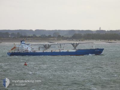
The vessel BALTIC WINTER (IMO: 9014755, MMSI: 309075000) is a Reefer that was built in 1992 ( 33 Jaar oud ). It's sailing under the flag of [BS] Bahamas.
In this page you can find informations about the vessels current position, last detected port calls, and current voyage information. If the vessels is not in coverage by AIS you will find the latest position.
The current position of BALTIC WINTER is detected by our AIS receivers and we are not responsible for the reliability of the data. The last position was recorded while the vessel was in Coverage by the Ais receivers of our vessel tracking app.
The current draught of BALTIC WINTER as reported by AIS is 8.6 meters
Weather
| Temperature | 23.5°C / 74.3°F |
|---|---|
| Wind Speed | 2 knots |
| Direction | 206° SSW |
| Pressure | 1009.6 hPa |
| Humidity | 93 % |
| Cloud Coverage | 85 % |
Featured Company
Last Port Calls
| Port | Arrival | Departure | Time In Port |
|---|---|---|---|
| 2025-02-05 05:58 | |||
| 2025-01-24 17:00 | 2025-01-27 19:11 | 3 d | |
| 2025-01-17 18:16 | 2025-01-23 11:40 | 5 d | |
| 2024-12-07 14:40 | 2024-12-24 19:36 | 17 d |
Most Visited Ports (Last year)
| Port | Arrivals | |
|---|---|---|
| 4 | ||
| 2 | ||
| 1 | ||
| 1 | ||
| 1 | ||
| 1 |
Last Trips
| Origin | Departure | Destination | Arrival | Distance | |
|---|---|---|---|---|---|
| 2025-01-27 13:11 | 2025-02-05 00:58 | 2052.76 nm | |||
| 2025-01-23 05:40 | 2025-01-24 11:00 | 422.51 nm | |||
| 2024-12-24 22:36 | 2025-01-17 12:16 | 7564.52 nm | |||
| 2024-11-11 14:15 | 2024-12-07 17:40 | 8614.60 nm |
Events
| Tijd | Evenement | Details | Positie / Bestemming | Info |
|---|---|---|---|---|
| 2025-02-05 05:58 | Stop beweging |
-3.25836 / -80.00194
[EC] PUERTO BOLIVAR
|
Snelheid: 0.2 kn Koers: 358° |
|
| 2025-02-05 05:58 | Aankomsthaven |
|
-3.25836 / -80.00194
[EC] PUERTO BOLIVAR
|
Snelheid: 2 kn Koers: 20° |
| 2025-02-05 04:42 | Start beweging | 4.9 nm, North West of PUERTO BOLIVAR |
-3.19253 / -80.05208
MX VER
|
Snelheid: 11.4 kn Koers: 90° |
| 2025-02-05 04:26 | Stop beweging | 5.58 nm, North West of PUERTO BOLIVAR |
-3.19056 / -80.06715
MX VER
|
Snelheid: 0.2 kn Koers: 92° |
| 2025-02-04 20:44 | Start beweging | 8.03 nm, South of GUAYAQUIL |
-2.31133 / -79.91882
MX VER
|
Snelheid: 11.3 kn Koers: 250° |
| 2025-02-02 11:34 | Stop beweging | 6.13 nm, South of GUAYAQUIL |
-2.28132 / -79.90829
MX VER
|
Snelheid: 0.1 kn Koers: 127° |
| 2025-02-02 05:21 | Start beweging | 12.74 nm, West of POSORJA |
-2.73012 / -80.45080
MX VER
|
Snelheid: 6.4 kn Koers: 171° |
| 2025-02-01 21:34 | Stop beweging | 12.95 nm, West of POSORJA |
-2.71599 / -80.45540
MX VER
|
Snelheid: 0.3 kn Koers: 116° |
| 2025-01-31 03:27 | Status Changed | Default Under way using engine |
8.91385 / -79.54176
MX VER
|
Snelheid: 14.6 kn Koers: 141.1° |
| 2025-01-31 03:20 | Buitenbereik |
8.93631 / -79.55984
Caribbean Sea
|
Snelheid: 14.6 kn Koers: 141.1° |