
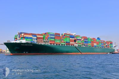
BALTIMORE EXPRESS
Container Ship
Current Trip
| Time Travelled | 25 days |
|---|---|
| Remaining Time | 2 days |
| Distance Travelled | 9807.04 nm |
| Remaining Distance | 1128.60 nm |
| AVG Speed | 16.6 Knopen |
| MAX Speed | 21 Knopen |
| AVG Wind | 12.8 knots |
| MAX Wind | 31 knots |
| MIN Temp | 7°C / 44.6°F |
| MAX Temp | 28.7°C / 83.66°F |
| Diepgang | 15.5 M |
| Positie ontvangen | 5 d geleden |
Current Position
| Lengtegraad | 31.61091° |
|---|---|
| Breedtegraat | -29.73977° |
| Status | Under way using engine |
| Snelheid | 18.9 Knopen |
| Koers | 39.4° |
| Gebied | Indian Ocean |
| Station | T-AIS |
| Positie ontvangen | 5 d geleden |
Info
Information
The current position of BALTIMORE EXPRESS is in Indian Ocean with coordinates -29.73977° / 31.61091° as reported on 2026-01-02 22:09 by AIS to our vessel tracker app. The vessel's current speed is 18.9 Knopen and is heading at the port of SALALAH. The estimated time of arrival as calculated by MyShipTracking vessel tracking app is 2026-01-10 20:11 LT
The vessel BALTIMORE EXPRESS (IMO: 9665621, MMSI: 636021036) is a Container Ship that was built in 2014 ( 12 Jaar oud ). It's sailing under the flag of [LR] Liberia.
In this page you can find informations about the vessels current position, last detected port calls, and current voyage information. If the vessels is not in coverage by AIS you will find the latest position.
The current position of BALTIMORE EXPRESS is detected by our AIS receivers and we are not responsible for the reliability of the data. The last position was recorded while the vessel was in Coverage by the Ais receivers of our vessel tracking app.
The current draught of BALTIMORE EXPRESS as reported by AIS is 15.5 meters
Weather
| Temperature | 25.9°C / 78.62°F |
|---|---|
| Wind Speed | 18 knots |
| Direction | 25° NNE |
| Pressure | 1013.5 hPa |
| Humidity | 79.1 % |
| Cloud Coverage | 10 % |
Featured Company
Last Port Calls
| Port | Arrival | Departure | Time In Port |
|---|---|---|---|
| 2025-12-12 19:08 | 2025-12-14 04:29 | 1 d | |
| 2025-12-07 18:43 | 2025-12-09 20:42 | 2 d | |
| 2025-12-04 11:23 | 2025-12-06 05:11 | 1 d | |
| 2025-11-28 14:35 | 2025-11-29 11:17 | 20 h | |
| 2025-11-03 21:11 | 2025-11-04 14:39 | 17 h |
Last Trips
| Origin | Departure | Destination | Arrival | Distance | |
|---|---|---|---|---|---|
| 2025-12-09 20:42 | 2025-12-12 19:08 | 523.55 nm | |||
| 2025-12-06 05:11 | 2025-12-07 18:43 | 346.71 nm | |||
| 2025-11-29 11:17 | 2025-12-04 11:23 | 1417.89 nm | |||
| 2025-11-04 14:39 | 2025-11-28 14:35 | 9408.73 nm | |||
| 2025-10-30 16:54 | 2025-11-03 21:11 | 1099.40 nm |
Events
| Tijd | Evenement | Details | Positie / Bestemming | Info |
|---|---|---|---|---|
| 2026-01-02 22:13 | Status Changed | Default Under way using engine |
-29.72523 / 31.62571
OMSLL
|
Snelheid: 18.9 kn Koers: 39.4° |
| 2026-01-02 22:09 | Buitenbereik |
-29.73977 / 31.61091
Indian Ocean
OMSLL
|
Snelheid: 18.9 kn Koers: 39.4° |
|
| 2026-01-02 20:24 | Wijzig zee gebeid | South African part of the Indian Ocean South African part of the South Atlantic Ocean |
-30.14651 / 31.17616
Indian Ocean
OMSLL
|
Snelheid: 18.9 kn Koers: 43.8° |
| 2026-01-02 20:24 | Status Changed | Under way using engine Default |
-30.14651 / 31.17616
OMSLL
|
Snelheid: 18.9 kn Koers: 43° |
| 2026-01-02 20:11 | Binnenbereik |
-30.14651 / 31.17616
Indian Ocean
OMSLL
|
Snelheid: 18.9 kn Koers: 43.8° |
|
| 2026-01-01 02:30 | Status Changed | Default Under way using engine |
-34.82730 / 19.18935
OMSLL
|
Snelheid: 16.8 kn Koers: 110.3° |
| 2026-01-01 02:27 | Status Changed | Under way using engine Default |
-34.82271 / 19.17436
OMSLL
|
Snelheid: 16.7 kn Koers: 109° |
| 2026-01-01 02:27 | Buitenbereik |
-34.82271 / 19.17436
South Atlantic Ocean
OMSLL
|
Snelheid: 16.8 kn Koers: 110.3° |
|
| 2026-01-01 01:40 | Status Changed | Default Under way using engine |
-34.74490 / 18.92799
OMSLL
|
Snelheid: 16.6 kn Koers: 106.4° |
| 2026-01-01 01:34 | Status Changed | Under way using engine Default |
-34.73564 / 18.89733
OMSLL
|
Snelheid: 16.6 kn Koers: 106° |