
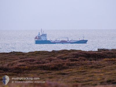
BERGEN STAR
Oil Products Tanker
Current Trip
| Time Travelled | 20 h, 12 mins |
|---|---|
| Remaining Time | --- |
| Distance Travelled | 179.66 nm |
| Remaining Distance | --- |
| AVG Speed | 11.4 Knopen |
| MAX Speed | 14 Knopen |
| AVG Wind | 12.8 knots |
| MAX Wind | 23 knots |
| MIN Temp | 4.8°C / 40.64°F |
| MAX Temp | 6.2°C / 43.16°F |
| Diepgang | 5.3 M |
| Positie ontvangen | 39 m geleden |
Current Position
| Lengtegraad | -5.27288° |
|---|---|
| Breedtegraat | 51.84438° |
| Status | At anchor |
| Snelheid | |
| Koers | 69° |
| Gebied | Celtic Sea |
| Station | T-AIS |
| Positie ontvangen | 39 m geleden |
Info
Information
The current position of BERGEN STAR is in Celtic Sea with coordinates 51.84438° / -5.27288° as reported on 2025-02-07 13:09 by AIS to our vessel tracker app. The vessel's current speed is 0 Knopen
The vessel BERGEN STAR (IMO: 9321603, MMSI: 258310000) is a Oil Products Tanker that was built in 2006 ( 19 Jaar oud ). It's sailing under the flag of [NO] Norway.
In this page you can find informations about the vessels current position, last detected port calls, and current voyage information. If the vessels is not in coverage by AIS you will find the latest position.
The current position of BERGEN STAR is detected by our AIS receivers and we are not responsible for the reliability of the data. The last position was recorded while the vessel was in Coverage by the Ais receivers of our vessel tracking app.
The current draught of BERGEN STAR as reported by AIS is 5.3 meters
Weather
| Temperature | 5.6°C / 42.08°F |
|---|---|
| Wind Speed | 20 knots |
| Direction | 61° ENE |
| Pressure | 1026.2 hPa |
| Humidity | 68.2 % |
| Cloud Coverage | 100 % |
Featured Company
Last Port Calls
| Port | Arrival | Departure | Time In Port |
|---|---|---|---|
| 2025-02-06 13:59 | 2025-02-06 17:36 | 3 h | |
| 2025-02-05 07:54 | 2025-02-05 09:49 | 1 h | |
| 2025-01-31 14:49 | 2025-02-04 09:28 | 3 d | |
| 2025-01-29 15:47 | 2025-01-30 16:44 | 1 d | |
| 2025-01-28 06:39 | 2025-01-28 08:49 | 2 h | |
| 2025-01-27 02:16 | 2025-01-27 05:13 | 2 h | |
| 2025-01-26 08:06 | 2025-01-26 09:42 | 1 h | |
| 2025-01-26 01:57 | 2025-01-26 04:04 | 2 h | |
| 2025-01-25 23:17 | 2025-01-26 01:12 | 1 h | |
| 2025-01-25 05:38 | 2025-01-25 07:39 | 2 h |
Last Trips
| Origin | Departure | Destination | Arrival | Distance | |
|---|---|---|---|---|---|
| 2025-02-05 09:49 | 2025-02-06 13:59 | 81.47 nm | |||
| 2025-02-04 09:28 | 2025-02-05 07:54 | 167.49 nm | |||
| 2025-01-30 16:44 | 2025-01-31 14:49 | 212.93 nm | |||
| 2025-01-28 08:49 | 2025-01-29 15:47 | 147.98 nm | |||
| 2025-01-27 05:13 | 2025-01-28 06:39 | 2.72 nm | |||
| 2025-01-26 09:42 | 2025-01-27 02:16 | 2.07 nm | |||
| 2025-01-26 04:04 | 2025-01-26 08:06 | 1.88 nm | |||
| 2025-01-26 01:12 | 2025-01-26 01:57 | 1.71 nm | |||
| 2025-01-25 07:39 | 2025-01-25 23:17 | 1.71 nm | |||
| 2025-01-23 11:12 | 2025-01-25 05:38 | 157.88 nm |
Events
| Tijd | Evenement | Details | Positie / Bestemming | Info |
|---|---|---|---|---|
| 2025-02-07 13:12 | Status Changed | Default At anchor |
51.84436 / -5.27288
GB PEM
|
Snelheid: Koers: 69° |
| 2025-02-07 13:09 | Gevonden in zee | United Kingdom part of the Celtic Sea |
51.84438 / -5.27288
Celtic Sea
GB PEM
|
Snelheid: Koers: 139.2° |
| 2025-02-07 13:09 | Status Changed | At anchor Default |
51.84438 / -5.27288
GB PEM
|
Snelheid: 0.1 kn Koers: 65° |
| 2025-02-07 13:03 | Binnenbereik |
51.84438 / -5.27288
Celtic Sea
GB PEM
|
Snelheid: Koers: 139.2° |
|
| 2025-02-07 11:23 | Stop beweging | 14.44 nm, North West of PEMBROKE |
51.84424 / -5.27273
GB PEM
|
Snelheid: 0.1 kn Koers: 60° |
| 2025-02-07 04:27 | Status Changed | Default Under way using engine |
52.81743 / -5.11724
GB PEM
|
Snelheid: 10.5 kn Koers: 192.7° |
| 2025-02-07 04:20 | Status Changed | Under way using engine Default |
52.83651 / -5.11015
GB PEM
|
Snelheid: 10.5 kn Koers: 193° |
| 2025-02-07 04:20 | Buitenbereik |
52.83651 / -5.11015
Irish Sea and St. George's Channel
GB PEM
|
Snelheid: 10.5 kn Koers: 192.7° |
|
| 2025-02-07 03:31 | Status Changed | Default Under way using engine |
52.97472 / -5.05944
GB PEM
|
Snelheid: 10.3 kn Koers: 189.2° |
| 2025-02-07 01:37 | Status Changed | Under way using engine Default |
53.29855 / -4.94444
GB PEM
|
Snelheid: 10.4 kn Koers: 193° |