
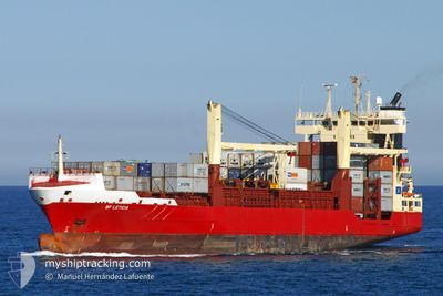
BF LETICIA
Container Ship
Current Trip
| Time Travelled | 16 days |
|---|---|
| Remaining Time | 19 h, 10 mins |
| Distance Travelled | 2688.22 nm |
| Remaining Distance | 293.00 nm |
| AVG Speed | 9.9 Knopen |
| MAX Speed | 15.3 Knopen |
| AVG Wind | 11 knots |
| MAX Wind | 23 knots |
| MIN Temp | 9.4°C / 48.92°F |
| MAX Temp | 23.8°C / 74.84°F |
| Diepgang | 8.7 M |
| Positie ontvangen | 16 h, 58 m geleden |
Current Position
| Lengtegraad | -17.54400° |
|---|---|
| Breedtegraat | 23.09417° |
| Status | Under way using engine |
| Snelheid | 9.3 Knopen |
| Koers | 191° |
| Gebied | North Atlantic Ocean |
| Station | T-AIS |
| Positie ontvangen | 16 h, 58 m geleden |
Info
Information
The current position of BF LETICIA is in North Atlantic Ocean with coordinates 23.09417° / -17.54400° as reported on 2025-02-24 15:04 by AIS to our vessel tracker app. The vessel's current speed is 9.3 Knopen and is heading at the port of NOUAKCHOTT. The estimated time of arrival as calculated by MyShipTracking vessel tracking app is 2025-02-26 03:13 LT
The vessel BF LETICIA (IMO: 9266542, MMSI: 209613000) is a Container Ship that was built in 2003 ( 22 Jaar oud ). It's sailing under the flag of [CY] Cyprus.
In this page you can find informations about the vessels current position, last detected port calls, and current voyage information. If the vessels is not in coverage by AIS you will find the latest position.
The current position of BF LETICIA is detected by our AIS receivers and we are not responsible for the reliability of the data. The last position was recorded while the vessel was in Coverage by the Ais receivers of our vessel tracking app.
The current draught of BF LETICIA as reported by AIS is 8.7 meters
Weather
| Temperature | 18.8°C / 65.84°F |
|---|---|
| Wind Speed | 14 knots |
| Direction | 50° NE |
| Pressure | 1019.7 hPa |
| Humidity | 70.3 % |
| Cloud Coverage | --- |
Featured Company
Last Port Calls
| Port | Arrival | Departure | Time In Port |
|---|---|---|---|
| 2025-02-07 20:02 | 2025-02-08 13:10 | 17 h | |
| 2025-02-01 14:12 | 2025-02-03 13:46 | 1 d | |
| 2025-01-25 18:09 | 2025-01-26 12:56 | 18 h | |
| 2024-12-25 11:49 | 2024-12-26 10:00 | 22 h | |
| 2024-12-21 15:06 | 2024-12-24 15:38 | 3 d | |
| 2024-12-19 11:08 | 2024-12-20 08:06 | 20 h | |
| 2024-12-01 08:46 |
Most Visited Ports (Last year)
| Port | Arrivals | |
|---|---|---|
| 8 | ||
| 5 | ||
| 4 | ||
| 4 | ||
| 3 | ||
| 3 |
Last Trips
| Origin | Departure | Destination | Arrival | Distance | |
|---|---|---|---|---|---|
| 2025-02-03 13:46 | 2025-02-07 20:02 | 253.72 nm | |||
| 2025-01-26 12:56 | 2025-02-01 14:12 | 258.88 nm | |||
| 2024-12-26 10:00 | 2025-01-25 18:09 | 3071.29 nm | |||
| 2024-12-24 15:38 | 2024-12-25 11:49 | 251.56 nm | |||
| 2024-12-20 08:06 | 2024-12-21 15:06 | 225.06 nm | |||
| 2024-12-01 08:46 | 2024-12-19 11:08 | 3374.26 nm |
Events
| Tijd | Evenement | Details | Positie / Bestemming | Info |
|---|---|---|---|---|
| 2025-02-24 15:13 | Status Changed | Default Under way using engine |
23.07067 / -17.54817
MRNKC
|
Snelheid: 9.3 kn Koers: 191° |
| 2025-02-24 15:04 | Status Changed | Under way using engine Default |
23.09417 / -17.54400
MRNKC
|
Snelheid: 9.3 kn Koers: 186° |
| 2025-02-24 15:04 | Buitenbereik |
23.09417 / -17.54400
North Atlantic Ocean
MRNKC
|
Snelheid: 9.3 kn Koers: 191° |
|
| 2025-02-24 15:03 | Status Changed | Default Under way using engine |
23.09717 / -17.54333
MRNKC
|
Snelheid: 9.2 kn Koers: 190° |
| 2025-02-24 14:34 | Status Changed | Under way using engine Default |
23.17033 / -17.53017
MRNKC
|
Snelheid: 9.4 kn Koers: 194° |
| 2025-02-24 14:18 | Status Changed | Default Under way using engine |
23.21133 / -17.52117
MRNKC
|
Snelheid: 9.3 kn Koers: 194° |
| 2025-02-24 13:56 | Status Changed | Under way using engine Default |
23.26667 / -17.50883
MRNKC
|
Snelheid: 9.1 kn Koers: 189° |
| 2025-02-24 13:55 | Status Changed | Default Under way using engine |
23.26917 / -17.50833
MRNKC
|
Snelheid: 9.2 kn Koers: 193° |
| 2025-02-24 13:48 | Status Changed | Under way using engine Default |
23.28683 / -17.50417
MRNKC
|
Snelheid: 9.1 kn Koers: 189° |
| 2025-02-24 13:47 | Binnenbereik |
23.28517 / -17.50467
North Atlantic Ocean
MRNKC
|
Snelheid: 9.2 kn Koers: 193° |