
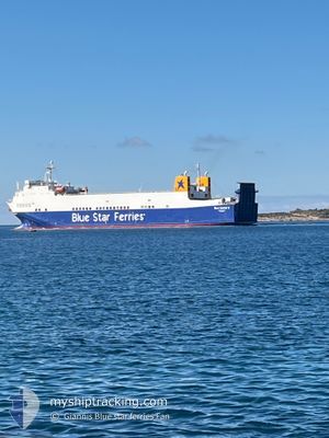
BLUE CARRIER 2
Ro-Ro Cargo
Current Trip
| Time Travelled | 10 h, 20 mins |
|---|---|
| Remaining Time | 4 h, 1 mins |
| Distance Travelled | 138.08 nm |
| Remaining Distance | 65.55 nm |
| AVG Speed | 13.3 Knopen |
| MAX Speed | 15.9 Knopen |
| AVG Wind | 30.8 knots |
| MAX Wind | 35 knots |
| MIN Temp | 5.9°C / 42.62°F |
| MAX Temp | 9.5°C / 49.1°F |
| Diepgang | 5.5 M |
| Positie ontvangen | Nu |
Current Position
| Lengtegraad | 24.58682° |
|---|---|
| Breedtegraat | 37.43407° |
| Status | Under way using engine |
| Snelheid | 14.5 Knopen |
| Koers | 299.1° |
| Gebied | Aegean Sea |
| Station | T-AIS |
| Positie ontvangen | Nu |
Info
Information
The current position of BLUE CARRIER 2 is in Aegean Sea with coordinates 37.43407° / 24.58682° as reported on 2025-02-06 09:03 by AIS to our vessel tracker app. The vessel's current speed is 14.5 Knopen and is heading at the port of PIRAEUS. The estimated time of arrival as calculated by MyShipTracking vessel tracking app is 2025-02-06 13:05 LT
The vessel BLUE CARRIER 2 (IMO: 9125384, MMSI: 241895000) is a Ro-Ro Cargo that was built in 1997 ( 28 Jaar oud ). It's sailing under the flag of [GR] Greece.
In this page you can find informations about the vessels current position, last detected port calls, and current voyage information. If the vessels is not in coverage by AIS you will find the latest position.
The current position of BLUE CARRIER 2 is detected by our AIS receivers and we are not responsible for the reliability of the data. The last position was recorded while the vessel was in Coverage by the Ais receivers of our vessel tracking app.
The current draught of BLUE CARRIER 2 as reported by AIS is 5.5 meters
Weather
| Temperature | 9.5°C / 49.1°F |
|---|---|
| Wind Speed | 28 knots |
| Direction | 29° NNE |
| Pressure | 1030.9 hPa |
| Humidity | 59.5 % |
| Cloud Coverage | 100 % |
Featured Company
Last Port Calls
| Port | Arrival | Departure | Time In Port |
|---|---|---|---|
| 2025-02-05 21:40 | 2025-02-05 22:44 | 1 h | |
| 2025-02-05 12:53 | 2025-02-05 16:57 | 4 h | |
| 2025-02-05 07:23 | 2025-02-05 08:46 | 1 h | |
| 2025-02-04 07:43 | 2025-02-04 16:55 | 9 h | |
| 2025-02-03 19:12 | 2025-02-03 19:42 | 29 m | |
| 2025-02-03 17:18 | 2025-02-03 18:10 | 52 m | |
| 2025-02-03 04:48 | 2025-02-03 13:09 | 8 h | |
| 2025-02-03 00:11 | 2025-02-03 00:42 | 30 m | |
| 2025-02-02 22:35 | 2025-02-02 23:01 | 26 m | |
| 2025-02-01 15:36 | 2025-02-02 10:24 | 18 h |
Last Trips
| Origin | Departure | Destination | Arrival | Distance | |
|---|---|---|---|---|---|
| 2025-02-05 18:57 | 2025-02-05 23:40 | 62.67 nm | |||
| 2025-02-05 10:46 | 2025-02-05 14:53 | 59.02 nm | |||
| 2025-02-04 18:55 | 2025-02-05 09:23 | 204.63 nm | |||
| 2025-02-03 21:42 | 2025-02-04 09:43 | 180.67 nm | |||
| 2025-02-03 20:10 | 2025-02-03 21:12 | 14.55 nm | |||
| 2025-02-03 15:09 | 2025-02-03 19:18 | 61.54 nm | |||
| 2025-02-03 02:42 | 2025-02-03 06:48 | 60.29 nm | |||
| 2025-02-03 01:01 | 2025-02-03 02:11 | 14.00 nm | |||
| 2025-02-02 12:24 | 2025-02-03 00:35 | 184.70 nm | |||
| 2025-02-01 06:32 | 2025-02-01 17:36 | 174.94 nm |
Events
| Tijd | Evenement | Details | Positie / Bestemming | Info |
|---|---|---|---|---|
| 2025-02-06 04:10 | ETA Changed | 2025/02/06 14:00 2025/02/06 13:30 |
37.12966 / 25.97835
PIRAEUS
|
Snelheid: 13.1 kn Koers: 303.8° |
| 2025-02-06 04:03 | ETA Changed | 2025/02/06 13:30 2025/02/06 12:30 |
37.11625 / 26.00184
PIRAEUS
|
Snelheid: 11.8 kn Koers: 308.8° |
| 2025-02-06 00:04 | Destination Changed | PIRAEUS KOS |
36.86102 / 26.93854
PIRAEUS
|
Snelheid: 14.3 kn Koers: 256.5° |
| 2025-02-06 00:04 | ETA Changed | 2025/02/06 12:30 2025/02/05 21:55 |
36.86102 / 26.93854
PIRAEUS
|
Snelheid: 14.3 kn Koers: 256.5° |
| 2025-02-05 22:59 | Wijzig zee gebeid | Greek part of the Aegean Sea Turkish part of the Aegean Sea |
36.93960 / 27.26492
Aegean Sea
KOS
|
Snelheid: 14.9 kn Koers: 248.1° |
| 2025-02-05 22:54 | Binnenbereik |
36.94082 / 27.27872
Aegean Sea
KOS
|
Snelheid: 14.1 kn Koers: 291° |
|
| 2025-02-05 22:44 | Vertrekhaven |
|
36.93706 / 27.28578
KOS
|
Snelheid: 0.3 kn Koers: 359° |
| 2025-02-05 21:40 | Stop beweging |
36.90057 / 27.29137
[GR] KOS
|
Snelheid: 0.3 kn Koers: 359° |
|
| 2025-02-05 21:40 | Aankomsthaven |
|
36.90057 / 27.29137
[GR] KOS
|
Snelheid: 14 kn Koers: 268° |
| 2025-02-05 21:00 | Buitenbereik |
36.83166 / 27.36940
Aegean Sea
[GR] KOS
|
Snelheid: 13.3 kn Koers: 11.3° |