

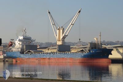
BLUE LAGOON
Cargo
Current Trip
| Time Travelled | 2 days |
|---|---|
| Remaining Time | 2 h, 33 mins |
| Distance Travelled | 637.57 nm |
| Remaining Distance | 30.07 nm |
| AVG Speed | 10.6 Knopen |
| MAX Speed | 11.5 Knopen |
| AVG Wind | 17.7 knots |
| MAX Wind | 21.8 knots |
| MIN Temp | 16.3°C / 61.34°F |
| MAX Temp | 21.7°C / 71.06°F |
| Diepgang | 5.9 M |
| Positie ontvangen | 2 m geleden |
Current Position
| Lengtegraad | -16.36945° |
|---|---|
| Breedtegraat | 18.26096° |
| Status | Under way using engine |
| Snelheid | 10.4 Knopen |
| Koers | 137.6° |
| Gebied | North Atlantic Ocean |
| Station | T-AIS |
| Positie ontvangen | 2 m geleden |
Information
The current position of BLUE LAGOON is in North Atlantic Ocean with coordinates 18.26096° / -16.36945° as reported on 2025-06-08 20:04 by AIS to our vessel tracker app. The vessel's current speed is 10.4 Knopen and is heading at the port of NOUAKCHOTT. The estimated time of arrival as calculated by MyShipTracking vessel tracking app is 2025-06-08 22:39 LT
The vessel BLUE LAGOON (IMO: 9633850, MMSI: 305695000) is a Cargo It's sailing under the flag of [AG] Antigua Barbuda.
In this page you can find informations about the vessels current position, last detected port calls, and current voyage information. If the vessels is not in coverage by AIS you will find the latest position.
The current position of BLUE LAGOON is detected by our AIS receivers and we are not responsible for the reliability of the data. The last position was recorded while the vessel was in Coverage by the Ais receivers of our vessel tracking app.
The current draught of BLUE LAGOON as reported by AIS is 5.9 meters
Weather
| Temperature | 21.6°C / 70.88°F |
|---|---|
| Wind Speed | 22 knots |
| Direction | 332° NNW |
| Pressure | 1010.6 hPa |
| Humidity | 76.2 % |
| Cloud Coverage | --- |
Featured Company
Last Port Calls
| Port | Arrival | Departure | Time In Port |
|---|---|---|---|
| 2025-06-05 21:14 | 2025-06-06 08:29 | 11 h | |
| 2025-05-29 07:34 | |||
| 2025-05-12 08:10 | 2025-05-15 19:05 | 3 d | |
| 2025-05-04 22:41 | 2025-05-05 10:04 | 11 h | |
| 2025-04-20 07:38 | 2025-04-24 08:00 | 4 d | |
| 2025-04-16 02:10 | 2025-04-18 20:02 | 2 d |
Most Visited Ports (Last year)
| Port | Arrivals | |
|---|---|---|
| 4 | ||
| 2 | ||
| 1 | ||
| 1 | ||
| 1 | ||
| 1 |
Last Trips
| Origin | Departure | Destination | Arrival | Distance | |
|---|---|---|---|---|---|
| 2025-05-29 07:34 | 2025-06-05 21:14 | 1789.52 nm | |||
| 2025-05-05 10:04 | 2025-05-12 08:10 | 1689.66 nm | |||
| 2025-04-24 08:00 | 2025-05-04 22:41 | 2344.97 nm | |||
| 2025-04-18 20:02 | 2025-04-20 07:38 | 250.81 nm | |||
| 2025-03-27 10:29 | 2025-04-16 02:10 | 2578.41 nm |
Events
| Tijd | Evenement | Details | Positie / Bestemming | Info |
|---|---|---|---|---|
| 2025-06-08 20:04 | Gevonden in zee | Mauritanian part of the North Atlantic Ocean |
18.26096 / -16.36945
North Atlantic Ocean
MRNKC
|
Snelheid: 10.4 kn Koers: 137.6° |
| 2025-06-08 20:04 | Status Changed | Under way using engine Default |
18.26096 / -16.36945
MRNKC
|
Snelheid: 10.4 kn Koers: 135° |
| 2025-06-08 19:52 | Binnenbereik |
18.26096 / -16.36945
North Atlantic Ocean
MRNKC
|
Snelheid: 10.4 kn Koers: 137.6° |
|
| 2025-06-08 07:48 | Status Changed | Default Under way using engine |
20.00263 / -17.55025
MRNKC
|
Snelheid: 9.8 kn Koers: 167.3° |
| 2025-06-08 07:39 | Buitenbereik |
20.02699 / -17.55580
North Atlantic Ocean
MRNKC
|
Snelheid: 9.8 kn Koers: 167.3° |
|
| 2025-06-08 07:27 | Gevonden in zee | Western Saharan part of the North Atlantic Ocean |
20.05934 / -17.56292
North Atlantic Ocean
MRNKC
|
Snelheid: 10.2 kn Koers: 170.3° |
| 2025-06-08 07:27 | Status Changed | Under way using engine Default |
20.05934 / -17.56292
MRNKC
|
Snelheid: 10 kn Koers: 167° |
| 2025-06-08 07:27 | Binnenbereik |
20.05934 / -17.56292
North Atlantic Ocean
MRNKC
|
Snelheid: 10.2 kn Koers: 170.3° |
|
| 2025-06-06 10:49 | Status Changed | Default Under way using engine |
27.58703 / -15.25389
MRNKC
|
Snelheid: 10.6 kn Koers: 200.7° |
| 2025-06-06 10:42 | Buitenbereik |
27.60668 / -15.24613
North Atlantic Ocean
MRNKC
|
Snelheid: 10.6 kn Koers: 200.7° |