
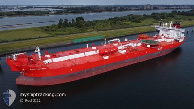
BODIL KNUTSEN
Shuttle Tanker
Current Trip
| Time Travelled | 23 days |
|---|---|
| Remaining Time | 1 day |
| Distance Travelled | 4594.80 nm |
| Remaining Distance | 487.92 nm |
| AVG Speed | 11.3 Knopen |
| MAX Speed | 17.3 Knopen |
| AVG Wind | 16.6 knots |
| MAX Wind | 47 knots |
| MIN Temp | -5.1°C / 22.82°F |
| MAX Temp | 8.7°C / 47.66°F |
| Diepgang | 12.8 M |
| Positie ontvangen | 1 m geleden |
Current Position
| Lengtegraad | 14.57260° |
|---|---|
| Breedtegraat | 55.23982° |
| Status | Under way using engine |
| Snelheid | 12.2 Knopen |
| Koers | 48.2° |
| Gebied | Kattegat |
| Station | T-AIS |
| Positie ontvangen | 1 m geleden |
Info
Information
The current position of BODIL KNUTSEN is in Kattegat with coordinates 55.23982° / 14.57260° as reported on 2025-03-13 00:16 by AIS to our vessel tracker app. The vessel's current speed is 12.2 Knopen and is heading at the port of PORVOO. The estimated time of arrival as calculated by MyShipTracking vessel tracking app is 2025-03-14 15:58 LT
The vessel BODIL KNUTSEN (IMO: 9472529, MMSI: 257998000) is a Shuttle Tanker that was built in 2011 ( 14 Jaar oud ). It's sailing under the flag of [NO] Norway.
In this page you can find informations about the vessels current position, last detected port calls, and current voyage information. If the vessels is not in coverage by AIS you will find the latest position.
The current position of BODIL KNUTSEN is detected by our AIS receivers and we are not responsible for the reliability of the data. The last position was recorded while the vessel was in Coverage by the Ais receivers of our vessel tracking app.
The current draught of BODIL KNUTSEN as reported by AIS is 12.8 meters
Weather
| Temperature | 4.1°C / 39.38°F |
|---|---|
| Wind Speed | 3 knots |
| Direction | 305° NW |
| Pressure | 998.2 hPa |
| Humidity | 78.4 % |
| Cloud Coverage | 100 % |
Featured Company
Events
| Tijd | Evenement | Details | Positie / Bestemming | Info |
|---|---|---|---|---|
| 2025-03-12 22:20 | Gevonden in zee | Danish part of the Kattegat |
54.99603 / 14.04290
Kattegat
PORVOO
|
Snelheid: 12 kn Koers: 70.3° |
| 2025-03-12 22:05 | Wijzig zee gebeid | Swedish part of the Baltic Sea German part of the Baltic Sea |
54.97924 / 13.95987
Baltic Sea
PORVOO
|
Snelheid: 12.1 kn Koers: 70.3° |
| 2025-03-12 20:07 | Status Changed | Under way using engine Default |
54.85018 / 13.29270
PORVOO
|
Snelheid: 12.1 kn Koers: 71° |
| 2025-03-12 20:06 | Status Changed | Default Under way using engine |
54.84889 / 13.28618
PORVOO
|
Snelheid: 12.1 kn Koers: 71.1° |
| 2025-03-12 20:05 | Status Changed | Under way using engine Default |
54.84874 / 13.28535
PORVOO
|
Snelheid: 12.1 kn Koers: 71° |
| 2025-03-12 20:02 | Status Changed | Default Constrained by her draught |
54.84456 / 13.26422
PORVOO
|
Snelheid: 12.2 kn Koers: 71.3° |
| 2025-03-12 17:26 | Wijzig zee gebeid | German part of the Baltic Sea Danish part of the Baltic Sea |
54.64709 / 12.40119
Baltic Sea
PORVOO
|
Snelheid: 12.4 kn Koers: 56.8° |
| 2025-03-12 16:41 | Wijzig zee gebeid | Danish part of the Baltic Sea German part of the Baltic Sea |
54.52510 / 12.24526
Baltic Sea
PORVOO
|
Snelheid: 12.6 kn Koers: 16.9° |
| 2025-03-12 15:59 | Gevonden in zee | German part of the Baltic Sea |
54.41072 / 12.11726
Baltic Sea
PORVOO
|
Snelheid: 12.2 kn Koers: 91.7° |
| 2025-03-12 13:59 | Wijzig zee gebeid | Danish part of the Baltic Sea German part of the Baltic Sea |
54.50131 / 11.44465
Baltic Sea
PORVOO
|
Snelheid: 12.8 kn Koers: 116.9° |