
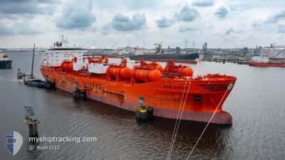
BOW SIRIUS
Tanker
Current Trip
| Time Travelled | 12 days |
|---|---|
| Remaining Time | --- |
| Distance Travelled | 3909.29 nm |
| Remaining Distance | --- |
| AVG Speed | 12.4 Knopen |
| MAX Speed | 15.6 Knopen |
| AVG Wind | 9.6 knots |
| MAX Wind | 28 knots |
| MIN Temp | 9.1°C / 48.38°F |
| MAX Temp | 29°C / 84.2°F |
| Diepgang | 12 M |
| Positie ontvangen | 1 m geleden |
Current Position
| Lengtegraad | -79.59209° |
|---|---|
| Breedtegraat | 8.99733° |
| Status | Under way using engine |
| Snelheid | |
| Koers | 316° |
| Gebied | North Pacific Ocean |
| Station | T-AIS |
| Positie ontvangen | 1 m geleden |
Info
Information
The current position of BOW SIRIUS is in North Pacific Ocean with coordinates 8.99733° / -79.59209° as reported on 2025-03-13 11:28 by AIS to our vessel tracker app. The vessel's current speed is 0 Knopen
The vessel BOW SIRIUS (MMSI: 258910000) is a Tanker It's sailing under the flag of [NO] Norway.
In this page you can find informations about the vessels current position, last detected port calls, and current voyage information. If the vessels is not in coverage by AIS you will find the latest position.
The current position of BOW SIRIUS is detected by our AIS receivers and we are not responsible for the reliability of the data. The last position was recorded while the vessel was in Coverage by the Ais receivers of our vessel tracking app.
The current draught of BOW SIRIUS as reported by AIS is 12 meters
Weather
| Temperature | 22.7°C / 72.86°F |
|---|---|
| Wind Speed | 4 knots |
| Direction | 335° NNW |
| Pressure | 1012.8 hPa |
| Humidity | 93 % |
| Cloud Coverage | 76 % |
Featured Company
Most Visited Ports (Last year)
| Port | Arrivals | |
|---|---|---|
| 4 | ||
| 3 | ||
| 3 | ||
| 3 | ||
| 3 | ||
| 2 |
Last Trips
| Origin | Departure | Destination | Arrival | Distance | |
|---|---|---|---|---|---|
| 2025-02-10 13:30 | 2025-02-27 01:05 | 4929.92 nm | |||
| 2025-02-09 14:37 | 2025-02-09 15:42 | 9.66 nm | |||
| 2025-01-30 13:50 | 2025-02-04 21:00 | 1385.13 nm | |||
| 2025-01-05 12:21 | 2025-01-06 17:57 | 53.82 nm | |||
| 2024-12-30 07:32 | 2025-01-04 08:08 | 559.13 nm |
Events
| Tijd | Evenement | Details | Positie / Bestemming | Info |
|---|---|---|---|---|
| 2025-03-13 10:09 | Stop beweging | 2.33 nm, North of RODMAN |
8.99228 / -79.58712
PABLB
|
Snelheid: 0.1 kn Koers: 315° |
| 2025-03-13 07:41 | Start beweging | 2.11 nm, North of TABOGUILLA |
8.84312 / -79.51366
PABLB
|
Snelheid: 5.1 kn Koers: 26.7° |
| 2025-03-13 07:33 | Status Changed | Under way using engine At anchor |
8.84016 / -79.51635
PABLB
|
Snelheid: 0.1 kn Koers: 89° |
| 2025-03-13 05:52 | Status Changed | At anchor Default |
8.84030 / -79.51694
PABLB
|
Snelheid: 0.1 kn Koers: 85° |
| 2025-03-13 05:49 | Status Changed | Default At anchor |
8.84037 / -79.51696
PABLB
|
Snelheid: 0.1 kn Koers: 90° |
| 2025-03-12 21:28 | Status Changed | At anchor Default |
8.83986 / -79.51698
PABLB
|
Snelheid: Koers: 62° |
| 2025-03-12 21:20 | Status Changed | Default At anchor |
8.83996 / -79.51702
PABLB
|
Snelheid: Koers: 67° |
| 2025-03-12 19:04 | Status Changed | At anchor Default |
8.84119 / -79.51703
PABLB
|
Snelheid: 0.1 kn Koers: 115° |
| 2025-03-12 19:01 | Status Changed | Default At anchor |
8.84119 / -79.51699
PABLB
|
Snelheid: Koers: 115° |
| 2025-03-12 18:04 | Status Changed | At anchor Default |
8.84145 / -79.51696
PABLB
|
Snelheid: 0.1 kn Koers: 120° |