
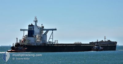
CAPE AMERICA
Cargo
Current Trip
| Time Travelled | 7 days |
|---|---|
| Remaining Time | --- |
| Distance Travelled | 1266.52 nm |
| Remaining Distance | 791.80 nm |
| AVG Speed | 10.8 Knopen |
| MAX Speed | 14.2 Knopen |
| AVG Wind | 8.9 knots |
| MAX Wind | 16.8 knots |
| MIN Temp | -0.1°C / 31.82°F |
| MAX Temp | 20.7°C / 69.26°F |
| Diepgang | 18 M |
| Positie ontvangen | 15 d geleden |
Current Position
| Lengtegraad | 120.50669° |
|---|---|
| Breedtegraat | 11.72923° |
| Status | Under way using engine |
| Snelheid | 10.6 Knopen |
| Koers | 358.5° |
| Gebied | Sulu Sea |
| Station | T-AIS |
| Positie ontvangen | 15 d geleden |
Info
Information
The current position of CAPE AMERICA is in Sulu Sea with coordinates 11.72923° / 120.50669° as reported on 2025-02-10 14:27 by AIS to our vessel tracker app. The vessel's current speed is 10.6 Knopen and is heading at the port of QINGDAO. The estimated time of arrival as calculated by MyShipTracking vessel tracking app is 2025-02-16 20:00 LT
The vessel CAPE AMERICA (IMO: 9654751, MMSI: 564190000) is a Cargo It's sailing under the flag of [SG] Singapore.
In this page you can find informations about the vessels current position, last detected port calls, and current voyage information. If the vessels is not in coverage by AIS you will find the latest position.
The current position of CAPE AMERICA is detected by our AIS receivers and we are not responsible for the reliability of the data. The last position was recorded while the vessel was in Coverage by the Ais receivers of our vessel tracking app.
The current draught of CAPE AMERICA as reported by AIS is 18 meters
Weather
| Temperature | 20.7°C / 69.26°F |
|---|---|
| Wind Speed | 10 knots |
| Direction | 149° SSE |
| Pressure | 1023.1 hPa |
| Humidity | 69 % |
| Cloud Coverage | 100 % |
Featured Company
Last Port Calls
| Port | Arrival | Departure | Time In Port |
|---|---|---|---|
| 2025-02-17 12:45 | 2025-02-18 16:09 | 1 d | |
| 2025-01-30 05:07 | 2025-02-01 16:28 | 2 d | |
| 2025-01-06 15:53 | 2025-01-09 00:57 | 2 d | |
| 2024-12-23 03:09 | 2024-12-24 22:35 | 1 d | |
| 2024-12-05 12:12 | 2024-12-07 02:42 | 1 d |
Most Visited Ports (Last year)
| Port | Arrivals | |
|---|---|---|
| 4 | ||
| 3 | ||
| 3 | ||
| 3 | ||
| 2 | ||
| 1 |
Last Trips
| Origin | Departure | Destination | Arrival | Distance | |
|---|---|---|---|---|---|
| 2025-02-02 00:28 | 2025-02-17 20:45 | 3718.40 nm | |||
| 2025-01-09 06:57 | 2025-01-30 13:07 | 3002.05 nm | |||
| 2024-12-25 06:35 | 2025-01-06 21:53 | 2835.54 nm | |||
| 2024-12-07 10:42 | 2024-12-23 11:09 | 3899.47 nm | |||
| 2024-11-12 18:25 | 2024-12-05 20:12 | 3888.02 nm |
Events
| Tijd | Evenement | Details | Positie / Bestemming | Info |
|---|---|---|---|---|
| 2025-02-23 23:29 | Start beweging | 12.08 nm, South West of GAOGANG |
32.19743 / 119.64180
CN TAO
|
Snelheid: 3.7 kn Koers: 69° |
| 2025-02-22 02:05 | Stop beweging | 12.13 nm, East of ZHENJIANG |
32.19421 / 119.64085
CN TAO
|
Snelheid: 0.1 kn Koers: 252° |
| 2025-02-21 22:53 | Start beweging | 0.74 nm, South East of JIANGSU HANTONG |
32.11393 / 119.91235
CN TAO
|
Snelheid: 5.9 kn Koers: 357° |
| 2025-02-21 18:24 | Stop beweging | 1.11 nm, South East of JIANGSU HANTONG |
32.10555 / 119.91306
CN TAO
|
Snelheid: 0.1 kn Koers: 355° |
| 2025-02-21 01:06 | Start beweging |
31.25978 / 122.63705
CN TAO
|
Snelheid: 6.5 kn Koers: 274° |
|
| 2025-02-20 02:29 | Stop beweging |
31.24789 / 122.64401
CN TAO
|
Snelheid: 0.1 kn Koers: 61° |
|
| 2025-02-18 16:09 | Vertrekhaven |
|
35.28873 / 119.52335
CN TAO
|
Snelheid: 3.7 kn Koers: 188° |
| 2025-02-18 16:05 | Start beweging |
35.29453 / 119.52376
[CN] RIZHAO
|
Snelheid: 3.7 kn Koers: 188° |
|
| 2025-02-17 13:10 | Stop beweging |
35.29712 / 119.52778
[CN] RIZHAO
|
Snelheid: Koers: 359° |
|
| 2025-02-17 12:45 | Aankomsthaven |
|
35.29416 / 119.52336
[CN] RIZHAO
|
Snelheid: 3 kn Koers: 354° |