
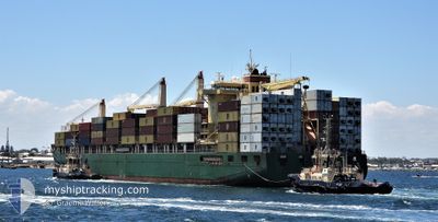
CAPE MOSS
Container Ship
Current Trip
TEMA
| Time Travelled | 10 h, 3 mins |
|---|---|
| Remaining Time | --- |
| Distance Travelled | 155.07 nm |
| Remaining Distance | --- |
| AVG Speed | 15.4 Knopen |
| MAX Speed | 16.7 Knopen |
| AVG Wind | 12.2 knots |
| MAX Wind | 13 knots |
| MIN Temp | 19.8°C / 67.64°F |
| MAX Temp | 21.1°C / 69.98°F |
| Diepgang | 12.2 M |
| Positie ontvangen | 2024-12-31 19:37 |
Current Position
| Lengtegraad | -17.42290° |
|---|---|
| Breedtegraat | 14.58021° |
| Status | Under way using engine |
| Snelheid | 7.1 Knopen |
| Koers | 51.4° |
| Gebied | North Atlantic Ocean |
| Station | T-AIS |
| Positie ontvangen | 2024-12-31 19:37 |
Info
Information
The current position of CAPE MOSS is in North Atlantic Ocean with coordinates 14.58021° / -17.42290° as reported on 2024-12-31 19:37 by AIS to our vessel tracker app. The vessel's current speed is 7.1 Knopen
The vessel CAPE MOSS (IMO: 9445916, MMSI: 538004165) is a Container Ship that was built in 2011 ( 14 Jaar oud ). It's sailing under the flag of [MH] Marshall Is.
In this page you can find informations about the vessels current position, last detected port calls, and current voyage information. If the vessels is not in coverage by AIS you will find the latest position.
The current position of CAPE MOSS is detected by our AIS receivers and we are not responsible for the reliability of the data. The last position was recorded while the vessel was in Coverage by the Ais receivers of our vessel tracking app.
The current draught of CAPE MOSS as reported by AIS is 12.2 meters
Weather
| Temperature | 21.1°C / 69.98°F |
|---|---|
| Wind Speed | 13 knots |
| Direction | 356° N |
| Pressure | 1012.2 hPa |
| Humidity | 76 % |
| Cloud Coverage | 42 % |
Featured Company
Last Port Calls
| Port | Arrival | Departure | Time In Port |
|---|---|---|---|
| 2025-02-26 10:52 | 2025-02-27 22:39 | 1 d | |
| 2025-02-05 11:47 | 2025-02-07 03:43 | 1 d | |
| 2025-01-24 13:03 | 2025-01-25 19:19 | 1 d | |
| 2025-01-17 00:23 | 2025-01-18 23:08 | 1 d | |
| 2024-12-31 21:55 | 2025-01-02 16:39 | 1 d | |
| 2024-12-18 23:29 | 2024-12-20 01:26 | 1 d | |
| 2024-12-11 04:15 | 2024-12-12 22:47 | 1 d |
Last Trips
| Origin | Departure | Destination | Arrival | Distance | |
|---|---|---|---|---|---|
| 2025-02-07 03:43 | 2025-02-26 10:52 | 3347.32 nm | |||
| 2025-01-25 19:19 | 2025-02-05 11:47 | 1835.68 nm | |||
| 2025-01-18 23:08 | 2025-01-24 13:03 | 1297.12 nm | |||
| 2025-01-02 16:39 | 2025-01-17 00:23 | 3169.50 nm | |||
| 2024-12-20 01:26 | 2024-12-31 21:55 | 2044.89 nm | |||
| 2024-12-12 22:47 | 2024-12-18 23:29 | 1321.27 nm | |||
| 2024-11-27 18:06 | 2024-12-11 04:15 | 1845.43 nm |
Events
| Tijd | Evenement | Details | Positie / Bestemming | Info |
|---|---|---|---|---|
| 2025-02-27 22:39 | Vertrekhaven |
|
14.67757 / -17.41752
TEMA
|
Snelheid: 4.2 kn Koers: 107° |
| 2025-02-27 22:24 | Start beweging |
14.68218 / -17.42633
[SN] DAKAR
|
Snelheid: 3.1 kn Koers: 343° |
|
| 2025-02-26 11:06 | Stop beweging |
14.68422 / -17.42633
[SN] DAKAR
|
Snelheid: 0.3 kn Koers: 331° |
|
| 2025-02-26 10:52 | Aankomsthaven |
|
14.67982 / -17.42474
[SN] DAKAR
|
Snelheid: 7.1 kn Koers: 270° |
| 2025-02-26 09:27 | Start beweging | 5.55 nm, South East of GOREE |
14.59481 / -17.34142
TEMA
|
Snelheid: 5.4 kn Koers: 353° |
| 2025-02-24 09:15 | Stop beweging | 6.04 nm, South East of GOREE |
14.58802 / -17.33693
TEMA
|
Snelheid: 0.1 kn Koers: 329° |
| 2025-02-19 09:53 | Start beweging | 3.48 nm, South East of LOME |
6.10997 / 1.33826
TEMA
|
Snelheid: 4.5 kn Koers: 193° |
| 2025-02-19 08:17 | Stop beweging | 2.96 nm, South East of LOME |
6.11001 / 1.32830
TEMA
|
Snelheid: 0.2 kn Koers: 278° |
| 2025-02-19 07:38 | Start beweging | 3.23 nm, South East of LOME |
6.10796 / 1.33218
TEMA
|
Snelheid: 3.5 kn Koers: 343° |
| 2025-02-19 07:17 | Stop beweging | 3.28 nm, South East of LOME |
6.10576 / 1.33170
TEMA
|
Snelheid: 0.1 kn Koers: 222° |