

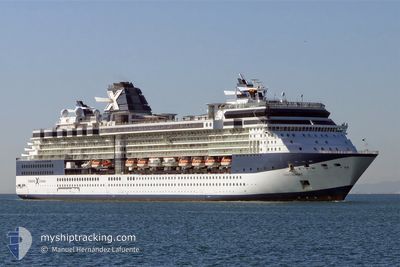
CELEBRITY SUMMIT
Passengers Ship

Current Trip
| Time Travelled | 15 h, 57 mins |
|---|---|
| Remaining Time | --- |
| Distance Travelled | 67.65 nm |
| Remaining Distance | 271.06 nm |
| AVG Speed | 8.6 Knopen |
| MAX Speed | 11.9 Knopen |
| AVG Wind | 2.9 knots |
| MAX Wind | 6.3 knots |
| MIN Temp | 3.3°C / 37.94°F |
| MAX Temp | 8.6°C / 47.48°F |
| Diepgang | 8.3 M |
| Positie ontvangen | 3 d geleden |
Current Position
| Lengtegraad | -131.67759° |
|---|---|
| Breedtegraat | 55.15268° |
| Status | Under way using engine |
| Snelheid | 12 Knopen |
| Koers | 6.3° |
| Gebied | The Coastal Waters of Southeast Alaska and British Columbia |
| Station | T-AIS |
| Positie ontvangen | 3 d geleden |
Information
The current position of CELEBRITY SUMMIT is in The Coastal Waters of Southeast Alaska and British Columbia with coordinates 55.15268° / -131.67759° as reported on 2025-06-08 12:45 by AIS to our vessel tracker app. The vessel's current speed is 12 Knopen and is heading at the port of KETCHIKAN. The estimated time of arrival as calculated by MyShipTracking vessel tracking app is 2025-06-08 06:00 LT
The vessel CELEBRITY SUMMIT (IMO: 9192387, MMSI: 249047000) is a Passengers Ship that was built in 2001 ( 24 Jaar oud ). It's sailing under the flag of [MT] Malta.
In this page you can find informations about the vessels current position, last detected port calls, and current voyage information. If the vessels is not in coverage by AIS you will find the latest position.
The current position of CELEBRITY SUMMIT is detected by our AIS receivers and we are not responsible for the reliability of the data. The last position was recorded while the vessel was in Coverage by the Ais receivers of our vessel tracking app.
The current draught of CELEBRITY SUMMIT as reported by AIS is 8.3 meters
Weather
| Temperature | 8.9°C / 48.02°F |
|---|---|
| Wind Speed | 7 knots |
| Direction | 303° WNW |
| Pressure | 1020.4 hPa |
| Humidity | 79 % |
| Cloud Coverage | 83 % |


Featured Company
Last Port Calls
| Port | Arrival | Departure | Time In Port |
|---|---|---|---|
| 2025-06-10 06:12 | 2025-06-10 22:20 | 16 h | |
| 2025-06-08 05:44 | 2025-06-08 15:56 | 10 h | |
| 2025-06-06 05:58 | 2025-06-06 17:31 | 11 h | |
| 2025-06-04 08:24 | 2025-06-04 17:40 | 9 h | |
| 2025-06-02 04:24 | 2025-06-02 20:52 | 16 h | |
| 2025-06-01 10:24 | 2025-06-01 21:24 | 11 h | |
| 2025-05-30 04:50 | 2025-05-30 20:07 | 15 h | |
| 2025-05-27 06:08 | 2025-05-27 22:24 | 16 h | |
| 2025-05-25 05:39 | 2025-05-25 15:49 | 10 h | |
| 2025-05-23 06:01 | 2025-05-23 17:35 | 11 h |
Last Trips
| Origin | Departure | Destination | Arrival | Distance | |
|---|---|---|---|---|---|
| 2025-06-08 15:56 | 2025-06-10 06:12 | 452.55 nm | |||
| 2025-06-06 17:31 | 2025-06-08 05:44 | 537.27 nm | |||
| 2025-06-04 17:40 | 2025-06-06 05:58 | 536.65 nm | |||
| 2025-06-02 20:52 | 2025-06-04 08:24 | 369.06 nm | |||
| 2025-06-01 21:24 | 2025-06-02 04:24 | 97.79 nm | |||
| 2025-05-30 20:07 | 2025-06-01 10:24 | 614.97 nm | |||
| 2025-05-27 22:24 | 2025-05-30 04:50 | 618.62 nm | |||
| 2025-05-25 15:49 | 2025-05-27 06:08 | 451.71 nm | |||
| 2025-05-23 17:35 | 2025-05-25 05:39 | 538.41 nm | |||
| 2025-05-21 17:33 | 2025-05-23 06:01 | 537.72 nm |
Events
| Tijd | Evenement | Details | Positie / Bestemming | Info |
|---|---|---|---|---|
| 2025-06-11 14:37 | Stop beweging | 1.45 nm, North of HOONAH |
58.13356 / -135.46733
US KTN
|
Snelheid: 0.3 kn Koers: 249° |
| 2025-06-11 06:20 | Vertrekhaven |
|
58.27325 / -134.37148
US KTN
|
Snelheid: 7.3 kn Koers: 127° |
| 2025-06-11 06:05 | Start beweging |
58.29264 / -134.40544
[US] JUNEAU
|
Snelheid: 4.1 kn Koers: 165° |
|
| 2025-06-10 14:45 | Stop beweging |
58.29791 / -134.40642
[US] JUNEAU
|
Snelheid: 0.3 kn Koers: 330° |
|
| 2025-06-10 14:12 | Aankomsthaven |
|
58.27859 / -134.38217
[US] JUNEAU
|
Snelheid: 6 kn Koers: 313° |
| 2025-06-09 23:41 | Start beweging | 5.32 nm, North West of SITKA |
57.12582 / -135.40033
US KTN
|
Snelheid: 3.6 kn Koers: 342° |
| 2025-06-09 14:37 | Stop beweging | 4.75 nm, North West of SITKA |
57.11681 / -135.39439
US KTN
|
Snelheid: 0.2 kn Koers: 168° |
| 2025-06-08 23:56 | Vertrekhaven |
|
55.38274 / -131.74940
US KTN
|
Snelheid: 7.2 kn Koers: 316° |
| 2025-06-08 23:21 | Start beweging |
55.34077 / -131.65930
[US] KETCHIKAN
|
Snelheid: 4.7 kn Koers: 283° |
|
| 2025-06-08 14:13 | Stop beweging |
55.34146 / -131.64856
[US] KETCHIKAN
|
Snelheid: 0.3 kn Koers: 322° |