
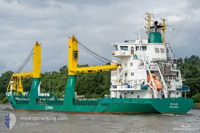
CELLUS
General Cargo
Current Trip
| Time Travelled | 15 h, 26 mins |
|---|---|
| Remaining Time | 1 day |
| Distance Travelled | 177.04 nm |
| Remaining Distance | 508.22 nm |
| AVG Speed | 11 Knopen |
| MAX Speed | 14.8 Knopen |
| AVG Wind | 19.4 knots |
| MAX Wind | 29.3 knots |
| MIN Temp | 3.5°C / 38.3°F |
| MAX Temp | 5.6°C / 42.08°F |
| Diepgang | 5.4 M |
| Positie ontvangen | Nu |
Current Position
| Lengtegraad | 5.68263° |
|---|---|
| Breedtegraat | 53.59427° |
| Status | Under way using engine |
| Snelheid | 11.9 Knopen |
| Koers | 77.9° |
| Gebied | North Sea |
| Station | T-AIS |
| Positie ontvangen | Nu |
Info
Information
The current position of CELLUS is in North Sea with coordinates 53.59427° / 5.68263° as reported on 2026-01-03 14:41 by AIS to our vessel tracker app. The vessel's current speed is 11.9 Knopen and is heading at the port of MONSTERAS. The estimated time of arrival as calculated by MyShipTracking vessel tracking app is 2026-01-05 11:12 LT
The vessel CELLUS (IMO: 9173317, MMSI: 211284350) is a General Cargo that was built in 1998 ( 28 Jaar oud ). It's sailing under the flag of [DE] Germany.
In this page you can find informations about the vessels current position, last detected port calls, and current voyage information. If the vessels is not in coverage by AIS you will find the latest position.
The current position of CELLUS is detected by our AIS receivers and we are not responsible for the reliability of the data. The last position was recorded while the vessel was in Coverage by the Ais receivers of our vessel tracking app.
The current draught of CELLUS as reported by AIS is 5.4 meters
Weather
| Temperature | 4.9°C / 40.82°F |
|---|---|
| Wind Speed | 24 knots |
| Direction | 322° NW |
| Pressure | 999.5 hPa |
| Humidity | 56 % |
| Cloud Coverage | 79 % |
Featured Company
Last Port Calls
| Port | Arrival | Departure | Time In Port |
|---|---|---|---|
| 2026-01-01 20:23 | 2026-01-03 00:16 | 1 d | |
| 2025-12-31 09:24 | 2025-12-31 10:40 | 1 h | |
| 2025-12-29 08:23 | 2025-12-29 17:02 | 8 h | |
| 2025-12-25 14:03 | 2025-12-27 14:28 | 2 d | |
| 2025-12-23 08:55 | 2025-12-23 17:09 | 8 h | |
| 2025-12-19 05:27 | 2025-12-20 16:26 | 1 d | |
| 2025-12-15 21:13 | 2025-12-16 11:56 | 14 h | |
| 2025-12-15 05:15 | 2025-12-15 11:06 | 5 h | |
| 2025-12-11 15:19 | 2025-12-12 16:00 | 1 d | |
| 2025-12-07 13:57 | 2025-12-08 14:27 | 1 d |
Last Trips
| Origin | Departure | Destination | Arrival | Distance | |
|---|---|---|---|---|---|
| 2025-12-31 10:40 | 2026-01-01 20:23 | 348.54 nm | |||
| 2025-12-29 17:02 | 2025-12-31 09:24 | 431.76 nm | |||
| 2025-12-27 14:28 | 2025-12-29 08:23 | 467.11 nm | |||
| 2025-12-23 17:09 | 2025-12-25 14:03 | 529.71 nm | |||
| 2025-12-20 16:26 | 2025-12-23 08:55 | 819.41 nm | |||
| 2025-12-16 11:56 | 2025-12-19 05:27 | 665.44 nm | |||
| 2025-12-15 11:06 | 2025-12-15 21:13 | 120.36 nm | |||
| 2025-12-12 16:00 | 2025-12-15 05:15 | 682.48 nm | |||
| 2025-12-08 14:27 | 2025-12-11 15:19 | 749.22 nm | |||
| 2025-12-06 09:16 | 2025-12-07 13:57 | 323.42 nm |
Events
| Tijd | Evenement | Details | Positie / Bestemming | Info |
|---|---|---|---|---|
| 2026-01-03 07:18 | Status Changed | Under way using engine Default |
52.72750 / 4.10396
SEJAT
|
Snelheid: 11.3 kn Koers: 35° |
| 2026-01-03 07:16 | Status Changed | Default Under way using engine |
52.72382 / 4.09959
SEJAT
|
Snelheid: 11.1 kn Koers: 49.5° |
| 2026-01-03 07:10 | Status Changed | Under way using engine Default |
52.70864 / 4.08153
SEJAT
|
Snelheid: 10.9 kn Koers: 48° |
| 2026-01-03 07:09 | Status Changed | Default Under way using engine |
52.70555 / 4.07587
SEJAT
|
Snelheid: 11.4 kn Koers: 49° |
| 2026-01-03 06:49 | Status Changed | Under way using engine Default |
52.66617 / 4.00441
SEJAT
|
Snelheid: 10.9 kn Koers: 47° |
| 2026-01-03 06:33 | Binnenbereik |
52.66778 / 4.00750
North Sea
|
Snelheid: 10.7 kn Koers: 50.8° |
|
| 2026-01-03 02:37 | Status Changed | Default Under way using engine |
51.95894 / 3.39831
SEJAT
|
Snelheid: 12.8 kn Koers: 6.7° |
| 2026-01-03 02:28 | Buitenbereik |
51.93020 / 3.39213
North Sea
|
Snelheid: 12.8 kn Koers: 6.7° |
|
| 2026-01-02 23:16 | Vertrekhaven |
|
51.44692 / 3.66972
SEJAT
|
Snelheid: 9.8 kn Koers: 205° |
| 2026-01-02 23:04 | Start beweging |
51.46207 / 3.69141
[NL] VLISSINGEN
|
Snelheid: 5.3 kn Koers: 235° |