
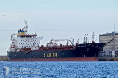
CIELO DI CAPRI
Tanker
Current Trip
| Time Travelled | 2 days |
|---|---|
| Remaining Time | 3 h, 58 mins |
| Distance Travelled | 400.15 nm |
| Remaining Distance | 33.47 nm |
| AVG Speed | 11.5 Knopen |
| MAX Speed | 14.7 Knopen |
| AVG Wind | 13.3 knots |
| MAX Wind | 31 knots |
| MIN Temp | 2°C / 35.6°F |
| MAX Temp | 6.4°C / 43.52°F |
| Diepgang | 11.7 M |
| Positie ontvangen | 2 m geleden |
Current Position
| Lengtegraad | 4.16269° |
|---|---|
| Breedtegraat | 60.60500° |
| Status | Under way using engine |
| Snelheid | 0.1 Knopen |
| Koers | 34° |
| Gebied | North Sea |
| Station | T-AIS |
| Positie ontvangen | 2 m geleden |
Info
Information
The current position of CIELO DI CAPRI is in North Sea with coordinates 60.60500° / 4.16269° as reported on 2025-02-12 13:20 by AIS to our vessel tracker app. The vessel's current speed is 0.1 Knopen and is heading at the port of MONGSTAD . The estimated time of arrival as calculated by MyShipTracking vessel tracking app is 2025-02-12 18:20 LT
The vessel CIELO DI CAPRI (IMO: 9717278, MMSI: 249435000) is a Tanker It's sailing under the flag of [MT] Malta.
In this page you can find informations about the vessels current position, last detected port calls, and current voyage information. If the vessels is not in coverage by AIS you will find the latest position.
The current position of CIELO DI CAPRI is detected by our AIS receivers and we are not responsible for the reliability of the data. The last position was recorded while the vessel was in Coverage by the Ais receivers of our vessel tracking app.
The current draught of CIELO DI CAPRI as reported by AIS is 11.7 meters
Weather
| Temperature | 4.4°C / 39.92°F |
|---|---|
| Wind Speed | 3 knots |
| Direction | 114° ESE |
| Pressure | 1029.6 hPa |
| Humidity | 62.8 % |
| Cloud Coverage | --- |
Featured Company
Last Port Calls
| Port | Arrival | Departure | Time In Port |
|---|---|---|---|
| 2025-02-08 21:33 | 2025-02-10 13:25 | 1 d | |
| 2025-02-04 10:01 | 2025-02-06 08:43 | 1 d | |
| 2025-01-27 13:56 | 2025-01-30 11:03 | 2 d | |
| 2025-01-22 15:49 | 2025-01-25 16:37 | 3 d | |
| 2025-01-18 15:00 | 2025-01-21 21:48 | 3 d | |
| 2025-01-12 01:17 | 2025-01-16 05:04 | 4 d | |
| 2025-01-05 09:40 | 2025-01-06 08:30 | 22 h | |
| 2025-01-04 02:51 | 2025-01-05 08:48 | 1 d | |
| 2024-12-28 14:24 | 2024-12-30 16:54 | 2 d | |
| 2024-12-22 21:40 | 2024-12-24 11:14 | 1 d |
Last Trips
| Origin | Departure | Destination | Arrival | Distance | |
|---|---|---|---|---|---|
| 2025-02-06 08:43 | 2025-02-08 21:33 | 427.58 nm | |||
| 2025-01-30 11:03 | 2025-02-04 10:01 | 839.25 nm | |||
| 2025-01-25 16:37 | 2025-01-27 13:56 | 391.37 nm | |||
| 2025-01-21 21:48 | 2025-01-22 15:49 | 110.66 nm | |||
| 2025-01-16 05:04 | 2025-01-18 15:00 | 662.57 nm | |||
| 2025-01-06 08:30 | 2025-01-12 01:17 | 1364.53 nm | |||
| 2025-01-05 08:48 | 2025-01-05 09:40 | 4.13 nm | |||
| 2024-12-30 16:54 | 2025-01-04 02:51 | 1372.92 nm | |||
| 2024-12-24 11:14 | 2024-12-28 14:24 | 1004.69 nm | |||
| 2024-12-19 06:54 | 2024-12-22 21:40 | 1048.13 nm |
Events
| Tijd | Evenement | Details | Positie / Bestemming | Info |
|---|---|---|---|---|
| 2025-02-12 10:05 | Stop beweging | 19.94 nm, South West of FEDJE |
60.61266 / 4.13309
MONGSTAD
|
Snelheid: 0.3 kn Koers: 149° |
| 2025-02-12 07:07 | Status Changed | Under way using engine Default |
60.65059 / 3.91362
MONGSTAD
|
Snelheid: 3 kn Koers: 87° |
| 2025-02-12 07:05 | Status Changed | Default Under way using engine |
60.65055 / 3.90961
MONGSTAD
|
Snelheid: 3 kn Koers: 87° |
| 2025-02-12 06:15 | Status Changed | Under way using engine Default |
60.64904 / 3.82917
MONGSTAD
|
Snelheid: 2.1 kn Koers: 88° |
| 2025-02-12 06:13 | Status Changed | Default Under way using engine |
60.64903 / 3.82664
MONGSTAD
|
Snelheid: 2.1 kn Koers: 88° |
| 2025-02-11 00:31 | Gevonden in zee | Norwegian part of the North Sea |
57.79594 / 7.33629
North Sea
MONGSTAD
|
Snelheid: 13.7 kn Koers: 270.5° |
| 2025-02-10 20:04 | Gevonden in zee | Norwegian part of the Skaggerak |
57.82813 / 9.09962
Skaggerak
MONGSTAD
|
Snelheid: 12.8 kn Koers: 268.9° |
| 2025-02-10 15:31 | Gevonden in zee | Danish part of the Skaggerak |
57.80582 / 10.94166
Skaggerak
MONGSTAD
|
Snelheid: 13.2 kn Koers: 308.8° |
| 2025-02-10 14:55 | Gevonden in zee | Danish part of the Kattegat |
57.72492 / 11.13124
Kattegat
MONGSTAD
|
Snelheid: 13 kn Koers: 308.6° |
| 2025-02-10 13:46 | ETA Changed | 2025/02/11 21:00 2025/02/12 00:00 |
57.59151 / 11.51441
MONGSTAD
|
Snelheid: 12.5 kn Koers: 274° |