
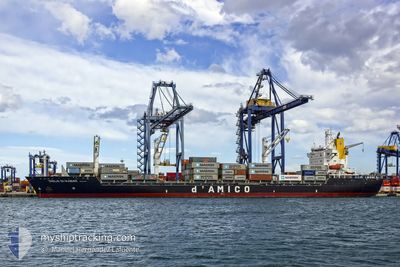
CIELO DI RABAT
Container Ship
Current Trip
MAPTM
| Time Travelled | 3 days |
|---|---|
| Remaining Time | --- |
| Distance Travelled | 267.55 nm |
| Remaining Distance | --- |
| AVG Speed | 7.9 Knopen |
| MAX Speed | 13.3 Knopen |
| AVG Wind | 7.4 knots |
| MAX Wind | 14 knots |
| MIN Temp | 8.8°C / 47.84°F |
| MAX Temp | 16.9°C / 62.42°F |
| Diepgang | 11.2 M |
| Positie ontvangen | 1 m geleden |
Current Position
| Lengtegraad | -7.62534° |
|---|---|
| Breedtegraat | 33.68407° |
| Status | Under way using engine |
| Snelheid | 0.1 Knopen |
| Koers | 204° |
| Gebied | North Atlantic Ocean |
| Station | T-AIS |
| Positie ontvangen | 1 m geleden |
Info
Information
The current position of CIELO DI RABAT is in North Atlantic Ocean with coordinates 33.68407° / -7.62534° as reported on 2025-02-10 10:20 by AIS to our vessel tracker app. The vessel's current speed is 0.1 Knopen
The vessel CIELO DI RABAT (IMO: 9141792, MMSI: 242198100) is a Container Ship that was built in 1997 ( 28 Jaar oud ). It's sailing under the flag of [MA] Morocco.
In this page you can find informations about the vessels current position, last detected port calls, and current voyage information. If the vessels is not in coverage by AIS you will find the latest position.
The current position of CIELO DI RABAT is detected by our AIS receivers and we are not responsible for the reliability of the data. The last position was recorded while the vessel was in Coverage by the Ais receivers of our vessel tracking app.
The current draught of CIELO DI RABAT as reported by AIS is 11.2 meters
Weather
| Temperature | 15.4°C / 59.72°F |
|---|---|
| Wind Speed | 6 knots |
| Direction | 199° SSW |
| Pressure | 1020.7 hPa |
| Humidity | 61.5 % |
| Cloud Coverage | 38 % |
Featured Company
Last Port Calls
| Port | Arrival | Departure | Time In Port |
|---|---|---|---|
| 2025-02-06 08:50 | 2025-02-06 21:10 | 12 h | |
| 2025-02-01 00:57 | 2025-02-03 23:55 | 2 d | |
| 2025-01-26 10:21 | 2025-01-27 01:26 | 15 h | |
| 2025-01-21 16:11 | 2025-01-24 11:04 | 2 d | |
| 2025-01-19 15:03 | 2025-01-20 00:50 | 9 h | |
| 2025-01-16 12:26 | 2025-01-19 00:27 | 2 d | |
| 2025-01-13 07:49 | 2025-01-14 00:35 | 16 h | |
| 2025-01-09 13:41 | 2025-01-11 23:37 | 2 d | |
| 2025-01-06 19:46 | 2025-01-07 09:44 | 13 h | |
| 2025-01-03 12:51 | 2025-01-05 23:05 | 2 d |
Most Visited Ports (Last year)
| Port | Arrivals | |
|---|---|---|
| 49 | ||
| 49 |
Last Trips
| Origin | Departure | Destination | Arrival | Distance | |
|---|---|---|---|---|---|
| 2025-02-04 00:55 | 2025-02-06 09:50 | 308.35 nm | |||
| 2025-01-27 02:26 | 2025-02-01 01:57 | 416.34 nm | |||
| 2025-01-24 12:04 | 2025-01-26 11:21 | 340.52 nm | |||
| 2025-01-20 01:50 | 2025-01-21 17:11 | 203.54 nm | |||
| 2025-01-19 01:27 | 2025-01-19 16:03 | 181.88 nm | |||
| 2025-01-14 01:35 | 2025-01-16 13:26 | 194.79 nm | |||
| 2025-01-12 00:37 | 2025-01-13 08:49 | 206.85 nm | |||
| 2025-01-07 10:44 | 2025-01-09 14:41 | 197.68 nm | |||
| 2025-01-06 00:05 | 2025-01-06 20:46 | 191.39 nm | |||
| 2024-12-30 17:32 | 2025-01-03 13:51 | 277.67 nm |
Events
| Tijd | Evenement | Details | Positie / Bestemming | Info |
|---|---|---|---|---|
| 2025-02-10 06:40 | Status Changed | Under way using engine Default |
33.68402 / -7.62489
MAPTM
|
Snelheid: 0.2 kn Koers: 229° |
| 2025-02-10 06:37 | Status Changed | Default Under way using engine |
33.68398 / -7.62482
MAPTM
|
Snelheid: 0.1 kn Koers: 229° |
| 2025-02-09 22:33 | Status Changed | Under way using engine Default |
33.68255 / -7.62773
MAPTM
|
Snelheid: 0.2 kn Koers: 89° |
| 2025-02-09 22:29 | Status Changed | Default Under way using engine |
33.68273 / -7.62778
MAPTM
|
Snelheid: Koers: 85° |
| 2025-02-09 09:28 | Status Changed | Under way using engine Default |
33.68165 / -7.62720
MAPTM
|
Snelheid: 0.1 kn Koers: 41° |
| 2025-02-09 09:09 | Status Changed | Default Under way using engine |
33.68168 / -7.62728
MAPTM
|
Snelheid: 0.1 kn Koers: 42° |
| 2025-02-09 08:56 | Status Changed | Under way using engine Default |
33.68178 / -7.62743
MAPTM
|
Snelheid: 0.1 kn Koers: 44° |
| 2025-02-09 08:50 | Status Changed | Default Under way using engine |
33.68178 / -7.62740
MAPTM
|
Snelheid: 0.2 kn Koers: 43° |
| 2025-02-09 05:21 | Status Changed | Under way using engine Default |
33.68165 / -7.62728
MAPTM
|
Snelheid: 0.1 kn Koers: 47° |
| 2025-02-09 05:15 | Status Changed | Default Under way using engine |
33.68166 / -7.62737
MAPTM
|
Snelheid: 0.1 kn Koers: 47° |