
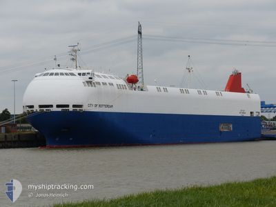
CITY OF ROTTERDAM
Vehicles Carrier
Current Trip
| Time Travelled | 18 h, 20 mins |
|---|---|
| Remaining Time | 2 days |
| Distance Travelled | 259.78 nm |
| Remaining Distance | 811.84 nm |
| AVG Speed | 14.2 Knopen |
| MAX Speed | 15.5 Knopen |
| AVG Wind | 11.2 knots |
| MAX Wind | 21 knots |
| MIN Temp | -5.6°C / 21.92°F |
| MAX Temp | 2.6°C / 36.68°F |
| Diepgang | 6.4 M |
| Positie ontvangen | 5 h, 45 m geleden |
Current Position
| Lengtegraad | 19.36176° |
|---|---|
| Breedtegraat | 57.54080° |
| Status | Under way using engine |
| Snelheid | 14.7 Knopen |
| Koers | 216.1° |
| Gebied | Baltic Sea |
| Station | T-AIS |
| Positie ontvangen | 5 h, 45 m geleden |
Info
Information
The current position of CITY OF ROTTERDAM is in Baltic Sea with coordinates 57.54080° / 19.36176° as reported on 2026-01-05 23:28 by AIS to our vessel tracker app. The vessel's current speed is 14.7 Knopen and is heading at the port of TYNE. The estimated time of arrival as calculated by MyShipTracking vessel tracking app is 2026-01-08 13:27 LT
The vessel CITY OF ROTTERDAM (IMO: 9473468, MMSI: 372002000) is a Vehicles Carrier that was built in 2011 ( 15 Jaar oud ). It's sailing under the flag of [PA] Panama.
In this page you can find informations about the vessels current position, last detected port calls, and current voyage information. If the vessels is not in coverage by AIS you will find the latest position.
The current position of CITY OF ROTTERDAM is detected by our AIS receivers and we are not responsible for the reliability of the data. The last position was recorded while the vessel was in Coverage by the Ais receivers of our vessel tracking app.
The current draught of CITY OF ROTTERDAM as reported by AIS is 6.4 meters
Weather
| Temperature | 1.3°C / 34.34°F |
|---|---|
| Wind Speed | 12 knots |
| Direction | 208° SSW |
| Pressure | 1009.3 hPa |
| Humidity | 98.2 % |
| Cloud Coverage | 100 % |
Featured Company
Last Port Calls
| Port | Arrival | Departure | Time In Port |
|---|---|---|---|
| 2026-01-03 20:53 | 2026-01-05 12:53 | 1 d | |
| 2026-01-02 07:06 | 2026-01-02 16:19 | 9 h | |
| 2025-12-29 00:57 | 2025-12-30 03:36 | 1 d | |
| 2025-12-26 19:47 | 2025-12-27 20:08 | 1 d | |
| 2025-12-23 06:17 | 2025-12-23 14:14 | 7 h | |
| 2025-12-17 20:16 | 2025-12-20 06:23 | 2 d | |
| 2025-12-16 15:23 | 2025-12-16 19:41 | 4 h | |
| 2025-12-15 07:34 | 2025-12-15 17:23 | 9 h | |
| 2025-12-14 14:38 | 2025-12-14 18:53 | 4 h | |
| 2025-12-12 01:48 | 2025-12-12 15:24 | 13 h |
Last Trips
| Origin | Departure | Destination | Arrival | Distance | |
|---|---|---|---|---|---|
| 2026-01-02 16:19 | 2026-01-03 20:53 | 372.67 nm | |||
| 2025-12-30 03:36 | 2026-01-02 07:06 | 966.69 nm | |||
| 2025-12-27 20:08 | 2025-12-29 00:57 | 297.83 nm | |||
| 2025-12-23 14:14 | 2025-12-26 19:47 | 964.81 nm | |||
| 2025-12-20 06:23 | 2025-12-23 06:17 | 961.82 nm | |||
| 2025-12-16 19:41 | 2025-12-17 20:16 | 344.06 nm | |||
| 2025-12-15 17:23 | 2025-12-16 15:23 | 279.18 nm | |||
| 2025-12-14 18:53 | 2025-12-15 07:34 | 148.03 nm | |||
| 2025-12-12 15:24 | 2025-12-14 14:38 | 625.60 nm | |||
| 2025-12-10 15:19 | 2025-12-12 01:48 | 299.29 nm |
Events
| Tijd | Evenement | Details | Positie / Bestemming | Info |
|---|---|---|---|---|
| 2026-01-05 23:33 | Status Changed | Default Under way using engine |
57.52438 / 19.33917
GB TYN
|
Snelheid: 14.7 kn Koers: 216.1° |
| 2026-01-05 23:28 | Buitenbereik |
57.54080 / 19.36176
Baltic Sea
GB TYN
|
Snelheid: 14.7 kn Koers: 216.1° |
|
| 2026-01-05 22:12 | Status Changed | Under way using engine Default |
57.79154 / 19.70451
GB TYN
|
Snelheid: 14.8 kn Koers: 217° |
| 2026-01-05 22:09 | Status Changed | Default Under way using engine |
57.80216 / 19.71937
GB TYN
|
Snelheid: 15 kn Koers: 217.3° |
| 2026-01-05 21:50 | Status Changed | Under way using engine Default |
57.86339 / 19.80477
GB TYN
|
Snelheid: 14.7 kn Koers: 216° |
| 2026-01-05 21:17 | Status Changed | Default Under way using engine |
57.97195 / 19.95344
GB TYN
|
Snelheid: 14.6 kn Koers: 217° |
| 2026-01-05 21:10 | Wijzig zee gebeid | Swedish part of the Baltic Sea Estonian part of the Baltic Sea |
57.99215 / 19.98267
Baltic Sea
GB TYN
|
Snelheid: 14.6 kn Koers: 217° |
| 2026-01-05 21:10 | Status Changed | Under way using engine Default |
57.99215 / 19.98267
GB TYN
|
Snelheid: 14.5 kn Koers: 216° |
| 2026-01-05 20:53 | Binnenbereik |
57.99215 / 19.98267
Baltic Sea
GB TYN
|
Snelheid: 14.6 kn Koers: 217° |
|
| 2026-01-05 15:00 | Buitenbereik |
59.19973 / 21.73139
Baltic Sea
GB TYN
|
Snelheid: 15.1 kn Koers: 232.3° |