
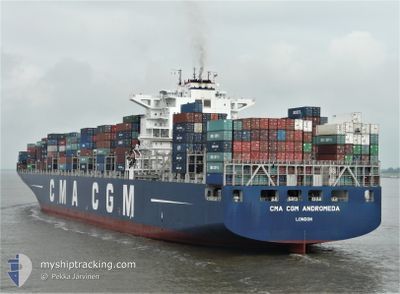
CMA CGM ANDROMEDA
Container Ship
Current Trip
| Trip Time | 3 days |
|---|---|
| Trip Distance | 907.03 nm |
| AVG Speed | 11.8 Knopen |
| MAX Speed | 18.5 Knopen |
| Diepgang | 14 M |
| AVG Wind | 13.2 knots |
| MAX Wind | 27 knots |
| MIN Temp | 14.6°C / 58.28°F |
| MAX Temp | 24.8°C / 76.64°F |
| Positie ontvangen | 1 d geleden |
Current Position
| Lengtegraad | 32.55101° |
|---|---|
| Breedtegraat | 29.86938° |
| Status | Under way using engine |
| Snelheid | 10.8 Knopen |
| Koers | 170.2° |
| Gebied | Gulf of Suez |
| Station | T-AIS |
| Positie ontvangen | 1 d geleden |
Info
Information
The current position of CMA CGM ANDROMEDA is in Gulf of Suez with coordinates 29.86938° / 32.55101° as reported on 2025-03-04 13:20 by AIS to our vessel tracker app. The vessel's current speed is 10.8 Knopen and is currently inside the port of JEDDAH.
The vessel CMA CGM ANDROMEDA (IMO: 9410727, MMSI: 215164000) is a Container Ship that was built in 2009 ( 16 Jaar oud ). It's sailing under the flag of [MT] Malta.
In this page you can find informations about the vessels current position, last detected port calls, and current voyage information. If the vessels is not in coverage by AIS you will find the latest position.
The current position of CMA CGM ANDROMEDA is detected by our AIS receivers and we are not responsible for the reliability of the data. The last position was recorded while the vessel was in Coverage by the Ais receivers of our vessel tracking app.
The current draught of CMA CGM ANDROMEDA as reported by AIS is 14 meters
Weather
| Temperature | 25.1°C / 77.18°F |
|---|---|
| Wind Speed | 9 knots |
| Direction | 325° NW |
| Pressure | 1013 hPa |
| Humidity | 40.8 % |
| Cloud Coverage | 100 % |
Featured Company
Last Port Calls
| Port | Arrival | Departure | Time In Port |
|---|---|---|---|
| 2025-03-06 06:44 | |||
| 2025-03-04 03:22 | 2025-03-04 12:45 | 9 h | |
| 2025-03-01 09:56 | 2025-03-03 01:49 | 1 d | |
| 2025-02-19 09:02 | 2025-02-22 22:47 | 3 d | |
| 2025-02-12 09:27 | 2025-02-13 11:03 | 1 d | |
| 2025-02-09 16:59 | 2025-02-11 09:53 | 1 d | |
| 2025-02-08 04:27 | 2025-02-08 13:45 | 9 h | |
| 2025-01-19 23:40 | 2025-01-20 23:44 | 1 d | |
| 2025-01-15 06:49 | 2025-01-16 11:09 | 1 d | |
| 2025-01-08 08:00 | 2025-01-09 23:04 | 1 d |
Most Visited Ports (Last year)
| Port | Arrivals | |
|---|---|---|
| 8 | ||
| 8 | ||
| 7 | ||
| 5 | ||
| 4 | ||
| 4 |
Last Trips
| Origin | Departure | Destination | Arrival | Distance | |
|---|---|---|---|---|---|
| 2025-03-03 03:49 | 2025-03-06 09:44 | 907.03 nm | |||
| 2025-03-03 03:49 | 2025-03-04 05:22 | 191.57 nm | |||
| 2025-02-22 23:47 | 2025-03-01 11:56 | 1365.10 nm | |||
| 2025-02-13 13:03 | 2025-02-19 10:02 | 1472.98 nm | |||
| 2025-02-11 11:53 | 2025-02-12 11:27 | 357.74 nm | |||
| 2025-01-21 07:44 | 2025-02-09 18:59 | 5311.76 nm | |||
| 2025-01-21 07:44 | 2025-02-08 06:27 | 5015.02 nm | |||
| 2025-01-16 19:09 | 2025-01-20 07:40 | 1471.26 nm | |||
| 2025-01-10 08:04 | 2025-01-15 14:49 | 1301.63 nm | |||
| 2025-01-07 12:01 | 2025-01-08 17:00 | 479.55 nm |
Events
| Tijd | Evenement | Details | Positie / Bestemming | Info |
|---|---|---|---|---|
| 2025-03-06 07:29 | Stop beweging |
21.48469 / 39.15302
[SA] JEDDAH
|
Snelheid: Koers: 261° |
|
| 2025-03-06 06:44 | Aankomsthaven |
|
21.47141 / 39.12571
[SA] JEDDAH
|
Snelheid: 8 kn Koers: 110° |
| 2025-03-04 13:25 | Status Changed | Default Under way using engine |
29.85486 / 32.55339
SAJED
|
Snelheid: 10.8 kn Koers: 170.2° |
| 2025-03-04 13:20 | Buitenbereik |
29.86938 / 32.55101
Gulf of Suez
SAJED
|
Snelheid: 10.8 kn Koers: 170.2° |
|
| 2025-03-04 12:47 | Wijzig zee gebeid | Egyptian part of the Gulf of Suez Greek part of the Mediterranean Sea - Eastern Basin |
29.94267 / 32.57493
Gulf of Suez
SAJED
|
Snelheid: 8.4 kn Koers: 222.7° |
| 2025-03-04 12:45 | Vertrekhaven |
|
29.94481 / 32.57695
SAJED
|
Snelheid: 8.6 kn Koers: 218° |
| 2025-03-04 11:38 | Draught Changed | 14 11.9 |
30.13932 / 32.56985
[EG] SUEZ CANAL
|
Snelheid: 9.6 kn Koers: 180° |
| 2025-03-04 11:38 | Destination Changed | SAJED EGALY |
30.13932 / 32.56985
[EG] SUEZ CANAL
|
Snelheid: 9.6 kn Koers: 180° |
| 2025-03-04 11:38 | ETA Changed | 2025/03/06 02:00 2025/03/01 08:00 |
30.13932 / 32.56985
[EG] SUEZ CANAL
|
Snelheid: 9.6 kn Koers: 180° |
| 2025-03-04 11:36 | Status Changed | Under way using engine Default |
30.14639 / 32.56974
[EG] SUEZ CANAL
|
Snelheid: 8.9 kn Koers: 181° |