

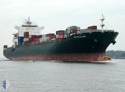
CMA CGM DOLPHIN
Container Ship

Current Trip
| Trip Time | 4 days |
|---|---|
| Trip Distance | 922.43 nm |
| AVG Speed | 9.3 Knopen |
| MAX Speed | 9.3 Knopen |
| Diepgang | 8 M |
| AVG Wind | 11.5 knots |
| MAX Wind | 19.9 knots |
| MIN Temp | 8°C / 46.4°F |
| MAX Temp | 18.9°C / 66.02°F |
| Positie ontvangen | 3 m geleden |
Current Position
| Lengtegraad | -123.15065° |
|---|---|
| Breedtegraat | 49.02002° |
| Status | Under way using engine |
| Snelheid | |
| Koers | 32° |
| Gebied | The Coastal Waters of Southeast Alaska and British Columbia |
| Station | T-AIS |
| Positie ontvangen | 3 m geleden |
Information
The current position of CMA CGM DOLPHIN is in The Coastal Waters of Southeast Alaska and British Columbia with coordinates 49.02002° / -123.15065° as reported on 2025-06-11 06:06 by AIS to our vessel tracker app. The vessel's current speed is 0 Knopen and is currently inside the port of TSAWWASSEN.
The vessel CMA CGM DOLPHIN (IMO: 9322487, MMSI: 229921000) is a Container Ship that was built in 2007 ( 18 Jaar oud ). It's sailing under the flag of [MT] Malta.
In this page you can find informations about the vessels current position, last detected port calls, and current voyage information. If the vessels is not in coverage by AIS you will find the latest position.
The current position of CMA CGM DOLPHIN is detected by our AIS receivers and we are not responsible for the reliability of the data. The last position was recorded while the vessel was in Coverage by the Ais receivers of our vessel tracking app.
The current draught of CMA CGM DOLPHIN as reported by AIS is 8 meters
Weather
| Temperature | 15.5°C / 59.9°F |
|---|---|
| Wind Speed | 2 knots |
| Direction | 232° SW |
| Pressure | 1011.8 hPa |
| Humidity | 75.3 % |
| Cloud Coverage | 54 % |


Featured Company
Last Port Calls
| Port | Arrival | Departure | Time In Port |
|---|---|---|---|
| 2025-06-10 17:28 | |||
| 2025-06-05 12:06 | 2025-06-06 15:39 | 1 d | |
| 2025-06-02 04:02 | 2025-06-03 20:35 | 1 d | |
| 2025-05-24 03:12 | 2025-05-24 12:04 | 8 h | |
| 2025-05-20 03:56 | 2025-05-21 00:01 | 20 h | |
| 2025-05-14 15:05 | 2025-05-15 18:39 | 1 d | |
| 2025-04-30 09:54 | 2025-05-01 03:39 | 17 h | |
| 2025-04-23 15:27 | 2025-04-24 13:43 | 22 h | |
| 2025-04-16 13:07 | 2025-04-17 04:43 | 15 h | |
| 2025-04-15 07:56 | 2025-04-16 00:59 | 17 h |
Last Trips
| Origin | Departure | Destination | Arrival | Distance | |
|---|---|---|---|---|---|
| 2025-06-06 15:39 | 2025-06-10 17:28 | 922.43 nm | |||
| 2025-06-03 20:35 | 2025-06-05 12:06 | 408.54 nm | |||
| 2025-05-24 12:04 | 2025-06-02 04:02 | 2970.97 nm | |||
| 2025-05-21 00:01 | 2025-05-24 03:12 | 785.99 nm | |||
| 2025-05-15 18:39 | 2025-05-20 03:56 | 1174.02 nm | |||
| 2025-05-01 03:39 | 2025-05-14 15:05 | 4198.79 nm | |||
| 2025-04-24 13:43 | 2025-04-30 09:54 | 457.58 nm | |||
| 2025-04-17 04:43 | 2025-04-23 15:27 | 599.48 nm | |||
| 2025-04-16 00:59 | 2025-04-16 13:07 | 118.97 nm | |||
| 2025-04-12 19:12 | 2025-04-15 07:56 | 136.09 nm |
Events
| Tijd | Evenement | Details | Positie / Bestemming | Info |
|---|---|---|---|---|
| 2025-06-11 00:30 | Stop beweging |
49.01990 / -123.15027
[CA] TSAWWASSEN
|
Snelheid: 0.3 kn Koers: 28° |
|
| 2025-06-11 00:28 | Aankomsthaven |
|
49.01953 / -123.15017
[CA] TSAWWASSEN
|
Snelheid: 0.7 kn Koers: 24° |
| 2025-06-11 00:05 | Wijzig zee gebeid | Canadian part of the The Coastal Waters of Southeast Alaska and British Columbia United States part of the The Coastal Waters of Southeast Alaska and British Columbia |
49.00080 / -123.15830
The Coastal Waters of Southeast Alaska and British Columbia
|
Snelheid: 5.1 kn Koers: 14° |
| 2025-06-10 23:13 | Wijzig zee gebeid | United States part of the The Coastal Waters of Southeast Alaska and British Columbia Canadian part of the The Coastal Waters of Southeast Alaska and British Columbia |
48.83823 / -123.01678
The Coastal Waters of Southeast Alaska and British Columbia
|
Snelheid: 17.8 kn Koers: 341° |
| 2025-06-10 23:10 | Wijzig zee gebeid | Canadian part of the The Coastal Waters of Southeast Alaska and British Columbia United States part of the The Coastal Waters of Southeast Alaska and British Columbia |
48.82383 / -123.01007
The Coastal Waters of Southeast Alaska and British Columbia
|
Snelheid: 18 kn Koers: 344° |
| 2025-06-10 23:04 | Wijzig zee gebeid | United States part of the The Coastal Waters of Southeast Alaska and British Columbia Canadian part of the The Coastal Waters of Southeast Alaska and British Columbia |
48.79540 / -123.00420
The Coastal Waters of Southeast Alaska and British Columbia
|
Snelheid: 17.5 kn Koers: 16° |
| 2025-06-10 22:49 | Wijzig zee gebeid | Canadian part of the The Coastal Waters of Southeast Alaska and British Columbia United States part of the The Coastal Waters of Southeast Alaska and British Columbia |
48.74465 / -123.08565
The Coastal Waters of Southeast Alaska and British Columbia
|
Snelheid: 18.2 kn Koers: 61° |
| 2025-06-10 22:31 | Wijzig zee gebeid | United States part of the The Coastal Waters of Southeast Alaska and British Columbia Canadian part of the The Coastal Waters of Southeast Alaska and British Columbia |
48.70765 / -123.21295
The Coastal Waters of Southeast Alaska and British Columbia
|
Snelheid: 18.3 kn Koers: 72° |
| 2025-06-10 22:28 | Wijzig zee gebeid | Canadian part of the The Coastal Waters of Southeast Alaska and British Columbia United States part of the The Coastal Waters of Southeast Alaska and British Columbia |
48.70245 / -123.23365
The Coastal Waters of Southeast Alaska and British Columbia
|
Snelheid: 17.6 kn Koers: 61° |
| 2025-06-10 21:40 | Status Changed | Under way using engine At anchor |
48.47873 / -123.16242
CAVAN
|
Snelheid: 17.3 kn Koers: 345° |