
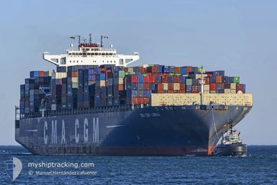
CMA CGM LIBRA
Not available
Current Trip
| Time Travelled | 5 days |
|---|---|
| Remaining Time | 10 h, 48 mins |
| Distance Travelled | 1609.69 nm |
| Remaining Distance | 214.82 nm |
| AVG Speed | 12.9 Knopen |
| MAX Speed | 16.1 Knopen |
| AVG Wind | 7.1 knots |
| MAX Wind | 20 knots |
| MIN Temp | 24.6°C / 76.28°F |
| MAX Temp | 28.7°C / 83.66°F |
| Diepgang | 14 M |
| Positie ontvangen | 4 d geleden |
Current Position
| Lengtegraad | -100.89939° |
|---|---|
| Breedtegraat | 16.65422° |
| Status | Under way using engine |
| Snelheid | 12.8 Knopen |
| Koers | 117° |
| Gebied | North Pacific Ocean |
| Station | T-AIS |
| Positie ontvangen | 4 d geleden |
Info
Information
The current position of CMA CGM LIBRA is in North Pacific Ocean with coordinates 16.65422° / -100.89939° as reported on 2025-03-08 18:49 by AIS to our vessel tracker app. The vessel's current speed is 12.8 Knopen and is heading at the port of BALBOA. The estimated time of arrival as calculated by MyShipTracking vessel tracking app is 2025-03-13 15:10 LT
The vessel CMA CGM LIBRA (MMSI: 249819000) is a Not available It's sailing under the flag of [MT] Malta.
In this page you can find informations about the vessels current position, last detected port calls, and current voyage information. If the vessels is not in coverage by AIS you will find the latest position.
The current position of CMA CGM LIBRA is detected by our AIS receivers and we are not responsible for the reliability of the data. The last position was recorded while the vessel was in Coverage by the Ais receivers of our vessel tracking app.
The current draught of CMA CGM LIBRA as reported by AIS is 14 meters
Weather
| Temperature | 26.4°C / 79.52°F |
|---|---|
| Wind Speed | 19 knots |
| Direction | 7° N |
| Pressure | 1010.4 hPa |
| Humidity | 77.8 % |
| Cloud Coverage | 100 % |
Featured Company
Last Port Calls
| Port | Arrival | Departure | Time In Port |
|---|---|---|---|
| 2025-03-07 07:03 | 2025-03-07 17:15 | 10 h | |
| 2025-02-14 21:21 | 2025-02-16 00:48 | 1 d | |
| 2025-02-11 08:37 | 2025-02-12 02:41 | 18 h | |
| 2025-02-08 16:36 | 2025-02-09 07:41 | 15 h | |
| 2025-02-04 11:08 | 2025-02-05 08:28 | 21 h | |
| 2025-02-01 03:29 | 2025-02-02 11:41 | 1 d | |
| 2025-01-25 17:59 | 2025-01-26 15:43 | 21 h |
Most Visited Ports (Last year)
| Port | Arrivals | |
|---|---|---|
| 5 | ||
| 4 | ||
| 4 | ||
| 4 | ||
| 4 | ||
| 4 |
Last Trips
| Origin | Departure | Destination | Arrival | Distance | |
|---|---|---|---|---|---|
| 2025-02-16 00:48 | 2025-03-07 07:03 | 6458.20 nm | |||
| 2025-02-12 02:41 | 2025-02-14 21:21 | 547.35 nm | |||
| 2025-02-09 07:41 | 2025-02-11 08:37 | 488.59 nm | |||
| 2025-02-05 08:28 | 2025-02-08 16:36 | 911.21 nm | |||
| 2025-02-02 11:41 | 2025-02-04 11:08 | 23.72 nm | |||
| 2025-01-26 15:43 | 2025-02-01 03:29 | 1520.36 nm | |||
| 2024-12-30 00:52 | 2025-01-25 17:59 | 11568.47 nm |
Events
| Tijd | Evenement | Details | Positie / Bestemming | Info |
|---|---|---|---|---|
| 2025-03-12 20:57 | Start beweging |
7.35163 / -82.90080
PABLB
|
Snelheid: 6.3 kn Koers: 192° |
|
| 2025-03-12 16:29 | Stop beweging |
7.35013 / -82.91888
PABLB
|
Snelheid: 0.3 kn Koers: 153° |
|
| 2025-03-08 18:55 | Status Changed | Default Under way using engine |
16.64302 / -100.87672
PABLB
|
Snelheid: 12.8 kn Koers: 117° |
| 2025-03-08 18:49 | Buitenbereik |
16.65422 / -100.89939
North Pacific Ocean
|
Snelheid: 12.8 kn Koers: 117° |
|
| 2025-03-08 18:46 | Status Changed | Under way using engine Default |
16.65807 / -100.90708
PABLB
|
Snelheid: 12.9 kn Koers: 118° |
| 2025-03-08 18:36 | Binnenbereik |
16.65422 / -100.89939
North Pacific Ocean
|
Snelheid: 12.8 kn Koers: 117° |
|
| 2025-03-08 11:36 | Status Changed | Default Under way using engine |
17.40892 / -102.37450
PABLB
|
Snelheid: 13.1 kn Koers: 117° |
| 2025-03-08 11:27 | Status Changed | Under way using engine Default |
17.42393 / -102.40392
PABLB
|
Snelheid: 13.3 kn Koers: 118° |
| 2025-03-08 11:27 | Buitenbereik |
17.42393 / -102.40392
North Pacific Ocean
|
Snelheid: 13.1 kn Koers: 117° |
|
| 2025-03-08 11:23 | Status Changed | Default Under way using engine |
17.43028 / -102.41638
PABLB
|
Snelheid: 13.2 kn Koers: 119° |