
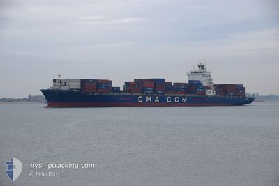
CMA CGM SYDNEY
Container Ship
Current Trip
| Time Travelled | 4 h, 1 mins |
|---|---|
| Remaining Time | --- |
| Distance Travelled | 36.69 nm |
| Remaining Distance | --- |
| AVG Speed | 15.1 Knopen |
| MAX Speed | 17.8 Knopen |
| AVG Wind | 3.1 knots |
| MAX Wind | 5.5 knots |
| MIN Temp | 12.1°C / 53.78°F |
| MAX Temp | 13°C / 55.4°F |
| Diepgang | 12.3 M |
| Positie ontvangen | 2 h, 5 m geleden |
Current Position
| Lengtegraad | 14.17825° |
|---|---|
| Breedtegraat | 40.43004° |
| Status | Under way using engine |
| Snelheid | 12.4 Knopen |
| Koers | 246.6° |
| Gebied | Tyrrhenian Sea |
| Station | T-AIS |
| Positie ontvangen | 2 h, 5 m geleden |
Info
Information
The current position of CMA CGM SYDNEY is in Tyrrhenian Sea with coordinates 40.43004° / 14.17825° as reported on 2025-02-06 14:02 by AIS to our vessel tracker app. The vessel's current speed is 12.4 Knopen and is heading at the port of TANGER MED. The estimated time of arrival as calculated by MyShipTracking vessel tracking app is 2025-02-09 00:59 LT
The vessel CMA CGM SYDNEY (IMO: 9315953, MMSI: 229699000) is a Container Ship that was built in 2007 ( 18 Jaar oud ). It's sailing under the flag of [MT] Malta.
In this page you can find informations about the vessels current position, last detected port calls, and current voyage information. If the vessels is not in coverage by AIS you will find the latest position.
The current position of CMA CGM SYDNEY is detected by our AIS receivers and we are not responsible for the reliability of the data. The last position was recorded while the vessel was in Coverage by the Ais receivers of our vessel tracking app.
The current draught of CMA CGM SYDNEY as reported by AIS is 12.3 meters
Weather
| Temperature | 13.3°C / 55.94°F |
|---|---|
| Wind Speed | 6 knots |
| Direction | 112° ESE |
| Pressure | 1026.8 hPa |
| Humidity | 61.3 % |
| Cloud Coverage | 8 % |
Featured Company
Last Port Calls
| Port | Arrival | Departure | Time In Port |
|---|---|---|---|
| 2025-02-05 19:27 | 2025-02-06 13:06 | 17 h | |
| 2025-02-02 01:52 | 2025-02-03 00:03 | 22 h | |
| 2025-01-31 12:37 | 2025-02-01 04:01 | 15 h | |
| 2025-01-30 08:35 | 2025-01-31 06:32 | 21 h | |
| 2025-01-29 11:35 | 2025-01-30 03:45 | 16 h | |
| 2025-01-27 12:14 | 2025-01-28 09:36 | 21 h | |
| 2025-01-21 08:22 | 2025-01-23 10:06 | 2 d | |
| 2025-01-13 14:04 | 2025-01-15 03:49 | 1 d | |
| 2025-01-08 14:52 | 2025-01-09 12:54 | 22 h | |
| 2025-01-04 00:47 | 2025-01-05 18:59 | 1 d |
Most Visited Ports (Last year)
| Port | Arrivals | |
|---|---|---|
| 9 | ||
| 9 | ||
| 9 | ||
| 9 | ||
| 9 | ||
| 9 |
Last Trips
| Origin | Departure | Destination | Arrival | Distance | |
|---|---|---|---|---|---|
| 2025-02-03 00:03 | 2025-02-05 19:27 | 853.09 nm | |||
| 2025-02-01 04:01 | 2025-02-02 01:52 | 294.67 nm | |||
| 2025-01-31 06:32 | 2025-01-31 12:37 | 63.19 nm | |||
| 2025-01-30 03:45 | 2025-01-30 08:35 | 51.29 nm | |||
| 2025-01-28 09:36 | 2025-01-29 11:35 | 374.34 nm | |||
| 2025-01-23 10:06 | 2025-01-27 12:14 | 610.44 nm | |||
| 2025-01-15 03:49 | 2025-01-21 08:22 | 2448.83 nm | |||
| 2025-01-09 12:54 | 2025-01-13 14:04 | 321.00 nm | |||
| 2025-01-05 18:59 | 2025-01-08 14:52 | 503.56 nm | |||
| 2024-12-30 19:26 | 2025-01-04 00:47 | 303.80 nm |
Events
| Tijd | Evenement | Details | Positie / Bestemming | Info |
|---|---|---|---|---|
| 2025-02-06 14:09 | Status Changed | Default Under way using engine |
40.41996 / 14.14793
ITSAL>MAPTM
|
Snelheid: 12.4 kn Koers: 246.6° |
| 2025-02-06 14:02 | Status Changed | Under way using engine Default |
40.43004 / 14.17825
ITSAL>MAPTM
|
Snelheid: 12.3 kn Koers: 246° |
| 2025-02-06 14:02 | Buitenbereik |
40.43004 / 14.17825
Tyrrhenian Sea
ITSAL>MAPTM
|
Snelheid: 12.4 kn Koers: 246.6° |
|
| 2025-02-06 13:49 | Status Changed | Default Under way using engine |
40.44700 / 14.22834
ITSAL>MAPTM
|
Snelheid: 13.4 kn Koers: 245.4° |
| 2025-02-06 13:36 | Status Changed | Under way using engine Default |
40.46956 / 14.29287
ITSAL>MAPTM
|
Snelheid: 17.5 kn Koers: 245° |
| 2025-02-06 13:28 | Status Changed | Default Under way using engine |
40.48447 / 14.33493
ITSAL>MAPTM
|
Snelheid: 17.6 kn Koers: 245° |
| 2025-02-06 13:03 | Draught Changed | 12.3 11.5 |
40.53854 / 14.48539
ITSAL>MAPTM
|
Snelheid: 17.4 kn Koers: 245.4° |
| 2025-02-06 13:03 | Destination Changed | ITSAL>MAPTM TRALI>ITSAL |
40.53854 / 14.48539
ITSAL>MAPTM
|
Snelheid: 17.4 kn Koers: 245.4° |
| 2025-02-06 13:03 | ETA Changed | 2025/02/08 23:59 2025/02/04 20:00 |
40.53854 / 14.48539
ITSAL>MAPTM
|
Snelheid: 17.4 kn Koers: 245.4° |
| 2025-02-06 12:31 | Status Changed | Under way using engine Default |
40.60200 / 14.66218
TRALI>ITSAL
|
Snelheid: 14.2 kn Koers: 246° |