
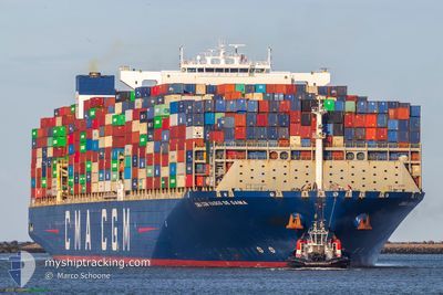
CMACGM VASCO DE GAMA
Cargo
Current Trip
| Time Travelled | 1 day |
|---|---|
| Remaining Time | 3 days |
| Distance Travelled | 139.40 nm |
| Remaining Distance | 1190.94 nm |
| AVG Speed | 12.6 Knopen |
| MAX Speed | 15.1 Knopen |
| AVG Wind | 11.5 knots |
| MAX Wind | 18 knots |
| MIN Temp | 10°C / 50°F |
| MAX Temp | 16.8°C / 62.24°F |
| Diepgang | 11.9 M |
| Positie ontvangen | 3 m geleden |
Current Position
| Lengtegraad | -1.05865° |
|---|---|
| Breedtegraat | 50.57934° |
| Status | At anchor |
| Snelheid | |
| Koers | 218° |
| Gebied | English Channel |
| Station | T-AIS |
| Positie ontvangen | 3 m geleden |
Info
Information
The current position of CMACGM VASCO DE GAMA is in English Channel with coordinates 50.57934° / -1.05865° as reported on 2025-03-21 23:14 by AIS to our vessel tracker app. The vessel's current speed is 0 Knopen and is heading at the port of GIBRALTAR. The estimated time of arrival as calculated by MyShipTracking vessel tracking app is 2025-03-25 06:10 LT
The vessel CMACGM VASCO DE GAMA (IMO: 9706889, MMSI: 215173000) is a Cargo It's sailing under the flag of [MT] Malta.
In this page you can find informations about the vessels current position, last detected port calls, and current voyage information. If the vessels is not in coverage by AIS you will find the latest position.
The current position of CMACGM VASCO DE GAMA is detected by our AIS receivers and we are not responsible for the reliability of the data. The last position was recorded while the vessel was in Coverage by the Ais receivers of our vessel tracking app.
The current draught of CMACGM VASCO DE GAMA as reported by AIS is 11.9 meters
Weather
| Temperature | 10.5°C / 50.9°F |
|---|---|
| Wind Speed | 13 knots |
| Direction | 146° SE |
| Pressure | 1000.3 hPa |
| Humidity | 91.7 % |
| Cloud Coverage | 100 % |
Featured Company
Last Port Calls
| Port | Arrival | Departure | Time In Port |
|---|---|---|---|
| 2025-03-16 15:57 | 2025-03-20 14:57 | 3 d | |
| 2025-03-10 09:52 | 2025-03-13 14:10 | 3 d | |
| 2025-03-04 00:33 | 2025-03-07 08:31 | 3 d | |
| 2025-02-28 02:34 | 2025-03-03 12:56 | 3 d | |
| 2025-02-23 05:15 | 2025-02-24 16:36 | 1 d | |
| 2025-01-28 18:42 | 2025-01-29 09:54 | 15 h | |
| 2025-01-24 03:23 | 2025-01-25 09:41 | 1 d | |
| 2025-01-20 11:05 | 2025-01-22 00:09 | 1 d | |
| 2025-01-08 21:29 | 2025-01-11 09:53 | 2 d |
Last Trips
| Origin | Departure | Destination | Arrival | Distance | |
|---|---|---|---|---|---|
| 2025-03-13 14:10 | 2025-03-16 15:57 | 1132.93 nm | |||
| 2025-03-07 08:31 | 2025-03-10 09:52 | 1250.02 nm | |||
| 2025-03-03 12:56 | 2025-03-04 00:33 | 160.27 nm | |||
| 2025-02-24 16:36 | 2025-02-28 02:34 | 1297.84 nm | |||
| 2025-01-29 09:54 | 2025-02-23 05:15 | 10746.09 nm | |||
| 2025-01-25 09:41 | 2025-01-28 18:42 | 1477.62 nm | |||
| 2025-01-22 00:09 | 2025-01-24 03:23 | 822.93 nm | |||
| 2025-01-11 09:53 | 2025-01-20 11:05 | 2508.65 nm | |||
| 2024-12-13 20:52 | 2025-01-08 21:29 | 11628.24 nm |
Events
| Tijd | Evenement | Details | Positie / Bestemming | Info |
|---|---|---|---|---|
| 2025-03-21 00:50 | Status Changed | At anchor Under way using engine |
50.57932 / -1.05662
GIGIB
|
Snelheid: 0.1 kn Koers: 195° |
| 2025-03-21 00:28 | Stop beweging | 5.69 nm, South East of SANDOWN |
50.57878 / -1.05649
GIGIB
|
Snelheid: 0.3 kn Koers: 218° |
| 2025-03-20 17:07 | Wijzig zee gebeid | United Kingdom part of the English Channel French part of the English Channel |
50.89226 / 1.28098
English Channel
GIGIB
|
Snelheid: 13.9 kn Koers: 218.5° |
| 2025-03-20 17:02 | Wijzig zee gebeid | French part of the English Channel United Kingdom part of the English Channel |
50.90753 / 1.29992
English Channel
GIGIB
|
Snelheid: 14.3 kn Koers: 216.8° |
| 2025-03-20 16:10 | Gevonden in zee | United Kingdom part of the English Channel |
51.04677 / 1.51378
English Channel
GIGIB
|
Snelheid: 13.4 kn Koers: 225.9° |
| 2025-03-20 15:26 | Wijzig zee gebeid | United Kingdom part of the North Sea French part of the North Sea |
51.09132 / 1.69598
North Sea
GIGIB
|
Snelheid: 14.5 kn Koers: 317.1° |
| 2025-03-20 13:57 | Vertrekhaven |
|
51.04686 / 2.15040
GIGIB
|
Snelheid: 12.3 kn Koers: 302° |
| 2025-03-20 13:34 | Start beweging |
51.00505 / 2.18170
[FR] DUNKERQUE
|
Snelheid: 3.1 kn Koers: 338° |
|
| 2025-03-20 13:31 | Status Changed | Under way using engine Moored |
51.00355 / 2.18318
[FR] DUNKERQUE
|
Snelheid: 0.2 kn Koers: 345° |
| 2025-03-20 11:55 | Status Changed | Moored Default |
51.00351 / 2.18392
[FR] DUNKERQUE
|
Snelheid: Koers: 344° |